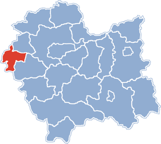
Osiek is a village in Oświęcim County, Lesser Poland Voivodeship, in southern Poland. It is the seat of the gmina called Gmina Osiek. It lies approximately 12 kilometres (7 mi) south of Oświęcim and 50 km (31 mi) west of the regional capital Kraków.

Wilczkowice is a village in the administrative district of Gmina Brzeszcze, within Oświęcim County, Lesser Poland Voivodeship, in southern Poland. It lies approximately 4 kilometres (2 mi) south-east of Brzeszcze, 8 km (5 mi) south-west of Oświęcim, and 54 km (34 mi) west of the regional capital Kraków.
Gorzów is a village in the administrative district of Gmina Chełmek, within Oświęcim County, Lesser Poland Voivodeship, in southern Poland. It lies approximately 4 kilometres (2 mi) south of Chełmek, 5 kilometres (3 mi) north of Oświęcim, and 51 km (32 mi) west of the regional capital Kraków.
Bulowice is a village in the administrative district of Gmina Kęty, within Oświęcim County, Lesser Poland Voivodeship, in southern Poland. It lies approximately 8 kilometres (5 mi) south of Kęty, 25 km (16 mi) south of Oświęcim, and 56 km (35 mi) south-west of the regional capital Kraków.
Witkowice is a village in the administrative district of Gmina Kęty, within Oświęcim County, Lesser Poland Voivodeship, in southern Poland. It lies approximately 5 kilometres (3 mi) east of Kęty, 16 km (10 mi) south of Oświęcim, and 50 km (31 mi) west of the regional capital Kraków.
Broszkowice is a village in the administrative district of Gmina Oświęcim, within Oświęcim County, Lesser Poland Voivodeship, in southern Poland. It lies approximately 1 kilometre (1 mi) north of Oświęcim and 51 km (32 mi) west of the regional capital Kraków.
Harmęże is a village in the administrative district of Gmina Oświęcim, within Oświęcim County, Lesser Poland Voivodeship, in southern Poland. It lies approximately 8 kilometres (5 mi) south-west of Oświęcim and 57 km (35 mi) west of the regional capital Kraków. The village has a population of 613.
Łazy is a village in the administrative district of Gmina Oświęcim, within Oświęcim County, Lesser Poland Voivodeship, in southern Poland. It lies approximately 8 kilometres (5 mi) south of Oświęcim and 49 km (30 mi) west of the regional capital Kraków.
Pławy is a village in the administrative district of Gmina Oświęcim, within Oświęcim County, Lesser Poland Voivodeship, in southern Poland. It lies approximately 7 kilometres (4 mi) west of Oświęcim and 57 km (35 mi) west of the regional capital Kraków.

Poręba Wielka is a village in the administrative district of Gmina Oświęcim, within Oświęcim County, Lesser Poland Voivodeship, in southern Poland. It lies approximately 7 kilometres (4 mi) south-east of Oświęcim and 48 km (30 mi) west of the regional capital Kraków.

Rajsko is a village in the administrative district of Gmina Oświęcim, within Oświęcim County, Lesser Poland Voivodeship, in southern Poland. It lies approximately 7 kilometres (4 mi) south-west of Oświęcim and 55 km (34 mi) west of the regional capital Kraków.
Włosienica is a village in the administrative district of Gmina Oświęcim, within Oświęcim County, Lesser Poland Voivodeship, in southern Poland. It lies approximately 8 kilometres (5 mi) south-east of Oświęcim and 45 km (28 mi) west of the regional capital Kraków.
Zaborze is a village in the administrative district of Gmina Oświęcim, within Oświęcim County, Lesser Poland Voivodeship, in southern Poland. It lies approximately 5 kilometres (3 mi) south of Oświęcim and 51 km (32 mi) west of the regional capital Kraków.
Przeciszów is a village in Oświęcim County, Lesser Poland Voivodeship, in southern Poland. It is the seat of the gmina called Gmina Przeciszów. It lies approximately 12 kilometres (7 mi) east of Oświęcim and 40 km (25 mi) west of the regional capital Kraków.
Palczowice is a village in the administrative district of Gmina Zator, within Oświęcim County, Lesser Poland Voivodeship, in southern Poland. It lies approximately 17 km (11 mi) east of Oświęcim and 36 km (22 mi) west of the regional capital Kraków.
Podolsze is a village in the administrative district of Gmina Zator, within Oświęcim County, Lesser Poland Voivodeship, in southern Poland. It lies approximately 3 kilometres (2 mi) north of Zator, 15 km (9 mi) east of Oświęcim, and 37 km (23 mi) west of the regional capital Kraków.
Smolice is a village in the administrative district of Gmina Zator, within Oświęcim County, Lesser Poland Voivodeship, in southern Poland. It lies approximately 5 kilometres (3 mi) north-east of Zator, 17 km (11 mi) east of Oświęcim, and 34 km (21 mi) west of the regional capital Kraków.
Jaryszki is a village in the administrative district of Gmina Kórnik, within Poznań County, Greater Poland Voivodeship, in west-central Poland. It lies approximately 13 kilometres (8 mi) north-west of Kórnik and 11 km (7 mi) south-east of the regional capital Poznań.
Wielopole is a village in the administrative district of Gmina Tuliszków, within Turek County, Greater Poland Voivodeship, in west-central Poland. It lies approximately 8 kilometres (5 mi) south of Tuliszków, 12 km (7 mi) west of Turek, and 106 km (66 mi) south-east of the regional capital Poznań.
Miechucino is a village in the administrative district of Gmina Chmielno, within Kartuzy County, Pomeranian Voivodeship, in northern Poland. It lies approximately 6 kilometres (4 mi) west of Chmielno, 12 km (7 mi) west of Kartuzy, and 41 km (25 mi) west of the regional capital Gdańsk.