Stonton Wyville

Last updated

Stonton Wyville
StontonWyville.jpg
St Denys Church
Leicestershire UK location map.svg
Red pog.svg
Stonton Wyville
Location within Leicestershire
Population21  [1]
Civil parish
  • Stonton Wyville
District
Shire county
Region
Country England
Sovereign state United Kingdom
Post town MARKET HARBOROUGH
Postcode district LE16
Police Leicestershire
Fire Leicestershire
Ambulance East Midlands
EU Parliament East Midlands
UK Parliament
List of places
UK
England
Leicestershire
52°32′56″N0°54′58″W / 52.548782°N 0.916027°W / 52.548782; -0.916027 Coordinates: 52°32′56″N0°54′58″W / 52.548782°N 0.916027°W / 52.548782; -0.916027

Stonton Wyville is a small village and civil parish in the Harborough district of Leicestershire, England. According to the 2001 census the parish had a population of 21. The population at the 2011 census remained fewer than 100 and was included in the civil parish of Glooston. The village is about eleven miles (17 km) south east of Leicester. [2] Nearby places include Kibworth Harcourt, Tur Langton, Church Langton, and Shangton.

Civil parish territorial designation and lowest tier of local government in England, UK

In England, a civil parish is a type of administrative parish used for local government, they are a territorial designation which is the lowest tier of local government below districts and counties, or their combined form, the unitary authority. Civil parishes can trace their origin to the ancient system of ecclesiastical parishes which historically played a role in both civil and ecclesiastical administration; civil and religious parishes were formally split into two types in the 19th century and are now entirely separate. The unit was devised and rolled out across England in the 1860s.

Harborough District District in England

Harborough is a local government district of Leicestershire, England, named after its main town, Market Harborough. Covering 230 square miles (600 km2), the district is by far the largest of the eight district authorities in Leicestershire and covers almost a quarter of the county.

Leicestershire County of England

Leicestershire is a landlocked county in the English Midlands. The county borders Nottinghamshire to the north, Lincolnshire to the north-east, Rutland to the east, Northamptonshire to the south-east, Warwickshire to the south-west, Staffordshire to the west, and Derbyshire to the north-west. The border with most of Warwickshire is Watling Street.

Contents

The buildings include a church, a manor house, a rectory and a farm that used to be the Fox and Hounds Inn.

Stonton Wyville parish is 1,217 acres (4.93 km2) or 1.9 square miles (4.9 km2) in area. Bounded on the western side by a tributary of the River Welland the parish rises from a height of 250 feet (76 m) near the river to about 450 feet (140 m) in the north and 500 feet (150 m) in the south. The soil is loamy clay over clay subsoil. The majority of farmland in Stonton is used for pasture and has been since 17th century enclosures. Stonton Wood, in the north of the parish, covered about 100 acres (0.40 km2) in 1279.

History

In 1086, the Domesday book shows that Stonton Wyville was part of the estates of Hugh de Grandmesnil. [3] Stonton was amongst a hundred manors that had been given to Hugh for his assistance in the Norman conquest of England.

Hugh de Grandmesnil, also known as Hugues or Hugo de Grentmesnil or Grentemesnil, is one of the very few proven companions of William the Conqueror known to have fought at the Battle of Hastings in 1066. Subsequently, he became a great landowner in England.

Norman conquest of England 11th-century invasion and conquest of England by Normans

The Norman Conquest of England was the 11th-century invasion and occupation of England by an army of Norman, Breton, Flemish, and French soldiers led by the Duke of Normandy, later styled William the Conqueror.

"The same man holds of Hugh 6 carucates of land in Stonton Wyville. There is land for 4 ploughs. In demesne are 2 ploughs and 2 slaves and 15 villans with a priest and 2 bordars have 4 ploughs. There are two mills rendering 5s4d and 8 acres (32,000 m2) of meadow, woodland 6 furlongs long and 4 furlongs broad. It was worth 40s now 60s". [3]

Hugh did not have rights over all the land in the village, some was controlled by the King's niece. She had interests which included "10 acres of meadow". [3]

There were two mills in Domesday and there were still two in 1605. One of the mills was still working in 1846 but not by 1863. [2] Which is regrettable as they could have used it to power a threshing machine ...

In 1494, the last William Wyville died. Stonton Wyville is named after him and his ancestors who had been instrumental in the village since the Domesday Book where they had been under tenants. [3]

Edmund Brudenelle died 1590 Brudenell Edmund Stonton Wyville.jpg
Edmund Brudenelle died 1590

On 25 February 1628 Sir Thomas Brudenell (whose family had married into the Wyvilles) was created Baron Brudenell of Stonton. There was a move to rename the village Stonton Brudenell, but this never stuck. [2] (Thomas went on to be first Earl of Cardigan). Edmund Brudenell has an impressive alabaster monument in the church. Alongside the father,a swaddled baby lies on its own tomb

In January 1862 there was an inquest held at the Fox and Hounds Inn into the deaths of several villagers who had died in a dreadful boiler explosion. Killed in the explosion "on the spot, Thomas Lee, about 40 years of age, was blown over 40 yards (37 m) into a ditch. William Woolman, about 65 years of age was blown fully fifty yards..." [4] and Samuel Ashby. George Woolman died of his injuries on the same day. It appears from the inquest that 13 people had been gathered around a steam engine [5] that was being used to power a small threshing machine that they had hired from a Mr Butcher of Debdale Wharf.

Stonton Wyville must have been much larger in the past. It is officially recognised as a "shrunken or deserted medieval village". [6]

Related Research Articles

Birstall, Leicestershire village in Leicestershire, England

Birstall is a large village and civil parish within the Charnwood borough of Leicestershire, England. It is three miles north of Leicester city centre and is part of the wider Leicester Urban Area.

Walcott, Lincolnshire village in United Kingdom

Walcott is a small village and civil parish in the North Kesteven district of Lincolnshire, England. The population of the civil parish at the 2011 census was 566. It is situated approximately 2 miles (3 km) north from Billinghay and 7 miles (11 km) north-east from the town of Sleaford.

Braunstone Town human settlement in United Kingdom

Braunstone is a civil parish and is the largest parish within the district of Blaby in Leicestershire, England, now known as the Town of Braunstone or more commonly, Braunstone Town. In 2007 the population was around 15,000. There are around 7,500 households including Thorpe Astley. At the 2011 census the population of the civil parish had increased to 16,850.

Waltham on the Wolds village in the United Kingdom

Waltham on the Wolds is an English village located in the civil parish of Waltham on the Wolds and Thorpe Arnold, in the Melton borough of Leicestershire, England. It lies about 5 miles (8.0 km) north-east of Melton Mowbray and 11 miles (17.7 km) south-west of Grantham on the A607 road. The population of the civil parish was 967 in 2011.

Glooston village in the United Kingdom

Glooston is a small village and civil parish in the Harborough district of Leicestershire, England. According to the 2001 census the parish had a population of 54, increasing to 147 at the 2011 census.

Stretton en le Field village in the United Kingdom

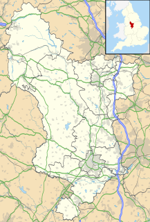
Stretton en le Field is a small village and civil parish in the North West Leicestershire district of Leicestershire, England. It is about seven miles (11 km) south-west of Ashby de la Zouch, and according to the 2001 census the parish had a population of 36. At the 2011 census the population remained less than 100 and is included in the civil parish of Chilcote.

Binton village in United Kingdom

Binton is a village and civil parish in the Stratford district of Warwickshire, England. It is about five miles (8 km) west of Stratford-upon-Avon. According to the 2001 census it had a population of 272, increasing to 311 at the 2011 census.

Newton Solney village and civil parish in South Derbyshire, England

Newton Solney is a small village and civil parish in South Derbyshire, England, located about two miles (3 km) from the East Staffordshire border, near to Burton upon Trent. The population of the civil parish as of the 2011 census was 659. Its nearest neighbour is Repton, situated about two miles (3 km) to the northeast.

Tittleshall village in the United Kingdom

Tittleshall is a village and civil parish in the English county of Norfolk.

Whitstone village and civil parish in east Cornwall, England

Whitstone is a village and civil parish in east Cornwall, England, United Kingdom. It is roughly halfway between the towns of Bude and Launceston. The population at the 2011 census was 590.

Spernall village in the United Kingdom

Spernall is a remote village 4 miles (6.4 km) north of Alcester in the Parish of Oldberrow, Morton Bagot, and Spernall, in the Stratford on Avon District of Warwickshire, England. In 2001 it had a population of 153. It is situated on the banks of the small River Arrow, the name meaning Spera's border. Early forms of the name are Spernore. and Spernoure in the 1327 Subsidy Roll. The village consists only of the church and rectory and a few scattered farms and cottages. At some time between 1195 and 1361 the parish was largely depopulated by pestilence, so that many of the villein tenements, which had hitherto accounted for almost the whole population, came into the hands of freemen. This may well refer to the Black Death; the priest at Spernall, Nicholas atte Yate, died in 1349 and there was another institution in 1351.

Sutton Scarsdale village in United Kingdom

Sutton Scarsdale is a very small village in Derbyshire, England. It is in the North East Derbyshire district. It is very close to the M1 motorway. It is in the civil parish of Sutton cum Duckmanton.

Honing, Norfolk village in the United Kingdom

Honing is a village and a civil parish in the English county of Norfolk. The village is 15.3 miles (24.6 km) north-northeast of Norwich, 13.3 miles (21.4 km) south east of Cromer and 135 miles (217 km) north-east of London. The village lies 3.9 miles (6.3 km) east of the town of North Walsham. The nearest railway station is at Worstead on the Bittern Line which runs between Cromer and Norwich. The nearest airport is Norwich International Airport. The village and parish of Honing with Crostwight had in the 2001 census, a population of 319, but this fell to 312 at the 2011 Census. For the purposes of local government, the village falls within the district of North Norfolk.

Kilkhampton village and civil parish in northeast Cornwall, England

Kilkhampton is a village and civil parish in northeast Cornwall, England, United Kingdom. The village is on the A39 about four miles (6 km) north-northeast of Bude.

Fifield, Oxfordshire village and civil parish in West Oxfordshire, Oxfordshire, England

Fifield is a village and civil parish about 4 miles (6.4 km) north of Burford in Oxfordshire. The western boundary of the parish forms part of the county boundary with Gloucestershire. The 2011 Census recorded the parish's population as 240.

Semer, Suffolk village in United Kingdom

Semer is a small village and civil parish in Suffolk, England. Located adjacent to a bridge over the River Brett on the B1115 between Hadleigh and Stowmarket, it is part of Babergh district. The parish also contains the hamlets of Ash Street and Drakestone Green.

Smallburgh village in the United Kingdom

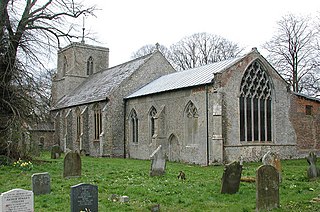
Smallburgh is a village and a civil parish in the English county of Norfolk. The village is fourteen miles (21 km) south-east of Cromer, fourteen miles (21 km) north-east of Norwich and 132 miles (212 km) north-east of London. The village lies five miles (8 km) south-east of the nearby town of North Walsham. The nearest railway station is at Worstead for the Bittern Line which runs between Sheringham, Cromer and Norwich. The nearest airport is Norwich International Airport. At the 2001 census it had a population of 518 in 219 households. For the purposes of local government, it falls within the district of North Norfolk.

St Mellion human settlement in United Kingdom

St Mellion is a village and rural civil parish in east Cornwall, England, United Kingdom. The parish is about 3 miles (5 km) south of Callington and is in the St Germans Registration District. To the north, the parish is bordered by Callington and St Dominick parishes, to the east and south by Pillaton parish, and to the west by St Ive parish.

Calthorpe, Norfolk village in the United Kingdom

Calthorpe is a small village within the civil parish of Erpingham in the English county of Norfolk, United Kingdom. The village is located 0.5 miles (0.80 km) west of the village of Erpingham, 3.4 miles (5.5 km) north of the nearest town of Aylsham and is 15.8 miles (25.4 km) north of the nearest city of Norwich. The nearest railway station is at Gunton for the Bittern Line which runs between Sheringham, Cromer and Norwich and is 7.8 miles (12.6 km) from the village. The nearest airport is Norwich International 14.2 miles (22.9 km) south of the village.

References

  1. 2001 census
  2. 1 2 3 'Stonton Wyville', A History of the County of Leicestershire: Volume 5: Gartree Hundred (1964), pp. 308-12 Date accessed: 21 February 2007
  3. 1 2 3 4 Domesday Book: A Complete Translation. London: Penguin, 2003. ISBN   0-14-143994-7
  4. "Contemporary newspaper account - January 1862
  5. Stationary Engine home page
  6. Ancient Monuments list