Related Research Articles

East Staffordshire is a local government district with borough status in Staffordshire, England. It has two main towns: Burton upon Trent and Uttoxeter.

The River Dove is the principal river of the southwestern Peak District, in the Midlands of England and is around 45 miles (72 km) in length. It rises on Axe Edge Moor near Buxton and flows generally south to its confluence with the River Trent at Newton Solney. From there, its waters reach the North Sea via the Humber Estuary. For almost its entire course it forms the boundary between the counties of Staffordshire and Derbyshire. The river meanders past Longnor and Hartington and cuts through a set of deep limestone gorges, Beresford Dale, Wolfscote Dale, Milldale and Dovedale.

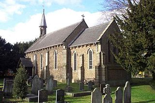
Doveridge is a village and civil parish in Derbyshire, United Kingdom, near the border with Staffordshire and about 2 km (1.2 mi) east of Uttoxeter. Its name may come from its having a bridge over the river Dove, a tributary of the River Trent. The civil parish population as taken at the 2011 Census was 1,622.

South Derbyshire is a constituency represented in the House of Commons of the UK Parliament since 2010 by Heather Wheeler, a Conservative.
Alkmonton is a village and civil parish in the Derbyshire Dales district of Derbyshire, England, roughly between Uttoxeter and Derby. The parish had a population of 75 at the 2001 census and it remained less than 100 in 2011. Details are included in the civil parish of Cubley, Derbyshire.
Belvoir was a rural district in Leicestershire, England from 1894 to 1935.
Burford was a rural district in Shropshire in England from 1894 to 1934.
Belchamp was a rural district in Essex in England. It was formed under the Local Government Act 1894 from that part of the Sudbury rural sanitary district which was in Essex.
South East Derbyshire was a rural district in Derbyshire, England from 1894 to 1974. It covered an area to the south-east of Derby.
Repton was a rural district in Derbyshire, England from 1894 to 1974.
Leake was a rural district in Nottinghamshire, England from 1894 to 1935.
Skegby was a rural district in Nottinghamshire, England from 1894 to 1935.

Blackwell was a rural district in Derbyshire, England from 1894 to 1974. It was created under the Local Government Act 1894 based on that part of the Mansfield rural sanitary district which was in Derbyshire.
Gnosall was a rural district in Staffordshire, England from 1894 to 1934. It was formed under the Local Government Act 1894 from that part of the Newport Rural Sanitary District which was in Staffordshire.
Cannock was a rural district in Staffordshire, England from 1894 to 1974.
Shifnal was a rural district in Shropshire, England from 1894 to 1974.
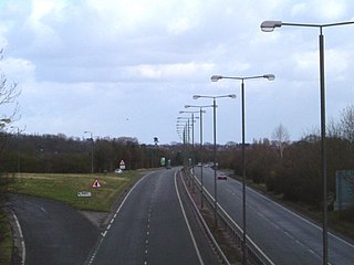
The A516 road is a road in Derbyshire that runs from the A50 Junction 5, to the A601 in Derby. The road is used mostly for traffic flowing from the A50 to the A38.

Uttoxeter Road is a cricket ground located along the Uttoxeter Road between the villages of Lower Tean and Checkley in Staffordshire. The ground is surrounded on all sides by countryside.

Totmonslow is a hundred in the county of Staffordshire, England. The hundred is located in the north-east of Staffordshire, named after the hamlet of the same name, which is a half mile east of Draycott in the Moors. The hamlet was the seat of the hundred court.
Ashbourne was a Rural District in Derbyshire, England from 1894 to 1974. It was created under the Local Government Act 1894.
References
Coordinates: 52°56′N1°48′W / 52.93°N 1.80°W
| | This Derbyshire location article is a stub. You can help Wikipedia by expanding it. |