Related Research Articles
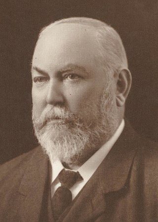
Sir John Forrest was an Australian explorer and politician. He was the first premier of Western Australia (1890–1901) and a long-serving cabinet minister in federal politics.

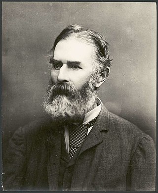
John Septimus Roe was the first Surveyor-General of Western Australia. He was a renowned explorer, a member of Western Australia's legislative and executive councils for nearly 40 years, but also a participant in the Pinjarra massacre on 28 October 1834.
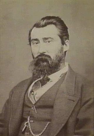
Sir Malcolm Fraser was Surveyor-General in colonial Western Australia from 1872 to 1883 and Agent-General for the colony 1892 to 1898.
A surveyor general is an official responsible for government surveying in a specific country or territory. Historically, this would often have been a military appointment, but it is now more likely to be a civilian post.
The Surveyor-General of New South Wales is the primary government authority responsible for land and mining surveying in New South Wales.

Surveyor Generals Corner is a remote point where the Australian state boundaries of South Australia, Western Australia and the Northern Territory meet.

British colonisation of South Australia describes the planning and establishment of the colony of South Australia by the British government, covering the period from 1829, when the idea was raised by the then-imprisoned Edward Gibbon Wakefield, to 1842, when the South Australia Act 1842 changed the form of government to a Crown colony.
The lands administrative divisions of Western Australia refer to subdivisions of the state of Western Australia for cadastral purposes, most of which have been in place since the 19th century. The state is divided up for this purpose into five land divisions, which in turn are subdivided into land districts, which correspond to counties in other Australian states. These districts are then subdivided further into numbered locations, as well as gazetted townsites. Together, they form part of the lands administrative divisions of Australia.
The Australian Antarctic Names and Medals Committee (AANMC) was established to advise the Government on names for features in the Australian Antarctic Territory and the subantarctic territory of Heard Island and the McDonald Islands. The committee also issues nominations Governor General for the award of the Australian Antarctic Medal.
Toitū Te Whenua Land Information New Zealand (LINZ) is the public service department of New Zealand charged with geographical information and surveying functions as well as handling land titles, and managing Crown land and property. The minister responsible is the Minister for Land Information, and was formerly the Minister of Survey and Land Information. LINZ was established in 1996 following the restructure of the Department of Survey and Land Information (DOSLI), which was itself one of the successor organisations to the Department of Lands and Survey.

George Christian Darbyshire was an English and Australian civil engineer. He was the second son of George Darbyshire, also a surveyor and railway engineer.

Esperance Land District is a land district of Western Australia, located within the Eucla Land Division on the state's south coast. It spans roughly 33°15'S - 34°00'S in latitude and 121°00'E - 122°20'E in longitude.
The Surveyor General of South Australia is a position originally created for the Surveyor General for the colony of South Australia. The post is held by an official responsible for government surveying.
Surveyor General of Queensland is a position originally created for the colony of Queensland, now a state of Australia. The position was the most senior surveyor within the Queensland Public Service.
Surveying in Australia is triangulation-based and shares many similarities with the United Kingdom, including the title deed system. However, a distinctive feature of surveying in Australia is the Torrens System, where real estate records are held in a central deposit and guaranteed by the state.
Edward Orpen Moriarty (1824-1896) MA MInstCE was an Australian civil engineer, who undertook a number of important public works in New South Wales in the late nineteenth century.
Minister for Lands is a position in the government of Western Australia, currently held by John Carey of the Labor Party. The position was first created in 1870, under the name Commissioner of Crown Lands, at a time when Western Australia was still a British colony and had not yet achieved responsible government. Exception for a brief period between 2001 and 2003, it has existed in every government since then. The minister is currently responsible for the state government's Land Use Management division comprising part of the Department of Planning, Lands and Heritage, which is responsible for the management of crown land in Western Australia.

Cameron Corner Survey Marker is a heritage-listed survey marker in the locality of Cameron Corner, Shire of Bulloo, Queensland, Australia. The survey marker is at the border corner of South-West Queensland with New South Wales and South Australia; it was established in 1880. It was added to the Queensland Heritage Register on 9 November 2012.

Queensland is the north-eastern state of Australia and has land borders with three other Australian states and territories: New South Wales, South Australia and Northern Territory. To the north of Queensland is the Torres Strait separating the Australian mainland from Papua New Guinea. To the east of Queensland is the Coral Sea, part of the Pacific Ocean. There are many islands off the Queensland coast which form part of the state of Queensland.
Mount Stuart is a locality in the City of Townsville, Queensland, Australia. In the 2016 census, Mount Stuart had no population.
References
- Lists of British, Australian and New Zealand Surveyors-General, Government Geologists... Retrieved 5 September 2016
- Australian Dictionary of Biography Surveyor-General search Retrieved 27 June 2012