East Sussex is a county in South East England. It is bordered by the counties of Kent to the north and east, Surrey to the north west and West Sussex to the west, and to the south by the English Channel.

An Area of Outstanding Natural Beauty (AONB) is an area of countryside in England, Wales or Northern Ireland which has been designated for conservation due to its significant landscape value. Areas are designated in recognition of their national importance, by the relevant public body: Natural England, Natural Resources Wales, or the Northern Ireland Environment Agency. In place of AONB, Scotland uses the similar national scenic area (NSA) designation. Areas of Outstanding Natural Beauty enjoy levels of protection from development similar to those of UK national parks, but unlike with national parks the responsible bodies do not have their own planning powers. They also differ from national parks in their more limited opportunities for extensive outdoor recreation.
The North Downs Way National Trail is a long-distance path in southern England, opened in 1978. It runs from Farnham to Dover, past Guildford, Dorking, Merstham, Otford and Rochester, along the Surrey Hills Area of Outstanding Natural Beauty (AONB) and Kent Downs AONB.

Wealden is a local government district in East Sussex, England: its name comes from the Weald, the remnant forest which was once unbroken and occupies much of the centre and north of this area. The term is cognate with Wald, forest or wood in German.

The Borough of Ashford is a local government district with borough status in Kent, England. It borders five other Kent districts, as well as East Sussex to the south-west. Ashford Borough Council's main offices are in the town of Ashford. The borough was formed on 1 April 1974, by the merger of the then Borough of Tenterden with Ashford urban district as well as the Rural Districts of East Ashford, West Ashford and Tenterden. Covering 58,000 hectares, it is the largest district by area in Kent.

The North Wessex Downs Area of Outstanding Natural Beauty (AONB) is located in the English counties of Berkshire, Hampshire, Oxfordshire and Wiltshire. The name North Wessex Downs is not a traditional one, the area covered being better known by various overlapping local names, including the Berkshire Downs, the North Hampshire Downs, the White Horse Hills, the Lambourn Downs, the Marlborough Downs, the Vale of Pewsey and Savernake Forest.

The National Parks and Access to the Countryside Act 1949 is an Act of the Parliament of the United Kingdom which created the National Parks Commission which later became the Countryside Commission and then the Countryside Agency, which became Natural England when it merged with English Nature in 2006. The Act provided the framework for the creation of National Parks and Areas of Outstanding Natural Beauty in England and Wales, and also addressed public rights of way and access to open land. The Act was passed in 1949 with all-party support, as part of the reconstruction of the UK by the Labour government after World War II.

The High Weald Area of Outstanding Natural Beauty is situated in south-east England. Covering an area of 1,450 square kilometres (560 sq mi), it extends across the counties of Surrey, West Sussex, East Sussex and Kent. It is the fourth largest Area of Outstanding Beauty (AONB) in England and Wales. It is characterised by an attractive, small-scale landscape containing a mosaic of small farms and woodlands, historic parks, sunken lanes and ridge-top villages.

Surrey Hills is a 422 km2 (163 sq mi) Area of Outstanding Natural Beauty (AONB) in Surrey, England. The AONB was designated in 1958 and covers one quarter of the county of Surrey. Surrey Hills AONB adjoins the Kent Downs AONB to the east and the South Downs National Park in the south west.
The Nidderdale AONB is an Area of Outstanding Natural Beauty in North Yorkshire, England, bordering the Yorkshire Dales National Park to the east and south. It comprises most of Nidderdale itself, part of lower Wharfedale, the Washburn valley and part of lower Wensleydale, including Jervaulx Abbey and the side valleys west of the River Ure. It covers a total area of 233 square miles (600 km2). The highest point in the Nidderdale AONB is Great Whernside, 704 metres (2,310 ft) above sea level, on the border with the Yorkshire Dales National Park.

Sussex is a historic county and cultural region in the south of England corresponding roughly in area to the ancient Kingdom of Sussex. It is bounded on the north by Surrey, north-east by Kent, south by the English Channel, and west by Hampshire, and is divided for local government into West Sussex and East Sussex and the city of Brighton and Hove. The city of Brighton & Hove was created a unitary authority in 1997, and was granted City status in 2000. Until then Chichester had been Sussex's only city. By convention, Chichester is Sussex's capital city and Lewes is Sussex's county town.
The western Weald is an area of undulating countryside in Hampshire and West Sussex containing a mixture of woodland and heathland areas.

The High Weald Landscape Trail (HWLT) is a 145-kilometre (90 mi) route in England between Horsham, West Sussex and Rye, East Sussex, designed to pass through the main landscape types of the High Weald Area of Outstanding Natural Beauty (AONB). It does not follow the highest ground, and the eastern section is only a few feet above sea level. It keeps to the northern edge of the High Weald except in the west where it runs close to the southern edge for a short distance.

Many parts of Wales are protected areas, according to a number of designations. They include three national parks, and five Areas of Outstanding Natural Beauty.

Goosehill Camp is a prehistoric earthwork that dates back to the Iron Age. It consists of two concentric banks and ditches. The inner enclosure has one entrance and surround two levelled hut sites. Goosehill Camp is within the Kingley Vale National Nature Reserve, on the South Downs.
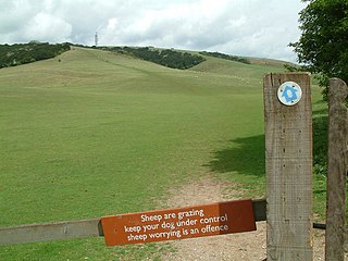
The Eastbourne Downland, Eastbourne Downs or Eastbourne Downland Estate, is an area of land at the easternmost end of the South Downs National Park in East Sussex, England. It was bought by the public, following threats to the beauty spots of Beachy Head and the surrounding farmland, which led to a public campaign and Act of Parliament in 1926. It is currently owned and managed, on behalf of the public, by Eastbourne Borough Council.