Sveti Vrh Vrh nad Mokronogom (1955–1992) | |
---|---|
Coordinates: 45°56′29.61″N15°10′22.6″E / 45.9415583°N 15.172944°E Coordinates: 45°56′29.61″N15°10′22.6″E / 45.9415583°N 15.172944°E | |
Country | |
Traditional region | Lower Carniola |
Statistical region | Southeast Slovenia |
Municipality | Mokronog-Trebelno |
Area | |
• Total | 1.74 km2 (0.67 sq mi) |
Elevation | 377.1 m (1,237.2 ft) |
Population (2002) | |
• Total | 92 |
[1] |
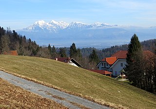
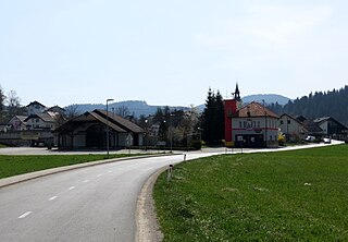
Sveti Vrh (pronounced [ˈsʋeːti ˈʋəɾx] ; German : Heiligenberg [2] ) is a settlement in the hills east of Mokronog in the Municipality of Mokronog-Trebelno in southeastern Slovenia. The area is part of the historical region of Lower Carniola. The municipality is now included in the Southeast Slovenia Statistical Region. [3]
German is a West Germanic language that is mainly spoken in Central Europe. It is the most widely spoken and official or co-official language in Germany, Austria, Switzerland, South Tyrol (Italy), the German-speaking Community of Belgium, and Liechtenstein. It is also one of the three official languages of Luxembourg and a co-official language in the Opole Voivodeship in Poland. The languages which are most similar to German are the other members of the West Germanic language branch: Afrikaans, Dutch, English, the Frisian languages, Low German/Low Saxon, Luxembourgish, and Yiddish. There are also strong similarities in vocabulary with Danish, Norwegian and Swedish, although those belong to the North Germanic group. German is the second most widely spoken Germanic language, after English.
Mokronog is a settlement in the Municipality of Mokronog-Trebelno in southeastern Slovenia. It is also the administrative centre of the municipality. The area is part of the historical region of Lower Carniola. The municipality is now included in the Southeast Slovenia Statistical Region.
A municipality is usually a single urban administrative division having corporate status and powers of self-government or jurisdiction as granted by national and regional laws to which it is subordinate. It is to be distinguished (usually) from the county, which may encompass rural territory or numerous small communities such as towns, villages and hamlets.
The name of the settlement was changed from Sveti Vrh (literally, 'holy peak') to Vrh nad Mokronogom (literally, 'peak above Mokronog') in 1955. The name was changed on the basis of the 1948 Law on Names of Settlements and Designations of Squares, Streets, and Buildings as part of efforts by Slovenia's postwar communist government to remove religious elements from toponyms. The name Sveti Vrh was restored in 1992. [4] [5] [6] In the past the German name was Heiligenberg. [2]
The local church is dedicated to the Assumption of Mary and belongs to the Parish of Mokronog. It dates to the early 15th century and preserves frescos dating to around 1430 on its interior walls. It was restyled in the Baroque in the 18th century. [7]
A church building or church house, often simply called a church, is a building used for Christian religious activities, particularly for Christian worship services. The term is often used by Christians to refer to the physical buildings where they worship, but it is sometimes used to refer to buildings of other religions. In traditional Christian architecture, the church is often arranged in the shape of a Christian cross. When viewed from plan view the longest part of a cross is represented by the aisle and the junction of the cross is located at the altar area.
The Assumption of Mary into Heaven is, according to the beliefs of the Catholic Church, Eastern and Oriental Orthodoxy, the bodily taking up of the Virgin Mary into Heaven at the end of her earthly life.
A parish is a territorial entity in many Christian denominations, constituting a division within a diocese. A parish is under the pastoral care and clerical jurisdiction of a parish priest, who might be assisted by one or more curates, and who operates from a parish church. Historically, a parish often covered the same geographical area as a manor. Its association with the parish church remains paramount.
Planina pod Golico is a mountain village in the Municipality of Jesenice, in the Upper Carniola region of Slovenia. It lies on the southern foot of Mount Golica in the Karawanks range, at an elevation of 954 metres (3,130 ft).
Hrastovec is a settlement in the Municipality of Velenje in northern Slovenia. The area was traditionally part of Styria. The municipality is now included in the Savinja Statistical Region.
Sveti Lenart is a small settlement in the Municipality of Cerklje na Gorenjskem in the Upper Carniola region of Slovenia.
Sveti Ožbolt is a settlement in the Municipality of Škofja Loka in the Upper Carniola region of Slovenia.
Sveti Andrej is a settlement in the Municipality of Škofja Loka in the Upper Carniola region of Slovenia.
Sveti Tomaž is a small settlement in the Municipality of Škofja Loka in the Upper Carniola region of Slovenia.
Žirovski Vrh Svetega Antona is a dispersed settlement above Gorenja Vas in the Municipality of Gorenja Vas–Poljane in the Upper Carniola region of Slovenia.
Žirovski Vrh Svetega Urbana is a dispersed settlement above Todraž in the Municipality of Gorenja Vas–Poljane in the Upper Carniola region of Slovenia.
Vrh pri Dolskem is a dispersed settlement in the hills northeast of Dolsko in the Municipality of Dol pri Ljubljani in the Upper Carniola region of Slovenia.
Jurski Vrh is a settlement in the Municipality of Kungota in the western part of the Slovene Hills in northeastern Slovenia, right on the border with Austria. It includes the hamlet of Jurij ob Pesnici, on the left bank of the Pesnica River, as well as the dispersed houses in the hills north of the village.
Podkum is a settlement in the Municipality of Zagorje ob Savi in central Slovenia. The area is part of the traditional region of Lower Carniola. It is now included with the rest of the municipality in the Central Sava Statistical Region.
Sveta Planina is a settlement in the Municipality of Trbovlje in central Slovenia. It lies in the hills northwest of the town of Trbovlje. Traditionally the area was part of the Styria region. It is now included with the rest of the municipality in the Central Sava Statistical Region.
Vrhe is a settlement in the Municipality of Trbovlje in central Slovenia. It lies in the hills northwest of the town of Trbovlje and part of the settlement lies in the neighbouring Municipality of Zagorje ob Savi. Traditionally the area was part of the Styria region. It is now included with the rest of the municipality in the Central Sava Statistical Region.
Gore is a settlement in the Municipality of Hrastnik in central Slovenia. Traditionally the area was part of the Styria region. It is now included with the rest of the municipality in the Central Sava Statistical Region.
Jelovice is a settlement in the western Haloze Hills in the Municipality of Majšperk in northeastern Slovenia. The area is part of the traditional region of Styria. It is now included with the rest of the municipality in the Drava Statistical Region.
Sveti Štefan is a small settlement in the Municipality of Šmarje pri Jelšah in eastern Slovenia. It lies in the hills south of Šmarje in the Kozje region. The area is part of the traditional region of Styria. The municipality is now included in the Savinja Statistical Region.
Beli Grič is a small settlement in the Municipality of Mokronog-Trebelno in southeastern Slovenia. The area is part of the historical region of Lower Carniola. The municipality is now included in the Southeast Slovenia Statistical Region.
Šent Jurij is a village in the Municipality of Grosuplje in central Slovenia. The area is part of the historical region of Lower Carniola. The municipality is now included in the Central Slovenia Statistical Region.
Šentpavel na Dolenjskem is a settlement just east of Šentvid pri Stični in the Municipality of Ivančna Gorica in central Slovenia. The area is part of the historical region of Lower Carniola. The municipality is now included in the Central Slovenia Statistical Region. It includes the hamlets of Grumlof, and Mandrga.
Primož is a small village in the hills south of Boštanj in the Municipality of Sevnica in central Slovenia. The area is part of the historical region of Lower Carniola. The municipality is now included in the Lower Sava Statistical Region.
This article about the Municipality of Mokronog-Trebelno in Slovenia is a stub. You can help Wikipedia by expanding it. |