The Legacy Highway is a proposed and partially completed freeway in northern Utah, United States, that is planned to eventually connect eastern Juab County with eastern Box Elder County, running along the west sides of Utah, Salt Lake, Davis, and Weber counties in between. Its purpose is to provide an alternate north–south transportation corridor to Interstate 15. It was proposed in 1996, but due to lawsuits over issues with the completeness of the environmental impact statement construction was delayed. Construction of one segment began in 2006. That segment, known as the Legacy Parkway, opened on 13 September 2008.

Transportation in Salt Lake City consists of a wide network of roads, an extensive bus system, a light rail system, and a commuter rail line. Although Salt Lake City, Utah, is a traditionally car-oriented city, the rapidly growing public transit system has a high number of riders for a city of its size, and public transit is widely supported by its residents and businesses.
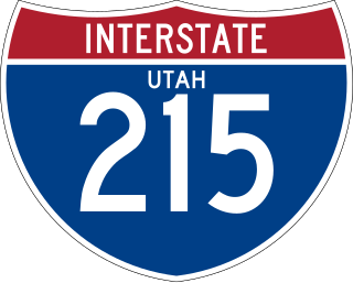
Interstate 215 (I-215), also known locally as the Belt Route, is the only auxiliary Interstate in the U.S. state of Utah, forming a three-quarters loop around Salt Lake City and many of its suburbs. The route begins at the mouth of Parley's Canyon at a junction with I-80 east of the city center, and heads south through the edge of the Salt Lake City metropolitan area's eastern suburbs of Millcreek, Holladay, and Cottonwood Heights. It continues west through Murray before turning north again, passing through the city's first-ring western suburbs of Taylorsville and West Valley City. It then enters North Salt Lake and Davis County for a short distance before reaching I-15 northwest of the city center.
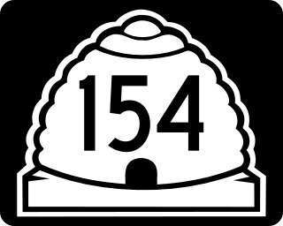
State Route 154 (SR-154) or Bangerter Highway is a partial expressway running west and then north from Draper through western Salt Lake County, eventually reaching the Salt Lake City International Airport in Salt Lake City. Construction began in 1988 after planning for the highway began more than two decades prior. For the next ten years, portions of the highway opened as constructed, with the entire route finished by 1998.
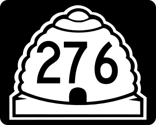
State Route 276 is a state highway in remote portions of San Juan County, eastern Garfield County, and Kane County, in the southeast of the U.S. state of Utah. The route is used as an access to Lake Powell, serving the small resort towns of Ticaboo and Bullfrog. Historically, SR-276 crossed Lake Powell via the Charles Hall Ferry, the only auto ferry in the state of Utah; however, the ferry is currently out of service due to low water levels. The entire route is part of the Trail of the Ancients National Scenic Byway. Lake Powell separates the route into two sections; the eastern section was numbered State Route 263 prior to the existence of the ferry.
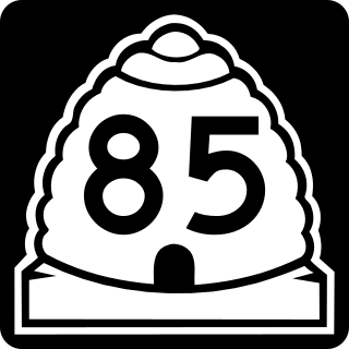
The Mountain View Corridor is a freeway under construction in northern Utah that will run along the western periphery of Salt Lake County and south into northwest Utah County. Except for the last several miles on its southern end the Mountain View Corridor is numerically designated as State Route 85 (SR-85) in the Utah state highway system. The entire Mountain View Corridor is maintained by the Utah Department of Transportation (UDOT).
The Utah Transportation Commission serves as an independent advisory committee within the State of Utah, United States with the responsibility of deciding how available transportation funds are spent and prioritizing transportation projects within the state. Members of the commission are appointed by the governor. With limited funds available, the commission is tasked with making difficult priority decisions. The commission also advises the Utah Department of Transportation (UDOT) on transportation systems policy. The commission coordinates directly with the executive director of UDOT.

Thistle is a ghost town in Spanish Fork Canyon in southeastern Utah County, Utah, United States. During the era of steam locomotives, the town's primary industry was servicing trains for the Denver and Rio Grande Western Railroad. The fortunes of the town were closely linked with those of the railroad until the changeover to diesel locomotives, when the town started to decline.

Interstate 70 (I-70) is a mainline route of the Interstate Highway System in the United States connecting Utah and Maryland. The Utah section runs east–west for approximately 232 miles (373 km) across the central part of the state. Richfield is the largest Utah city served by the freeway, which does not serve or connect any urban areas in the state. The freeway was built as part of a system of highways connecting Los Angeles and the Northeastern United States. I-70 was the second attempt to connect southern California to the east coast of the United States via central Utah, the first being a failed attempt to construct a transcontinental railroad. Parts of that effort were reused in the laying out of the route of I-70.

Interstate 80 (I-80) is a part of the Interstate Highway System that runs from San Francisco, California, to Teaneck, New Jersey. The portion of the highway in the US state of Utah is 197.51 miles (317.86 km) long through the northern part of the state. From west to east, I-80 crosses the state line from Nevada in Tooele County and traverses the Bonneville Salt Flats—which are a part of the larger Great Salt Lake Desert. It continues alongside the Wendover Cut-off—the corridor of the former Victory Highway—US Route 40 (US-40) and the Western Pacific Railroad Feather River Route. After passing the Oquirrh Mountains, I-80 enters the Salt Lake Valley and Salt Lake County. A short portion of the freeway is concurrent with I-15 through Downtown Salt Lake City. At the Spaghetti Bowl, I-80 turns east again into the mouth of Parleys Canyon and Summit County, travels through the mountain range, and intersects the eastern end of I-84 near Echo Reservoir before turning northeast toward the Wyoming border near Evanston. I-80 was built along the corridor of the Lincoln Highway and the Mormon Trail through the Wasatch Range. The easternmost section also follows the historical routes of the first transcontinental railroad and US-30S.

Interstate 84 (I-84) is a part of the Interstate Highway System that links Portland, Oregon, to I-80 near Echo, Utah. The 117.38-mile-long (188.90 km) segment in the US state of Utah is the shortest of any of the three states the western I-84 passes through and contains the eastern terminus of the highway. I-84 enters Box Elder County near Snowville before becoming concurrent with I-15 in Tremonton. The concurrent highways travel south through Brigham City and Ogden and separate near Ogden-Hinckley Airport. Turing east along the Davis County border, I-84 intersects US Route 89 (US-89) and enters Weber Canyon as well as Morgan County. While in Morgan County, I-84 passes the Devil's Gate-Weber Hydroelectric Power Plant and Devil's Slide rock formation. Past Morgan, the highway crosses into Summit County, past the Thousand Mile Tree before reaching its eastern terminus at I-80 near Echo.

Interstate 15 (I-15) runs north–south in the U.S. state of Utah through the southwestern and central portions of the state, passing through most of the state's population centers, including St. George and those comprising the Wasatch Front: Provo–Orem, Salt Lake City, and Ogden–Clearfield. It is Utah's primary and only north–south interstate highway, as the vast majority of the state's population lives along its corridor; the Logan metropolitan area is the state's only Metropolitan Statistical Area through which I-15 does not pass. In 1998, the Utah State Legislature designated Utah's entire portion of the road as the Veterans Memorial Highway.

The Wendover Cut-off, also called the Wendover Road or Wendover Route, is a two-lane highway in the western part of Tooele County in the U.S. state of Utah. Stretching 40.3 miles (64.9 km) from Wendover to Knolls across the Bonneville Salt Flats, a part of the Great Salt Lake Desert, the cut-off was once part of the primary link between the Nevada state line and Salt Lake City. In 2012, between 240 and 250 vehicles used the cut-off near its western terminus in Wendover on an average day.

Legacy Parkway is an 11.5-mile-long (18.5 km) four-lane controlled-access parkway located almost completely within Davis County in the northern part of the U.S. state of Utah. The parkway travels north from Interstate 215 (I-215) in northwestern Salt Lake City to an interchange named the Wasatch Weave in Farmington with two intermediate interchanges providing access to Woods Cross and Centerville. Wetlands of the nearby Great Salt Lake and nature preserves border the western side of the parkway while the eastern side roughly parallels Union Pacific and Utah Transit Authority rail lines and I-15. On average, between 20,000 and 23,000 vehicles use the parkway daily.
The Adams Avenue Parkway is a 1.6-mile-long (2.6 km) road that is almost entirely within Washington Terrace, Utah, United States, that connects Interstate 84 (I‑84) with U.S. Route 89. Approximately 1⁄2 mile (800 m) of the southern end of the road is also a private toll road. The southern (toll) section opened in 2001 at a cost of $8.9 million and was created after decades of requests by locals to connect the existing 500 East to I‑84. The toll section allowed commuters to bypass the rest of US‑89 through southern Weber County to I‑84.

State Route 103 (SR-103) is a 0.225-mile-long (362 m) urban minor arterial state highway in the U.S. state of Utah. It branches off from SR-126 in downtown Clearfield and extends east to Interstate 15 (I-15), with the roadway continuing to the Falcon Hill National Aerospace Research Park, just outside Hill Air Force Base. The entire route is located in Davis County and was formed in 1965 coinciding with the construction of I-15.
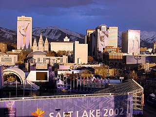
The 2002 Winter Olympic Games were held in and around Salt Lake City, United States from February 8 to 24, 2002, and the Paralympics from March 7 to 16, 2002. The sporting events were held in ten competitive venues, while non-competitive events, such as the opening ceremony, were held in six other venues. Three venues were also created for training purposes. All Olympic venues were scattered throughout Northern Utah and the Wasatch Front.
The Sam White Bridge is a reinforced concrete and steel overpass beam bridge which crosses Interstate 15 in American Fork, Utah. The original bridge was named for Sam White, a former homesteader in the nearby city of Pleasant Grove. It had only 14 feet 7 inches (4.45 m) underpass clearance. The new bridge has an underpass clearance of 17 feet 3 inches (5.26 m), which exceeds the minimum standard for interstate bridges in the United States.
The Uinta Basin Rail project is a proposed 100-mile (160 km) rail line to connect the shale oil rich Uinta Basin region of eastern Utah to the national rail network. Numerous proposals have been made, some as far back as 1902, that are still under consideration. The current effort is a public-private partnership between a coalition of 7 counties in Utah, the Rio Grande Pacific Corporation and Drexel Hamilton Infrastructure Partners. The railroad is also backed by the Ute Tribe who hold a 5% stake in the project. If the rail line is built it will be the first major greenfield rail line built in the United States since the Chicago and North Western’s line to the Powder River Basin was built in the early 1980s. The Surface Transportation Board approved construction of the line in December 2021, however, the approval is being challenged in court by various environmentalist groups. In 2024, the Supreme Court of the United States agreed to hear the case Seven County Infrastructure Coalition v. Eagle County, involving the approval to build the rail line.

The West Davis Corridor is a 16-mile-long (26 km) freeway completely within Davis County in northern Utah. The corridor splits off from Interstate 15 (I-15) and U.S. Route 89 (US-89) along with the Legacy Parkway (SR-67) in Farmington and goes through the western confines of the Ogden–Clearfield metropolitan area before ending at an T-intersection with SR-193 in West Point.