Tenmile Creek (Coos County, Oregon)

Last updated
Tenmile Creek
Tenmile Creek in Coos County, Oregon.jpg
The creek passes under U.S. Route 101 and a railway trestle after leaving Tenmile Lake.
Country United States
State Oregon
County Coos
Source Tenmile Lake
 - location Lakeside
 - elevation14 ft (4 m) [1]
 - coordinates 43°34′24″N124°10′24″W / 43.57333°N 124.17333°W / 43.57333; -124.17333   [2]
Mouth Pacific Ocean
 - elevation3 ft (1 m) [2]
 - coordinates 43°33′42″N124°13′55″W / 43.56167°N 124.23194°W / 43.56167; -124.23194 Coordinates: 43°33′42″N124°13′55″W / 43.56167°N 124.23194°W / 43.56167; -124.23194   [2]
Length3 mi (5 km) [3]
USA Oregon location map.svg
Red pog.svg
Location of the mouth of Tenmile Creek in Oregon

Tenmile Creek is the outlet for a chain of lakes ending at Tenmile Lake near Lakeside in Coos County in the U.S. state of Oregon. The creek flows generally west for about 3 miles (5 km) from the lake to the Pacific Ocean. [3] The stream's name stems from its approximate distance from Winchester Bay, the earliest pioneer village along this part of the coast. [4]

Tenmile Lake (Oregon) lake in Coos County, Oregon, USA

Tenmile Lake is the largest and southernmost of a chain of lakes along the Oregon Coast south of the Umpqua River in the United States. The chain includes North Tenmile, Eel, Clear, and smaller lakes, which drain into the Pacific Ocean via Tenmile Creek. The lake is 8 miles (13 km) south of Reedsport and 0.5 miles (0.80 km) east of U.S. Route 101 near the community of Lakeside.

Lakeside, Oregon City in Oregon, United States

Lakeside is a city in Coos County, Oregon, United States. The population was 1,699 at the 2010 census.

Coos County, Oregon county in Oregon, USA

Coos County is a county in the U.S. state of Oregon. As of the 2010 census, the population was 63,043. The county seat is Coquille. The county was formed from the western parts of Umpqua and Jackson counties. It is named after a tribe of Native Americans who live in the region.

Contents

Course

Tenmile Creek meanders generally west from its source at Lakeside, which is on the creek's right bank. Slightly west of town, the creek enters the Siuslaw National Forest, then passes under U.S. Route 101. Just beyond the highway, Eel Creek, the outlet from Eel Lake, enters from the right. Turning south parallel to the highway, which is on its left, Tenmile Creek arrives at Spinreel Campground, where Saunders Creek enters from the left. Turning northwest, Tenmile Creek enters Oregon Dunes National Recreation Area, through which it meanders until reaching the ocean. [5]

Siuslaw National Forest

The Siuslaw National Forest is a national forest in western Oregon in the United States. Established in 1908, the Siuslaw is made up of a wide variety of ecosystems, ranging from coastal forests to sand dunes.

U.S. Route 101 in Oregon highway in Oregon

U.S. Route 101 (US 101), is a major north–south U.S. Highway in Oregon that runs through the state along the coastline near the Pacific Ocean. It runs from the California border, south of Brookings, to the Washington state line on the Columbia River, between Astoria, Oregon, and Megler, Washington.

Eel Lake lake of the United States of America

Eel Lake is large, deep lake in a chain of water bodies along the Oregon Coast south of the Umpqua River in the United States. The chain includes other large lakes—Clear, North Tenmile, and Tenmile—as well as smaller lakes, which drain into the Pacific Ocean via Tenmile Creek.

Geology and geography

Tenmile Lake is the largest and southernmost of a chain of lakes that formed behind a ridge of dunes along the Oregon Coast south of the Umpqua River. The lakes developed after rising sea levels, driven by post-glacial warming, drowned the lower reaches of ancestral Tenmile Creek and its tributaries. Sand dunes later blocked the streams and helped produce lakes at varied elevations within the Tenmile drainage basin. Other large lakes in the chain are, from north to south, Clear, Eel, and North Tenmile. All drain toward Lakeside, about 8 miles (13 km) south of Reedsport and 0.5 miles (0.8 km) east of U.S. Route 101 [6]

Dune A hill of loose sand built by aeolian processes or the flow of water

In physical geography, a dune is a hill of loose sand built by aeolian processes (wind) or the flow of water. Dunes occur in different shapes and sizes, formed by interaction with the flow of air or water. Most kinds of dunes are longer on the stoss (upflow) side, where the sand is pushed up the dune, and have a shorter "slip face" in the lee side. The valley or trough between dunes is called a slack. A "dune field" or erg is an area covered by extensive dunes.

Oregon Coast

The Oregon Coast is a region of the U.S. state of Oregon. It runs generally north–south along the Pacific Ocean, forming the western border of the state; the region is bounded to the east by the Oregon Coast Range. The Oregon Coast stretches approximately 362 miles (583 km) from the Columbia River in the north to the California state border in the south. The Oregon Coast is not a specific geological, environmental, or political entity, but instead includes the entire coastline of Oregon, including the Columbia River Estuary.

Umpqua River river in the United States of America

The Umpqua River on the Pacific coast of Oregon in the United States is approximately 111 miles (179 km) long. One of the principal rivers of the Oregon Coast and known for bass and shad, the river drains an expansive network of valleys in the mountains west of the Cascade Range and south of the Willamette Valley, from which it is separated by the Calapooya Mountains. From its source northeast of Roseburg, the Umpqua flows northwest through the Oregon Coast Range and empties into the Pacific at Winchester Bay. The river and its tributaries flow entirely within Douglas County, which encompasses most of the watershed of the river from the Cascades to the coast. The "Hundred Valleys of the Umpqua" form the heart of the timber industry of southern Oregon, generally centered on Roseburg.

Recreation

The United States Forest Service manages Spinreel Campground, near the confluence of Tenmile and Saunders Creek and the edge of the dunes. Spinreel has a boat ramp for non-motorized boats and a staging area for dune buggies. Activities at the campground include fishing for steelhead (sea-run rainbow trout), picnicking, and recreational vehicle (RV) camping. [7]

United States Forest Service federal forest and grassland administrators

The United States Forest Service (USFS) is an agency of the U.S. Department of Agriculture that administers the nation's 154 national forests and 20 national grasslands, which encompass 193 million acres (780,000 km2). Major divisions of the agency include the National Forest System, State and Private Forestry, Business Operations, and the Research and Development branch. Managing approximately 25% of federal lands, it is the only major national land agency that is outside the U.S. Department of the Interior.

Dune buggy Off-road vehicle

A dune buggy — also known as a beach buggy — is a recreational motor vehicle with large wheels, and wide tires, designed for use on sand dunes, beaches, or desert recreation.

Rainbow trout species of trout

The rainbow trout is a trout and species of salmonid native to cold-water tributaries of the Pacific Ocean in Asia and North America. The steelhead is an anadromous (sea-run) form of the coastal rainbow trout(O. m. irideus) or Columbia River redband trout (O. m. gairdneri) that usually returns to fresh water to spawn after living two to three years in the ocean. Freshwater forms that have been introduced into the Great Lakes and migrate into tributaries to spawn are also called steelhead.

See also

Related Research Articles

Elk River (Oregon) river in southwestern Oregon in the United States

The Elk River is in southwestern Oregon in the United States. About 29 miles (47 km) long, the river drains a remote 92-square-mile (240 km2) area of the Coast Range into the Pacific Ocean.

Salmon River (Clackamas County, Oregon) river in Oregons Cascade Range

The Salmon River is a 33.5-mile (53.9 km) river in the Cascade Range in the U.S. state of Oregon that drains part of southwestern Mount Hood. The entire length of the river is a protected National Wild and Scenic River. Several portions are in protected wilderness. It is affluent to the Sandy River, a tributary of the Columbia River.

Siltcoos River river in the United States of America

The Siltcoos River is a 3-mile (4.8 km) stream on the central coast of the U.S. state of Oregon. It begins at Siltcoos Lake, which straddles the border between Douglas and Lane counties. The river meanders generally west to the Pacific Ocean. It is located about 8 miles (13 km) south of Florence and 13 miles (21 km) north of Reedsport. The river, losing little elevation between source and mouth, passes through the Westlake section of Dunes City, under U.S. Route 101, and through a marshy area and sand dunes of Oregon Dunes National Recreation Area, which is within Siuslaw National Forest.

Blue River (Oregon) tributary of the McKenzie River in Linn and Lane counties in the U.S. state of Oregon

Blue River is a tributary of the McKenzie River in Linn and Lane counties in the U.S. state of Oregon. From its source at the confluence of Mann and Wolf creeks in the Cascade Range, it flows generally southwest to join the McKenzie near the community of Blue River. Saddle Dam and Blue River Dam block the river about 2 miles (3 km) from its mouth to form Blue River Reservoir, a multipurpose impoundment built in 1968 by the United States Army Corps of Engineers.

Little White Salmon River river in the United States of America

The Little White Salmon River is a tributary, about 19 miles (31 km) long, of the Columbia River in the U.S. state of Washington. Its headwaters are in the Monte Cristo Range in Gifford Pinchot National Forest. The river flows from this part of the Cascade Range into Drano Lake, an arm of the Bonneville Pool of the Columbia. The river drains a basin of 136 square miles (350 km2) The basin's population was an estimated 513 in 2000.

South Fork Rogue River tributary of the Rogue River in Oregon

The South Fork Rogue River is a 25-mile (40 km) tributary of the Rogue River in the U.S. state of Oregon. Rising in the Sky Lakes Wilderness in the Cascade Range, it flows generally northeast through the Rogue River – Siskiyou National Forest to meet the Rogue River downstream of Prospect and slightly upstream of Lost Creek Lake.

North Fork Malheur River river in the United States of America

The North Fork Malheur River is a 59-mile (95 km) tributary of the Malheur River in eastern Oregon in the United States. Rising in Big Cow Burn in the Blue Mountains, it flows generally south to join the larger river at Juntura. The upper 25.5 miles (41.0 km) of the river have been designated Wild and Scenic. This part of the river basin offers camping, hiking, and fishing opportunities in a remote forest setting. The lower river passes through Beulah Reservoir, which stores water for irrigation and has facilities for boaters.

Rock Creek (Catlow Valley) stream in the Catlow Valley, Oregon, United States

Rock Creek is a 56-mile (90 km) intermittent stream flowing in Lake and Harney counties in the U.S. state of Oregon. The source of Rock Creek is at an elevation of 6,914 feet (2,107 m) on Hart Mountain, while the mouth is at an elevation of 4,557 feet (1,389 m) in the Catlow Valley. Rock Creek has a 269-square-mile (700 km2) watershed.

South Fork McKenzie River tributary of the McKenzie River in Oregon

The South Fork McKenzie River is a tributary, about 31 miles (50 km) long, of the McKenzie River in the U.S. state of Oregon. It begins at about 4,500 feet (1,400 m) above sea level near Mink Lake in the Three Sisters Wilderness of the Cascade Range. Flowing northwest within Lane County, it meets the McKenzie River about 60 miles (97 km) from the larger river's confluence with the Willamette River.

Clear Lake (Douglas County, Oregon) lake in United States of America

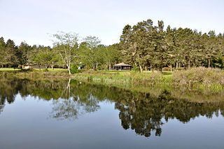
Clear Lake is a natural body of water impounded by sand dunes along the Oregon Coast of the Pacific Ocean in the United States. The lake is the municipal water supply for the city of Reedsport, which lies about 4 miles (6 km) northeast of the lake. Clear Lake is closed to public access to protect the purity of the water.

North Tenmile Lake lake of the United States of America

North Tenmile Lake is one of a chain of lakes along the Oregon Coast south of the Umpqua River in the United States. The chain includes Tenmile, Eel, Clear, and smaller lakes, which drain into the Pacific Ocean via Tenmile Creek. The lake is 8 miles (13 km) south of Reedsport and 1 mile (1.6 km) east of U.S. Route 101 near the community of Lakeside. North Tenmile Lake is connected to Tenmile Lake by a navigable 0.5-mile (0.80 km) channel.

Tenmile, Coos County, Oregon Unincorporated community in Oregon, United States

Tenmile is an unincorporated community in Coos County, Oregon, United States. It is about 8 miles (13 km) south of Winchester Bay and one mile west of Lakeside, on U.S. Route 101 next to Tenmile Creek and the Oregon Dunes. Tenmile Lake was named for Tenmile Creek, which was said to be ten miles south of Winchester Bay.

Tenmile Creek (Lane County, Oregon)

Tenmile Creek is a stream in Lane County, in the U.S. state of Oregon. It flows west from the Siuslaw National Forest in the Oregon Coast Range into the Pacific Ocean at Stonefield Beach State Recreation Site, about 6 miles (10 km) south of Yachats.

North Fork Siuslaw River river in the United States of America

The North Fork Siuslaw River is a tributary of the Siuslaw River in Lane County in the United States state of Oregon. It is formed by the confluence of Sam Creek and West Branch in the Siuslaw National Forest of the Central Oregon Coast Range. The former community of Pawn was once at the juncture of the two creeks. From here, the river flows about 2 miles (3 km) southeast, then about 25 miles (40 km) southwest to meet the main stem 1.2 miles (1.9 km) east of Florence.

South Fork Burnt River river in the United States of America

The South Fork Burnt River is a tributary of the Burnt River in Baker County in the U.S. state of Oregon. Its headwaters lie in the Monument Rock Wilderness and the Wallowa–Whitman National Forest of the Blue Mountains. It flows generally northeast for about to meet the main stem at Unity Reservoir, north of Unity. The river, about 12 miles (19 km) long, crosses under U.S. Route 26 about 3 miles (5 km) northwest of Unity.

Big Creek (Lane County, Oregon)

Big Creek is a stream that enters the Pacific Ocean along the coast of Lane County in the U.S. state of Oregon. Beginning at Saddle Mountain Spring in the Central Oregon Coast Range, it flows generally west through the Siuslaw National Forest to the ocean north of Heceta Head. Near its mouth, it passes under Big Creek Bridge, which carries U.S. Route 101.

Deadwood Creek (Oregon) river in the United States of America

Deadwood Creek is a tributary of Lake Creek in the Siuslaw River basin in Lane County in the U.S. state of Oregon. Beginning near Taylor Butte in the Central Oregon Coast Range, it meanders generally southwest through the Siuslaw National Forest to meet the larger creek at the rural community of Deadwood. This is 5 miles (8 km) from Lake Creek's confluence with the river near Swisshome and 34 miles (55 km) by water from the Siuslaw River's mouth on the Pacific Ocean at Florence.

Fall Creek (Middle Fork Willamette River)

Fall Creek is a 34-mile (55 km) tributary of the Middle Fork Willamette River in Lane County in the U.S. state of Oregon. Beginning in the Cascade Range, the creek flows generally west through the Willamette National Forest to enter the Middle Fork upstream of Jasper, southeast of Springfield and Eugene.

References

  1. Source elevation derived from Google Earth search using GNIS source coordinates.
  2. 1 2 3 "Tenmile Creek". Geographic Names Information System (GNIS). United States Geological Survey. November 28, 1980. Retrieved December 31, 2012.
  3. 1 2 Sheehan, Madelynne Diness (2005). Fishing in Oregon: The Complete Oregon Fishing Guide (10th ed.). Scappoose, Oregon: Flying Pencil Publications. p. 96. ISBN   0-916473-15-5.
  4. McArthur, Lewis A.; McArthur, Lewis L. (2003) [1928]. Oregon Geographic Names (7th ed.). Portland, Oregon: Oregon Historical Society Press. p. 943. ISBN   978-0875952772.
  5. United States Geological Survey (USGS). "United States Geological Survey Topographic Map". TopoQuest. Retrieved December 31, 2012. The relevant quadrangle is Lakeside.
  6. Johnson, Daniel M.; Petersen, Richard R.; Lycan, D. Richard; Sweet, James W.; Neuhaus, Mark E., and Schaedel, Andrew L. (1985). Atlas of Oregon Lakes. Corvallis: Oregon State University Press. pp. 130&ndash, 31 and 243. ISBN   0-87071-343-4.
  7. "Spinreel Campground". U.S. Forest Service. Retrieved December 31, 2012.