Texarkana Air Force Station

Last updated
Texarkana Air Force Station
Air Defense Command.png
Part of Air Defense Command (ADC)
USA Arkansas location map.svg
Red pog.svg
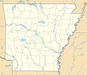
Texarkana AFS
Location of Texarkana AFS, Texas
Coordinates 33°27′20″N093°59′53″W / 33.45556°N 93.99806°W / 33.45556; -93.99806 (Texarkana AFS M-91) Coordinates: 33°27′20″N093°59′53″W / 33.45556°N 93.99806°W / 33.45556; -93.99806 (Texarkana AFS M-91)
Type Air Force Station
Site information
Controlled byFlag of the United States Air Force.svg  United States Air Force
Site history
Built 1955
In use 1955-1968
Garrison information
Garrison 703d Aircraft Control and Warning Squadron
Map all coordinates using: OpenStreetMap  ·  Google Maps
Download coordinates as: KML  ·  GPX
Emblem of the 703d Aircraft Control and Warning Squadron 703d Radar Squadron - Emblem.png
Emblem of the 703d Aircraft Control and Warning Squadron

Texarkana Air Force Station (ADC ID: M-91, NORAD ID: Z-91) is a closed United States Air Force General Surveillance Radar station. It is located 2.4 miles (3.9 km) east-northeast of Texarkana, Arkansas. It was closed in 1968.

United States Air Force Air and space warfare branch of the United States Armed Forces

The United States Air Force (USAF) is the aerial and space warfare service branch of the United States Armed Forces. It is one of the five branches of the United States Armed Forces, and one of the seven American uniformed services. Initially formed as a part of the United States Army on 1 August 1907, the USAF was established as a separate branch of the U.S. Armed Forces on 18 September 1947 with the passing of the National Security Act of 1947. It is the youngest branch of the U.S. Armed Forces, and the fourth in order of precedence. The USAF is the largest and most technologically advanced air force in the world. The Air Force articulates its core missions as air and space superiority, global integrated intelligence, surveillance, and reconnaissance, rapid global mobility, global strike, and command and control.

Texarkana, Arkansas City in the United States

Texarkana is a city in Arkansas and the county seat of Miller County. The city is located across the state line from its twin city, Texarkana, Texas. The city was founded at a railroad intersection on December 8, 1873, and was incorporated in Arkansas on August 10, 1880. Texarkana is the principal city of the Texarkana metropolitan area, which is ranked 274th in terms of population in the United States with 150,098 in 2016 according to the United States Census Bureau.

Contents

History

Texarkana Air Force Station was part of the planned deployment by Air Defense Command of forty-four Mobile radar Texarkana across the United States to support the permanent Radar network established during the Cold War for air defense of the United States. In addition, it provided radar coverage for the Strategic Air Command base at Barksdale AFB, Louisiana. This deployment had been projected to be operational by mid-1952. Funding, constant site changes, construction, and equipment delivery delayed deployment.

Cold War State of geopolitical tension after World War II between powers in the Eastern Bloc and the Western Bloc

The Cold War was a period of geopolitical tension between the Soviet Union with its satellite states, and the United States with its allies after World War II. A common historiography of the conflict begins with 1946, the year U.S. diplomat George F. Kennan's "Long Telegram" from Moscow cemented a U.S. foreign policy of containment of Soviet expansionism threatening strategically vital regions, and ending between the Revolutions of 1989 and the 1991 collapse of the USSR, which ended communism in Eastern Europe. The term "cold" is used because there was no large-scale fighting directly between the two sides as well as no "hot" firearms were used, but they each supported major regional wars known as proxy wars.

Strategic Air Command 1946-1992 United States Air Force major command; predecessor of Air Force Global Strike Command

Strategic Air Command (SAC) was both a United States Department of Defense (DoD) Specified Command and a United States Air Force (USAF) Major Command (MAJCOM), responsible for Cold War command and control of two of the three components of the U.S. military's strategic nuclear strike forces, the so-called "nuclear triad," with SAC having control of land-based strategic bomber aircraft and intercontinental ballistic missiles or ICBMs.

On 1 July 1955 the 703d Aircraft Control and Warning Squadron began operations at Texarkana, and initially the station functioned as a Ground-Control Intercept (GCI) and warning station. As a GCI station, the squadron's role was to guide interceptor aircraft toward unidentified intruders picked up on the unit's radar scopes.

By 1958 the 703rd was using AN/FPS-20 and AN/MPS-14 sets. In 1960 this site was also performing air traffic control duties for the Federal Aviation Administration (FAA). By 1966, the search radar was upgraded to an AN/FPS-91A set. On 31 July 1963, the site was redesignated as NORAD ID Z-91

Federal Aviation Administration United States Government agency dedicated to civil aviation matters

The Federal Aviation Administration (FAA) of the United States is a national authority with powers to regulate all aspects of civil aviation. These include the construction and operation of airports, air traffic management, the certification of personnel and aircraft, and the protection of U.S. assets during the launch or re-entry of commercial space vehicles.

The Air Force inactivated the 703rd on 8 September 1968 with the closure of Texarkana Air Force Station due to the perceived remote threat of an aircraft attack. Today it is used as part of Texarkana Regional Airport. Most USAF buildings are still intact.

Texarkana Regional Airport

Texarkana Regional Airport, also known as Webb Field, is a public use airport located three nautical miles (6 km) northeast of the central business district of Texarkana, a city in Miller County, Arkansas, United States. It is owned by the Texarkana Airport Authority. The airport is located within the city limits of Texarkana, roughly 3 miles east of State Line Avenue. The front gate opens to the northwest, at the intersection of Arkansas Boulevard and U.S. Route 67. A Union Pacific Railroad line runs parallel to US 67 on the side of the highway facing the airport. It is mostly used for general aviation, but is also served by American Eagle.

Air Force units and assignments

Units

Activated at Oklahoma City AFS, OK (P-86), 1 December 1953 (not manned or equipped)
Moved to Texarkana AFS on 1 July 1955
Discontinued and inactivated on 8 September 1968

Assignments

Oklahoma City Air Defense Sector

The Oklahoma City Air Defense Sector (OCADS) is an inactive United States Air Force organization. Its last assignment was with the Air Defense Command's 29th Air Division at Oklahoma City Air Force Station, Oklahoma.

31st Air Division

The 31st Air Division is an inactive United States Air Force organization. Its last assignment was with Air Defense Command, assigned to Tenth Air Force, being stationed at Sioux City Municipal Airport, Iowa. It was inactivated on 31 December 1969.

See also

References

PD-icon.svg This article incorporates  public domain material from the Air Force Historical Research Agency website http://www.afhra.af.mil/ .