The Arctic Archipelago, also known as the Canadian Arctic Archipelago, is an archipelago lying to the north of the Canadian continental mainland, excluding Greenland and Iceland.

The St. Marys River is a 22.3-mile-long (35.9 km) river in southern Maryland in the United States. It rises in southern St. Mary's County, and flows to the southeast through Great Mills, widening into a tidal estuary near St. Mary's City, approximately 2 miles (3 km) wide at its mouth on the north bank of the Potomac River, near the Chesapeake Bay to the east.

The Second Happy Time was a phase in the Battle of the Atlantic during which Axis submarines attacked merchant shipping and Allied naval vessels along the east coast of North America. The First Happy Time was in 1940–1941 in the North Atlantic and North Sea. Adolf Hitler and Benito Mussolini declared war on the United States on 11 December 1941, and as a result their navies could begin the Second Happy Time.

Central Frontenac is a township in eastern Ontario, Canada in the County of Frontenac.

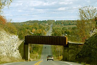
South Frontenac is a township in Frontenac County in eastern Ontario, Canada. It was amalgamated in 1998 from the former townships of Bedford, Loughborough, Portland, and Storrington.

Senneterre is a town in the Abitibi-Témiscamingue region of northwestern Quebec, Canada. It is in La Vallée-de-l'Or Regional County Municipality.
Pleasant Bay is a bay in Washington County, Maine, at the mouth of the Pleasant River.
Conowingo Creek is a 20.2-mile-long (32.5 km) tributary of the Susquehanna River in Lancaster County, Pennsylvania, and Cecil County, Maryland.
Little Chiques Creek is a 20.6-mile-long (33.2 km) tributary of Chiques Creek in Lancaster County, Pennsylvania in the United States.

Stone Mills is a lower-tier township north of Greater Napanee in Lennox and Addington County, Ontario, Canada. According to the 2016 census, the township has a population of 7,702.
Lyons Creek is an 11.2-mile-long (18.0 km) tributary of the Patuxent River in Maryland. Lyons Creek serves as the border between southern Anne Arundel County, Maryland and northern Calvert County, Maryland.
Foustown is an unincorporated community in West Manchester Township, York County, Pennsylvania, United States.

The Civil War Defenses of Washington were a group of Union Army fortifications that protected the federal capital city, Washington, D.C., from invasion by the Confederate States Army during the American Civil War.
Saqajaa {Inuktitut syllabics: ᓴᖃᔮ) formerly Sakkiak Island is one of the uninhabited Canadian arctic islands located in Hudson Strait, Nunavut, Canada. It is a Baffin Island offshore island in the Qikiqtaaluk Region, separated by deep water from Cape Dorset 64°10′40″N76°29′00″W, 1.5 mi (2.4 km) to the south-southwest. The island is approximately 6 km2 (2.3 sq mi) in size, 2.25 mi (3.62 km) long, and 1 mi (1.6 km) wide. The elevation is approximately 65 m (213 ft) above sea level.
German submarine U-76 was a Type VIIB U-boat of Nazi Germany's Kriegsmarine during World War II. She played a minor role in the Battle of the Atlantic, but was destroyed south of Iceland.

Pennsylvania State Game Lands Number 13 are Pennsylvania State Game Lands in Columbia County and Sullivan County, in Pennsylvania, in the United States. They have an area of 49,529 acres. The game lands are mountainous and contain streams such as West Branch Fishing Creek and its tributaries. The main game animals in the area include bear, deer, grouse, turkey, and waterfowl. The game lands are adjacent to Pennsylvania State Game Lands Number 57.


