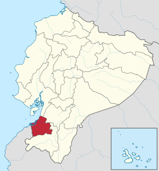
Guayas is a coastal province in Ecuador. It is bordered to the west by Manabí, Santa Elena, and the Pacific Ocean ; to the east by Los Ríos, Bolívar, Chimborazo, Cañar, and Azuay; to the north by Los Ríos and Bolívar; and to the south by El Oro and the Pacific Ocean.
El Oro is the southernmost of Ecuador's coastal provinces. It was named for its historically important gold production. Today it is one of the world's major exporters of bananas. The capital is Machala.

Los Ríos is a province in Ecuador. The capital is Babahoyo. The province was founded on October 6, 1860. Under legislative decree. Babahoyo was made its capital on September 30, 1948.

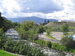
The Daule River is a river in Ecuador, in Guayas Province. At Guayaquil, it joins the Babahoyo River; from that point the confluence becomes the Guayas River.
The Babahoyo River is a river in western Ecuador, fed by tributaries rising in the Andes Mountains. It takes its name from the town of Babahoyo in Los Ríos. At Durán, it joins the Daule River to form the Guayas River, which continues to the Pacific Ocean.
Naranjal is a canton in the province of Guayas in western continental Ecuador. The canton was created in 1960 and named after its seat, Naranjal.

Catamayo Canton is a canton of Loja Province in Ecuador. Its seat is Catamayo. It is located in the north of the province, bordered by the cantons of Loja, Gonzanamá, Olmedo, and Chaguarpamba. In it is located the largest and most fertile valley of the province, and is the location of the Monterrey Sugar Cane Processing Plant, a major sugarcane operation which is a financial boon to the province and country. The town of La Toma in Catamayo is the seat of the city of Loja's airport.

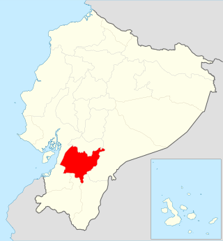
Daule, is a canton located in the Guayas province in Ecuador. Created in 1820, it is one of the most important parts of Guayas thanks to its rice production and other products such as corn and eggs.

The Province of Santa Elena is a province of Ecuador in the coastal region. Created in 2007 from territory that belonged to the Guayas Province, it is one of the two newest provinces of Ecuador, along with Santo Domingo de Los Tsáchilas. Its capital city is Santa Elena, from which the province derives its name.
The Taura River is a river of Ecuador. It flows into the Churute Estuary in the Gulf of Guayaquil. It gives its name to the shrimp disease Taura syndrome, which was first described in shrimp farms along the river.
The Vinces River is a river of western Ecuador.
The Yanuncay River is a river of Ecuador. It runs through the city of Cuenca.
Santa Isabel Canton is a canton of Ecuador, located in the Azuay Province. Its capital is the town of Santa Isabel. Its population at the 2001 census was 18,015.
Santa Lucía Canton is a canton of Ecuador, located in the Guayas Province. Its capital is the town of Santa Lucía. Its population at the 2001 census was 33,868.
Simón Bolívar Canton is a canton of Ecuador, located in the Guayas Province. Its capital is the town of Simón Bolívar. Its population at the 2001 census was 20,385.

Macará Canton is a canton of Ecuador, located in the Loja Province. Its capital is the town of Macará. Its population at the 2001 census was 18,350.
Sozoranga Canton is a canton of Ecuador, located in the Loja Province. Its capital is the town of Sozoranga. Its population at the 2001 census was 7,994.

Puebloviejo Canton is a canton of Ecuador, located in the Los Ríos Province. Its capital is the town of Puebloviejo. Its population at the 2001 census was 29,420.

The University of Guayaquil, known colloquially as the Estatal, is a public university in Guayaquil, Guayas Province, Ecuador.
The National Unity Bridge is a bridge complex in northeastern Guayaquil, Ecuador with a length of 2,186 metres (7,172 ft). The National Unity Bridge crosses the Daule River and Babahoyo River, which combine to form the Guayas River immediately downstream. The bridge complex consists of four individual bridges: two parallel bridges across the Daule River and two parallel bridges across the Babahoyo River, along with a road in La Puntilla, Samborondón that links each set of bridges. The bridge connects the city of Guayaquil with Durán to its east, and by extension to the highland part of Ecuador. Construction of the National Unity Bridge commenced on 23 March 1967, and the bridge was inaugurated on 9 October 1970.