The Picts were a group of peoples who lived in Britain north of the Forth–Clyde isthmus in the Pre-Viking, Early Middle Ages. Where they lived and details of their culture can be inferred from early medieval texts and Pictish stones. The term Picti appears in written records as a Latin pejorative exonym from the third century CE, but was adopted as an endonym in the late seventh century during the Verturian hegemony. This lasted around 160 years until the succession of the Alpínid dynasty, when the Pictish kingdom merged with that of Dál Riata to form the Kingdom of Alba. The concept of "Pictish kingship" continued for a few decades until it was abandoned entirely as a contemporary signifier during the reign of Caustantín mac Áeda.
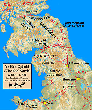
Rheged was one of the kingdoms of the Hen Ogledd, the Brittonic-speaking region of what is now Northern England and southern Scotland, during the post-Roman era and Early Middle Ages. It is recorded in several poetic and bardic sources, although its borders are not described in any of them. A recent archaeological discovery suggests that its stronghold was located in what is now Galloway in Scotland rather than, as was previously speculated, being in Cumbria. Rheged possibly extended into Lancashire and other parts of northern England. In some sources, Rheged is intimately associated with the king Urien Rheged and his family. Its inhabitants spoke Cumbric, a Brittonic dialect closely related to Old Welsh.

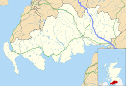
Kirkcudbrightshire, or the County of Kirkcudbright or the Stewartry of Kirkcudbright is one of the historic counties of Scotland, covering an area in the south-west of the country. Until 1975, Kirkcudbrightshire was an administrative county used for local government. Since 1975, the area has formed part of Dumfries and Galloway for local government purposes. Kirkcudbrightshire continues to be used as a registration county for land registration. A lower-tier district called Stewartry covered the majority of the historic county from 1975 to 1996. The area of Stewartry district is still used as a lieutenancy area. Dumfries and Galloway Council also has a Stewartry area committee.

Galloway is a region in southwestern Scotland comprising the historic counties of Wigtownshire and Kirkcudbrightshire. It is administered as part of the council area of Dumfries and Galloway.

Jarlshof is the best-known prehistoric archaeological site in Shetland, Scotland. It lies in Sumburgh, Mainland, Shetland and has been described as "one of the most remarkable archaeological sites ever excavated in the British Isles". It contains remains dating from 2500 BC up to the 17th century AD.

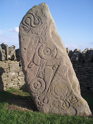
A Pictish stone is a type of monumental stele, generally carved or incised with symbols or designs. A few have ogham inscriptions. Located in Scotland, mostly north of the Clyde-Forth line and on the Eastern side of the country, these stones are the most visible remaining evidence of the Picts and are thought to date from the 6th to 9th century, a period during which the Picts became Christianized. The earlier stones have no parallels from the rest of the British Isles, but the later forms are variations within a wider Insular tradition of monumental stones such as high crosses. About 350 objects classified as Pictish stones have survived, the earlier examples of which holding by far the greatest number of surviving examples of the mysterious symbols, which have long intrigued scholars.
Portmahomack is a small fishing village in Easter Ross, Scotland. It is situated in the Tarbat Peninsula in the parish of Tarbat. Tarbat Ness Lighthouse is about three miles from the village at the end of the Tarbat Peninsula. Ballone Castle lies about one mile from the village. There is evidence of early settlement, and the area seems to have been the site of significant activity during the time of the Picts, early Christianity and the Vikings. The village is situated on a sandy bay and has a small harbour designed by Thomas Telford: it shares with Hunstanton the unusual distinction of being on the east coast but facing west. Portmahomack lies inside the Moray Firth Special Area of Conservation with the associated dolphin and whale watching activity.

Gatehouse of Fleet is a town half in the civil parish of Girthon and half in the parish of Anwoth, divided by the river Fleet, Kirkcudbrightshire, within the district council region of Dumfries and Galloway, Scotland, which has existed since the mid-18th century, although the area has been inhabited since much earlier.

The Britons, also known as Celtic Britons or Ancient Britons, were the people of Celtic language and culture who inhabited Great Britain from at least the British Iron Age until the High Middle Ages, at which point they diverged into the Welsh, Cornish and Bretons. They spoke Common Brittonic, the ancestor of the modern Brittonic languages.
The Novantae were a people of the late 2nd century who lived in what is now Galloway and Carrick, in southwesternmost Scotland. They are mentioned briefly in Ptolemy's Geography, and there is no other historical record of them. Excavations at Rispain Camp, near Whithorn, show that it was a large fortified farmstead occupied between 100 BC and 200 AD, indicating that the people living in the area at that time were engaged in agriculture.
Vitrified forts are stone enclosures whose walls have been subjected to vitrification through heat. It was long thought that these structures were unique to Scotland, but they have since been identified in several other parts of western and northern Europe.
Dunragit is a village on the A75, between Stranraer and Glenluce in Dumfries and Galloway, south-west Scotland. Dunragit is within the parish of Old Luce, in the traditional county of Wigtownshire. The modern village grew up around the west gate of Dunragit House, an 18th-century country house, though there is evidence of Neolithic settlement in the area.
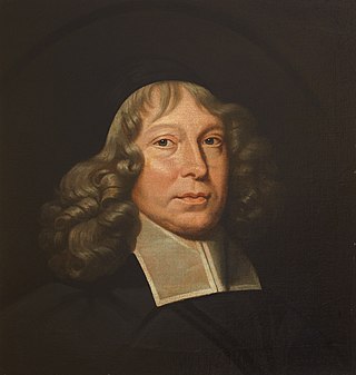
Anwoth is a settlement near the Solway Firth in the historic county of Kirkcudbrightshire, southwest Scotland, within a parish of the same name in the Vale of Fleet, Dumfries and Galloway. Anwoth lies a mile (1.5 km) to the west of Gatehouse of Fleet.

Scotland was divided into a series of kingdoms in the early Middle Ages, i.e. between the end of Roman authority in southern and central Britain from around 400 CE and the rise of the kingdom of Alba in 900 CE. Of these, the four most important to emerge were the Picts, the Gaels of Dál Riata, the Britons of Alt Clut, and the Anglian kingdom of Bernicia. After the arrival of the Vikings in the late 8th century, Scandinavian rulers and colonies were established on the islands and along parts of the coasts. In the 9th century, the House of Alpin combined the lands of the Scots and Picts to form a single kingdom which constituted the basis of the Kingdom of Scotland.

Prehistoric Orkney refers only to the prehistory of the Orkney archipelago of Scotland that begins with human occupation. Although some records referring to Orkney survive that were written during the Roman invasions of Scotland, “prehistory” in northern Scotland is defined as lasting until the start of Scotland's Early Historic Period.
Old Luce is a civil parish in Dumfries and Galloway, Scotland. It lies in the Machars peninsula, in the traditional county of Wigtownshire. The parish is around 10 miles (16 km) long and 8 miles (13 km) broad, and contains 40,350 acres (16,330 ha).

Hillforts in Scotland are earthworks, sometimes with wooden or stone enclosures, built on higher ground, which usually include a significant settlement, built within the modern boundaries of Scotland. They were first studied in the eighteenth century and the first serious field research was undertaken in the nineteenth century. In the twentieth century there were large numbers of archaeological investigations of specific sites, with an emphasis on establishing a chronology of the forts. Forts have been classified by type and their military and ritual functions have been debated.

Burghead Fort was a Pictish promontory fort on the site now occupied by the small town of Burghead in Moray, Scotland. It was one of the earliest power centres of the Picts and was three times the size of any other enclosed site in Early Medieval Scotland. The fort was probably the main centre of the Pictish Kingdom of Fortriu, flourishing like the kingdom itself from the 4th to the 9th centuries.
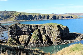
Dunnicaer, or Dun-na-caer, is a precipitous sea stack just off the coast of Aberdeenshire, Scotland, between Dunnottar Castle and Stonehaven. Despite the unusual difficulty of access, in 1832 Pictish symbol stones were found on the summit and 21st-century archaeology has discovered evidence of a Pictish hill fort which may have incorporated the stones in its structure. The stones may have been incised in the third or fourth centuries AD but this goes against the general archaeological view that the simplest and earliest symbol stones date from the fifth or even seventh century AD.

William Galloway (1830–1897) was a 19th-century architect mainly remembered as an architectural historian. He also worked as an architectural illustrator and photographer.

