Barnet was a local government district in south Hertfordshire from 1863 to 1965 around the town of Barnet.
East Barnet Valley was a local government district from 1863 to 1965 around the town of East Barnet. It was partly in the counties of Hertfordshire and Middlesex until 1889, when the Middlesex part was transferred to Hertfordshire. It was renamed East Barnet in 1935.
The London Borough of Barnet, located on the northern periphery of London and having much of the area within its boundaries in the Metropolitan Green Belt, has a large number of parks and open spaces. In addition there are large areas taken over by cemeteries and golf courses, and part of Hampstead Heath.
Mill Hill Park is a large public park in Mill Hill in the London Borough of Barnet. It one of Barnet's premier parks and it has been given a Green Flag Award.

Hadley Wood is a suburb in the north of Greater London, close to the border with Hertfordshire. It is located in the London Borough of Enfield, about 11 miles (17.7 km) north north-west of Charing Cross and is situated close to Barnet.
Ludgrove, or Ludgrave, or Ludgraves, was an estate and farm in Middlesex between Monken Hadley in the west and Cockfosters in the east in what is now north London. It was centered on Ludgrove Farm near to Cockfosters.

Pymmes Brook is located in North London and named after William Pymme, a local land owner. It is a minor tributary of the River Lea. The brook mostly flows through urban areas and is particularly prone to flooding in its lower reaches. To alleviate the problem the brook has been culverted in many areas. Part of it is a Site of Borough Importance for Nature Conservation, Grade II.

Hadley Green is a 10 hectare Site of Metropolitan Importance for Nature Conservation in Monken Hadley in the London Borough of Barnet. The reserve straddles the Great North Road between Hadley Green Road and Fold Lane.

King George's Fields is a 28 hectare Site of Borough Importance for Nature Conservation, Grade II, in Monken Hadley in the London Borough of Barnet.

Basing Hill Park is a small public park in Childs Hill in the London Borough of Barnet. Together with the neighbouring Childs Hill Park it is one of Barnet's 'Premier Parks'. It is mainly grassed with scattered trees, a multipurpose tennis court/football pitch, basketball court and a children's playground.

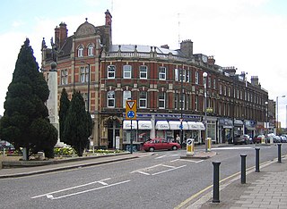
Victoria Recreation Ground is a public park in New Barnet in the London Borough of Barnet. It is one of Barnet's 'Premier Parks'.

Covert Way is the only Local Nature Reserve in the London Borough of Enfield. It is also part of the Hadley Wood Golf Course and Covert Way Field Site of Borough Importance for Nature Conservation, Grade I, and it has an area of 7 hectares. It is on the southern border of Enfield between the road named Covert Way and Monken Hadley Common in Barnet.

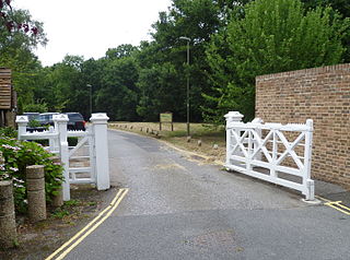
The Gate House and Gate, Monken Hadley, in the London Borough of Barnet, are grade II listed buildings The house is in the Gothic style, early nineteenth century. The gates are of timber and are one of a number of white timber gates that mark the main access points to Monken Hadley Common.

Pagitts Almshouses, 1–6 Hadley Green Road, Monken Hadley, in the London Borough of Barnet, are grade II listed buildings. The almshouses are on the north side of the road between St Mary, Monken Hadley church and the Monken Hadley Common Gate House and Gates.
Games Road is a road in Cockfosters, London, that runs from Chalk Road in the east into Monken Hadley Common in the west. The road falls into the Monken Hadley Conservation Area.
Monken Hadley School is a primary school located in Monken Hadley Common. Monks founded Monken Hadley in the 13th century and a school was built by the Church of England in partnership with the government in 1832. The Common leads to Hadley Woods which used to be part of Enfield Chase. Royalty hunted here and in 1777 King George III passed an act of parliament giving the villagers local farming rights. The school badge features the church tower and its 'creset beacon'.

Folly Farm, originally Folly House, on the southern edge of Monken Hadley Common, was a farm that dated from 1686 and became a popular recreation site in the early 20th century. The site is now occupied by the Jewish Community Secondary School.
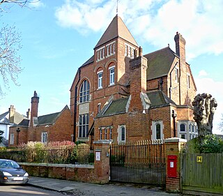
Monkenhurst is a house in the Victorian Gothic style at 15 The Crescent on the north edge of New Barnet in London, England. It overlooks Monken Hadley Common. The house was built in 1880 to a design by Peter Dollar and was once the home of the comedian Spike Milligan. In 2002 Mr & Mrs Dervish, Solicitors purchased Monkenhurst.