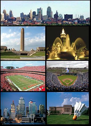
The Kansas City metropolitan area is a bi-state metropolitan area containing Kansas City, Missouri. Its 14 counties straddle the border between the U.S. states of Missouri and Kansas having its core in both states.. With 8,472 square miles (21,940 km2) and a population of more than 2.2 million people, it is the second-largest metropolitan area with its 1950s dominant historic core city in Missouri and is the largest metropolitan area in Kansas, though Wichita is the largest metropolitan area with its 1950s dominant historic core city in Kansas. Alongside Kansas City, Missouri, these are the suburbs with populations above 100,000: Overland Park, Kansas; Kansas City, Kansas; Olathe, Kansas; Independence, Missouri; and Lee's Summit, Missouri.

Crown Center is a shopping center and neighborhood located near Downtown Kansas City, Missouri between Gillham Road and Main Street to the east and west, and between OK/E 22nd St and E 27th St to the north and south. The shopping center is anchored by Halls, a department store which is owned and operated by Hallmark Cards. The neighborhood contains numerous residences, retail establishments, entertainment venues, and restaurants including the American Restaurant, the only Forbes Travel Guide four-star restaurant in Missouri. It is home to Hallmark Cards, and the headquarters of Shook, Hardy & Bacon and Lathrop GPM, two of Kansas City's largest law firms.

The Crossroads is a neighborhood within Greater Downtown with a population of 7,491. It is centered at approximately 19th Street and Baltimore Avenue, directly south of the Downtown Loop and north of Crown Center. It is the city's main art gallery district and center for the visual arts. Dozens of galleries are located in its renovated warehouses and industrial buildings. It is also home to numerous restaurants, housewares shops, architects, designers, an advertising agency, and other visual artists. The district also has several live music venue.
Strawberry Hill is a historic neighborhood in Kansas City, Kansas, United States. It is bordered by Minnesota Avenue to its north, by Interstate 70 to its east and south, and by 7th Street to its west.

Ward Parkway is a boulevard in Kansas City, Missouri, United States. Ward Parkway begins at Brookside Boulevard on the eastern edge of the Country Club Plaza and travels west 2.8 miles along Brush Creek as U.S. Route 56 before turning south near Kansas-Missouri state line. It continues south for 4 miles, terminating at Wornall Road near Bannister Road. A short spur, Brush Creek Parkway, connects Ward Parkway to Shawnee Mission Parkway at State Line Road.
Volker is a historic neighborhood in Kansas City, MO that lies just northwest of the Westport historic and entertainment district. The 39th Street West District and the Old Westport Shopping Center lie within the Volker neighborhood. The boundaries of the Volker Neighborhood are 31st Street on the north and Westport Road/43rd Street on the south. The western boundary is State Line Road. On the east, the boundaries are Roanoke Road on the north side of 39th and Southwest Trafficway south of 39th.
Southwest Boulevard is an arterial street in Kansas City, MO and Kansas City, KS.
Brookside is a collection of neighborhoods located in Kansas City, Missouri, bounded by 55th Street on the North, Gregory on the South, Ward Parkway on the West, and Troost on the East. The neighborhood contains the Brookside Shopping District.

The Paseo is a major north–south parkway in Kansas City, Missouri. As the city's first major boulevard, it runs approximately 10 miles (16 km) through the center of the city: from Cliff Drive and Lexington Avenue on the bluffs above the Missouri River in the Pendleton Heights historic neighborhood, to 85th Street and Woodland Avenue. The parkway holds 223 acres (0.90 km2) of boulevard parkland dotted with several Beaux-Arts-style decorative structures and architectural details maintained by the city's Parks and Recreation department.
Main Street or Main is a one of the major streets in Kansas City, Missouri and the Kansas City metropolitan area. Main Street serves as the main administrative dividing line for house numbering and east–west streets in Kansas City; for example, it separates East 59th Street from West 59th Street. Address numbers on east–west streets increase in both directions as one moves away from Main Street. This should not be confused with the Kansas City "East Side" and "West Side," a cultural distinction which has arisen from a history of racist segregation in the city, separated by Troost Avenue approximately 1 mile east of Main Street.

Southmoreland is a neighborhood located in Kansas City, Missouri. Home to the Nelson-Atkins Museum of Art, Kemper Museum of Contemporary Art and the Kansas City Art Institute, it is noteworthy for its reputation as home to Kansas City’s artistic and intellectual elite. Southmoreland neighborhood is located between 39th Street on the north, Rockhill and Gillham Road on the east, Emanuel Cleaver II Boulevard on the south and Main Street on the west. Since 2019, following finalized plans for a Streetcar extension from Union Station to UMKC, the neighborhood has experienced a massive wave of new real estate development along Main Street.

Hyde Park is a historic residential neighborhood and city park in Kansas City, Missouri.
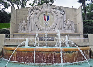
39th Street is a major east–west street in Kansas City, Missouri, running almost 5 miles from State Line Road at the Kansas-Missouri border to Topping Avenue in Kansas City's East Side. It was originally named Rosedale Avenue as it led to the town of Rosedale. It continues west into Kansas as 39th Avenue through The University of Kansas Hospital's Kansas City, Kansas, campus.
Gillham Road is a major north/south main street that runs in Kansas City, Missouri from the intersection of 22nd Street at Oak Street to Harrison Road between 45th and 46th Streets. Gillham Road becomes Gillham Plaza from 31st Street to 34th Street. This causes Gillham Road to go over one block east into a residential neighborhood.
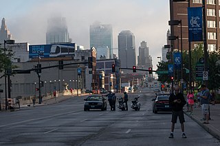
Hospital Hill is a neighborhood in Kansas City, Missouri. The neighborhood is located between 22nd Street to 25th Street and Gillham Road to Troost Avenue. This name reflects the geography and a history of public hospitals on the same site since 1870. Hospital Hill grew in concordance with the construction of local hospitals, and was further populated as the University of Missouri–Kansas City School of Medicine was established.
Washington-Wheatley is a historic neighborhood in Kansas City, Missouri, United States. The neighborhood is located between 18th Street and 27th Street and Prospect Avenue to I-70.

Armour Hills is a neighborhood located in Kansas City, Missouri. It is bounded on the west by Brookside Road, on the north by 65th Street, on the east by Oak Street and the south by Gregory Boulevard. The name of this area derives from the fact that the land was owned by members of the Armour family of the Armour and Company.
Valentine is a historic neighborhood in Midtown Kansas City, Missouri. It is just north of the Westport entertainment district, bounded by Broadway on the east, Southwest Trafficway on the west, 31st Street on the north, and 40th Street on the south.
Southwest is a mixed commercial and residential neighborhood in Wichita, Kansas, United States. It consists of a large area west of the Arkansas River in the southern part of the city.
Polish Hill is a neighborhood in Kansas City, Kansas, located southwest of Strawberry Hill, that was historically occupied by mixed Slavic and Eastern European immigrants.


