Birch Cove is a subdivision and a cove in the community of Bedford area of the Halifax Regional Municipality, Nova Scotia, Canada, on the shore of Bedford Basin and along the Bedford Highway. The name is after the birch trees that hung over the cove by William Donaldson, who named his estate Birch Cove.

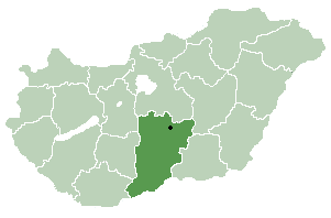
Jakabszállás is a village in Bács-Kiskun county, in the Southern Great Plain region of Hungary.

Verin Ptghni, is a village in the Kotayk Province of Armenia.

Katarzynów is a village in the administrative district of Gmina Kobiele Wielkie, within Radomsko County, Łódź Voivodeship, in central Poland. It lies approximately 4 kilometres (2 mi) south-west of Kobiele Wielkie, 13 km (8 mi) south-east of Radomsko, and 87 km (54 mi) south of the regional capital Łódź.

Zrecze Chałupczańskie is a village in the administrative district of Gmina Chmielnik, within Kielce County, Świętokrzyskie Voivodeship, in south-central Poland. It lies approximately 4 kilometres (2 mi) east of Chmielnik and 34 km (21 mi) south of the regional capital Kielce.

Pętkowice is a village in the administrative district of Gmina Bałtów, within Ostrowiec County, Świętokrzyskie Voivodeship, in south-central Poland. It lies approximately 4 kilometres (2 mi) east of Bałtów, 17 km (11 mi) north-east of Ostrowiec Świętokrzyski, and 71 km (44 mi) east of the regional capital Kielce.

Sośniczany is a village in the administrative district of Gmina Koprzywnica, within Sandomierz County, Świętokrzyskie Voivodeship, in south-central Poland. It lies approximately 3 kilometres (2 mi) north-east of Koprzywnica, 13 km (8 mi) south-west of Sandomierz, and 76 km (47 mi) south-east of the regional capital Kielce.
Lichwin is a village in the administrative district of Gmina Sieraków, within Międzychód County, Greater Poland Voivodeship, in west-central Poland.

Stara Kaletka is a village in the administrative district of Gmina Purda, within Olsztyn County, Warmian-Masurian Voivodeship, in northern Poland. It lies approximately 16 kilometres (10 mi) south-west of Purda and 21 km (13 mi) south of the regional capital Olsztyn.

Grabowiec is a village in the administrative district of Gmina Recz, within Choszczno County, West Pomeranian Voivodeship, in north-western Poland. It lies approximately 4 kilometres (2 mi) east of Recz, 17 km (11 mi) north-east of Choszczno, and 71 km (44 mi) east of the regional capital Szczecin.

Jadwiżyn is a village in the administrative district of Gmina Szczecinek, within Szczecinek County, West Pomeranian Voivodeship, in north-western Poland. It lies approximately 5 kilometres (3 mi) south-west of Szczecinek and 139 km (86 mi) east of the regional capital Szczecin.

Krušje is a village in the municipality of Aleksinac, Serbia. According to the 2002 census, the village has a population of 332 people.

Jaruga is a village in the municipality of Bosansko Grahovo, Bosnia and Herzegovina.

Nuglašica is a village in the municipality of Bosansko Grahovo, Bosnia and Herzegovina.

Zavolje is a village in the municipality of Ključ, Bosnia and Herzegovina.

Crijevčići is a village in the municipality of Kladanj, Bosnia and Herzegovina.

Vranovo is a village in the municipality of Smederevo, Serbia. According to the 2012 census, the village has a population of 13882 people.
Do Palangu is a village in Bord Khun Rural District, Bord Khun District, Deyr County, Bushehr Province, Iran. At the 2006 census, its population was 55, in 13 families.
Shahrak-e Gharbi is a village in Qeshlaq-e Shomali Rural District, in the Central District of Parsabad County, Ardabil Province, Iran. At the 2006 census, its population was 1,425, in 384 families.
Adatepe Olive Oil Museum is a museum in Çanakkale Province, Turkey The museum is at 39°32′51″N26°36′04″E in Adatepe village of Ayvacık ilçe (district) and on Turkish state highway connecting İzmir to Çanakkale. It is located in an abandoned soap plant. It was opened in 2001 by a private olive company.


