Valley Creek (Pennsylvania)

Last updated
Valley Creek
Creek
Country United States
State Pennsylvania
Region Chester County
Tributaries
 - right Little Valley Creek
Mouth Schuylkill River
 - location Valley Forge
 - elevation 59 ft (18 m)
 - coordinates 40°06′09″N75°27′42.4″W / 40.10250°N 75.461778°W / 40.10250; -75.461778 Coordinates: 40°06′09″N75°27′42.4″W / 40.10250°N 75.461778°W / 40.10250; -75.461778
Basin 23.4 sq mi (61 km2)
Discharge for 40°04′45″N75°27′40″W / 40.07917°N 75.46111°W / 40.07917; -75.46111
 - average 19 cu ft/s (1 m3/s)
 - max 53 cu ft/s (2 m3/s)
 - min 9.1 cu ft/s (0 m3/s)
USA Pennsylvania location map.svg
Red pog.svg
Location of Valley Creek's Mouth

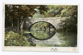
Valley Creek is a 10.8-mile-long (17.4 km) tributary of the Schuylkill River in eastern Chester County, Pennsylvania, United States, flowing through an area known as the Great Valley. [1]

Schuylkill River River in eastern Pennsylvania, United States

The Schuylkill River is an important river running northwest to southeast in eastern Pennsylvania, which was improved by navigations into the Schuylkill Canal. Several of its tributaries drain major parts of the center-southern and easternmost Coal Regions in the state.

Chester County, Pennsylvania County in Pennsylvania, United States

Chester County (Chesco) is a county in the U.S. state of Pennsylvania. As of the 2010 census, the population was 498,886, increasing by 4.1% to a census-estimated 519,293 residents as of 2017. The county seat is West Chester. Chester County was one of the three original Pennsylvania counties created by William Penn in 1682. It was named for Chester, England.

United States Federal republic in North America

The United States of America (USA), commonly known as the United States or America, is a country composed of 50 states, a federal district, five major self-governing territories, and various possessions. At 3.8 million square miles, the United States is the world's third or fourth largest country by total area and is slightly smaller than the entire continent of Europe's 3.9 million square miles. With a population of over 327 million people, the U.S. is the third most populous country. The capital is Washington, D.C., and the largest city by population is New York City. Forty-eight states and the capital's federal district are contiguous in North America between Canada and Mexico. The State of Alaska is in the northwest corner of North America, bordered by Canada to the east and across the Bering Strait from Russia to the west. The State of Hawaii is an archipelago in the mid-Pacific Ocean. The U.S. territories are scattered about the Pacific Ocean and the Caribbean Sea, stretching across nine official time zones. The extremely diverse geography, climate, and wildlife of the United States make it one of the world's 17 megadiverse countries.

Contents

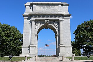
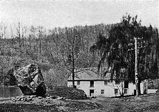
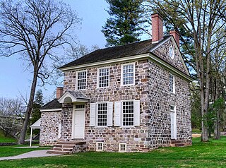
Around 1740 a forge was erected along Valley Creek near its confluence with the Schuylkill. This gave rise to the community of Valley Forge. Later the creek powered a saw mill and grist mill there. In 1777, the forge and mills were destroyed by the British Army during the American Revolutionary War. In December 1777, George Washington chose Valley Forge as the site for the winter encampment of the Continental Army partly because Valley Creek and the Schuylkill River formed natural defensive barriers for the rear of the camp. Washington's Headquarters during this period was in a farmhouse close to the confluence. The American forces departed in the spring of 1778.

Confluence Meeting of two or more bodies of flowing water

In geography, a confluence occurs where two or more flowing bodies of water join together to form a single channel. A confluence can occur in several configurations: at the point where a tributary joins a larger river ; or where two streams meet to become the source of a river of a new name ; or where two separated channels of a river rejoin at the downstream end.

Valley Forge, Pennsylvania Unincorporated settlement in Pennsylvania, United States

The Village of Valley Forge is an unincorporated settlement located on the west side of Valley Forge National Historical Park at the confluence of Valley Creek and the Schuylkill River in Pennsylvania, United States. The remaining village is in Schuylkill Township of Chester County, but once spanned Valley Creek into Montgomery County. The name Valley Forge is often used to refer to anywhere in the general vicinity of the park, and many places actually in King of Prussia, Trooper, Oaks, and other nearby communities will use the name, leading to some ambiguity on the actual location of the modern village.

British Army land warfare branch of the British Armed Forces of the United Kingdom

The British Army is the principal land warfare force of the United Kingdom, a part of British Armed Forces. As of 2018, the British Army comprises just over 81,500 trained regular (full-time) personnel and just over 27,000 trained reserve (part-time) personnel.

See also

Related Research Articles

Audubon, Pennsylvania Census-designated place in Pennsylvania, United States

Audubon is a census-designated place (CDP) in Montgomery County, Pennsylvania, United States. The population was 8,433 at the 2010 census.

King of Prussia, Pennsylvania Census-designated place in Pennsylvania, United States

King of Prussia is a census-designated place in Upper Merion Township, Montgomery County, Pennsylvania, United States. As of the 2010 census, its population was 19,936. The community took its name in the 18th century from a local tavern named the King of Prussia Inn, which was named after King Frederick the Great of Prussia. Like the rest of Montgomery County, King of Prussia continues to experience rapid development. The largest shopping mall in the United States, King of Prussia, is located here. Also located here is the headquarters of the Nuclear Regulatory Commission Region I. King of Prussia is considered to be an edge city of Philadelphia, consisting of large amounts of retail and office space situated at the convergence of four highways.

Tulpehocken Creek (Pennsylvania) creek in southeastern Pennsylvania, United States

Tulpehocken Creek is a 39.5-mile-long (63.6 km) tributary of the Schuylkill River in southeastern Pennsylvania in the United States, and during the American Canal Age, once provided nearly half the length of the Union Canal linking the port of Philadelphia, the largest American city and the other communities of Delaware Valley with the Susquehanna basin and the Pennsylvania Canal System connecting the Eastern seaboard to Lake Erie and the new settlements of the Northwest Territory via the Allegheny}, Monongahela. and Ohio Rivers at Pittsburgh.

Valley Forge National Historical Park

Valley Forge National Historical Park is the site of the third winter encampment of the Continental Army during the American Revolutionary War, taking place from December 19, 1777 to June 19, 1778. The National Historical Park preserves the site and interprets the history of the Valley Forge encampment. Originally Valley Forge State Park, it became a national historical park in 1976. The Park contains historical buildings, recreated encampment structures, memorials, museums, and recreation facilities.

Pine Creek is a tributary of Mahantango Creek in Schuylkill and Dauphin counties, Pennsylvania, in the United States. It is approximately 23.7 miles (38.1 km) long. The creek flows through Foster Township, Hegins Township, Hubley Township, and Upper Mahantango Township in Schuylkill County and Lykens Township in Dauphin County. The creek's watershed has an area of 76.8 square miles (199 km2) and its tributaries include Rausch Creek and Deep Creek. Pine Creek is considered by the Pennsylvania Department of Environmental Protection to be impaired by abandoned mine drainage and resource extraction. However, it is designated as a coldwater fishery.

Wiconisco Creek is a tributary of the Susquehanna River in Schuylkill and Dauphin counties, Pennsylvania, in the United States. It is approximately 45.5 miles (73.2 km) long.

Catawissa Creek tributary of the Susquehanna River in Pennsylvania

Catawissa Creek is a 41.8-mile-long (67.3 km) tributary of the Susquehanna River in east-central Pennsylvania in the United States. Its watershed has an area of 153 square miles (400 km2).

Octoraro Creek river in the United States of America

Octoraro Creek is a 22.1-mile-long (35.6 km) tributary of the Susquehanna River, joining it 9 miles (14 km) above the Susquehanna's mouth at Chesapeake Bay. The Octoraro rises as an East and West Branch in Pennsylvania. The East Branch and Octoraro Creek form the southern half of the border between Lancaster and Chester counties until the creek crosses the Mason-Dixon line. It winds through northwestern Cecil County, Maryland before joining the Susquehanna.

French Creek (Schuylkill River tributary) Pennsylvania

French Creek, once known as Saukanac Creek, is a 22.6-mile-long (36.4 km) tributary of the Schuylkill River in Berks and Chester counties, Pennsylvania, in the United States. The water course was also known as the Vincent River, after Sir Mathias Vincent, who purchased land along it in Chester County in 1686.

The Battle of Matson's Ford was a battle in the Philadelphia campaign of the American Revolutionary War fought on December 11, 1777 in the area surrounding Matson's Ford. In this series of minor skirmish actions, advance patrols of Pennsylvania militia encountered a British foraging expedition and were overrun. The British pushed ahead to Matson's Ford, where units of the Continental Army were making their way across the Schuylkill River. The Americans retreated to the far side, destroying their temporary bridge across the Schuylkill. The British left the area the next day to continue foraging elsewhere; the Continentals crossed the river at Swede's Ford, a few miles upriver from Matson's Ford.

Washingtons Headquarters (Valley Forge)

Washington's Headquarters at Valley Forge, also known as the Isaac Potts House, is a historic house that is one of the centerpieces of Valley Forge National Historical Park in southeastern Pennsylvania. Probably built about 1773, General George Washington made his headquarters here during the encampment at Valley Forge of the Continental Army between December 1777 and June 1778. The restored building is part of the Valley Forge National Historical Park and is open to the public. It was designated a National Historic Landmark in 1972.

Maiden Creek tributary of the Schuylkill River in Berks County, Pennsylvania, United States

Maiden Creek is a 20.3-mile-long (32.7 km) tributary of the Schuylkill River in Berks County, Pennsylvania in the United States. The name "Maiden" is an English translation of the Native American word Ontelaunee.

Gulph Mills, Pennsylvania Unincorporated community in Pennsylvania, United States

Gulph Mills is an unincorporated community in Upper Merion Township, Montgomery County, Pennsylvania. It is served by the Upper Merion Area School District. There is a station on the Norristown High Speed Line.

West Branch Schuylkill River river in the United States of America

The West Branch Schuylkill River is an approximately 12.9-mile-long (20.8 km) tributary of the Schuylkill River in central Schuylkill County, Pennsylvania, USA, with a watershed approximately 21 square miles (54 km2) in size. Several small communities are located in the watershed, which include Beaver Meadows, Buck Run, Glen Dower, Minersville, Pottsville, Cressona, and Schuylkill Haven. Mild amounts of acid mine drainage affect the West Branch and its tributaries. From its headwaters near Interstate 81, the river flows southeast through several water gaps in the Ridge-and-Valley Appalachians, ending at its confluence with the Schuylkill River in Schuylkill Haven.

Chester Valley Rail Trail is a 13-mile (21 km) rail trail through Chester and Montgomery Counties in Pennsylvania. The east end is in King of Prussia, while the west end is in Exton, PA. Phase 1 of the trail was funded by the American Recovery and Reinvestment Act of 2009. Phase 2 of the trail's construction has begun in an attempt to connect the trail's three sections, adding 7.6 miles (12.2 km).

Wissahickon Valley Park park in Philadelphia, Pennsylvania, United States

Wissahickon Valley Park contains 2,042 acres (8.26 km2) of parkland in Northwest Philadelphia, including the Wissahickon Creek from its confluence with the Schuylkill River to the northwestern boundary of the city with eastern Montgomery County. Visitors travel by foot, bicycle and horse along Forbidden Drive where motor vehicles are not allowed. Side trails off Forbidden Drive lead up into the wooded gorge above the creek along a total of 50 mi (80 km) of trails. Philadelphia Parks & Recreation manages the park as the second largest part of the city's parkland areas, after the slightly larger Fairmount Park. The Wissahickon Valley was designated a National Natural Landmark in 1964, including 1,250 acres (5.1 km2) of the parkland.

Gulph Creek is a tributary of the Schuylkill River in southeastern Pennsylvania. It is approximately six miles long and flows in a easterly direction. It passes through Tredyffrin, Radnor, and Upper Merion Townships, and the borough of West Conshohocken. It also passes through the village of Gulph Mills and goes past Hanging Rock alongside Route 320.

References

  1. U.S. Geological Survey. National Hydrography Dataset high-resolution flowline data. The National Map, accessed April 1, 2011