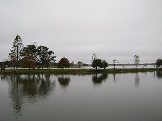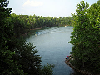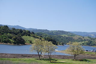
Lady Bird Lake is a river-like reservoir on the Colorado River in Austin, Texas, United States. The City of Austin created the reservoir in 1960 as a cooling pond for a new city power plant. The lake, which has a surface area of 416 acres (168 ha), is now used primarily for recreation and flood control. The reservoir is named in honor of former First Lady of the United States Lady Bird Johnson.

Lake Austin, formerly Lake McDonald, is a water reservoir on the Colorado River in Austin, Texas. The reservoir was formed in 1939 by the construction of Tom Miller Dam by the Lower Colorado River Authority. Lake Austin is one of the seven Highland Lakes created by the LCRA, and is used for flood control, electrical power generation, and recreation.

Lake Marble Falls is a reservoir on the Colorado River in the Texas Hill Country in the United States. The reservoir was formed in 1951 by the construction of Max Starcke Dam by the Lower Colorado River Authority. Originally named Marble Falls Dam, the dam was renamed in 1962 for Max Starcke, the second general director of the LCRA. Located near the city of Marble Falls, the lake is used as a venue for aquatic recreation and for the purpose of generating hydroelectric power. It is the newest and smallest of the Texas Highland Lakes.

Lake Lyndon B. Johnson is a reservoir on the Colorado River in the Texas Hill Country about 45 miles northwest of Austin. The reservoir was formed in 1950 by the construction of Granite Shoals Dam by the Lower Colorado River Authority (LCRA). The Colorado River and the Llano River meet in the northern portion of the lake at Kingsland.

Lake Nacimiento is an 18-mile (29 km) long lake on the Nacimiento River in northern San Luis Obispo County, California. The lake contains many arms including Snake Creek and Dip Creek, nearer the dam, and the central Las Tablas and Franklin Creeks.

Gibbons Creek Reservoir is a power plant cooling reservoir on Gibbons Creek in the Navasota River basin, 20 miles (32 km) east of College Station, Texas, United States. The dam and lake are managed by Texas Municipal Power Agency (TMPA), which uses the reservoir as a cooling pond for a coal-fired power plant generating electricity for the cities of Bryan, Denton, Garland, and Greenville.

Amistad Reservoir is a reservoir on the Rio Grande at its confluence with the Devils River 12 miles (19 km) northwest of Del Rio, Texas. The lake is bounded by Val Verde County on the United States side of the international border and by the state of Coahuila on the Mexican side of the border; the American shoreline forms the Amistad National Recreation Area. The reservoir was formed in 1969 by the construction of Amistad Dam. The dam and lake are managed jointly by the governments of the United States and Mexico through the International Boundary and Water Commission. The name of the dam and lake is the Spanish word for "friendship". The reservoir is also known as Lake Amistad.

New Hogan Lake is an artificial lake in the foothills of the Sierra Nevada in Calaveras County, California, about 30 miles (48.3 km) northeast of Stockton. It is formed by New Hogan Dam on the Calaveras River, whose North and South forks combine just upstream of the lake, and has a capacity of 317,000 acre⋅ft (391,000,000 m3). The earth-fill dam, completed in 1963, is 210 feet (64.0 m) high from the crest of the dam to the original streambed. The reservoir was first filled in 1965. There is a small hydroelectric plant at its base. It is owned by the United States Army Corps of Engineers and provides flood protection, drinking water, electricity and water for irrigation. There is also recreation available, such as boating, fishing, water skiing and camping.

Canyon Lake is a reservoir on the Guadalupe River in the Texas Hill Country in the United States. Canyon Lake is a U.S. Army Corps of Engineers reservoir formed on the Guadalupe River in Comal County by Canyon Dam, which is located about sixteen miles northwest of New Braunfels. The dam, lake, and all adjacent property are managed by the U.S. Army Corps Of Engineers. Water rights, waste water treatment, and hydroelectric generating facilities are managed by the Guadalupe-Blanco River Authority. Construction of the dam began in 1958 and was completed in 1964. The reservoir serves to provide flood control and water supply for the communities downstream from the dam. The lake is also a popular recreational destination.

Lake Walter E. Long is a power plant cooling reservoir on Decker Creek in Austin, Texas. The reservoir was officially impounded in 1967 and serves to provide water for turbines used in the production of electricity from petroleum-based fuels. The dam and the lake are managed by the City of Austin. Surrounding Lake Walter E. Long is the city of Austin's Lake Walter E. Long Metropolitan Park, a popular recreational destination.

Lake Bastrop is a reservoir on Spicer Creek in the Colorado River basin 3 miles (5 km) northeast of the town of Bastrop in central Bastrop County, Texas, United States. The reservoir was formed in 1964 by the construction of a dam by the Lower Colorado River Authority. The lake serves primarily as a power plant cooling pond for the Sim Gideon Power Plant operated by the LCRA and the Lost Pines Power Project 1, owned by GenTex Power Corporation, a wholly owned affiliate of the LCRA. Lake Bastrop also serves as a venue for outdoor recreation, including fishing, boating, swimming, camping and picnicking, and is maintained at a constant level year round.

Calaveras Lake is a reservoir on Calaveras Creek, located 20 miles southeast of Downtown San Antonio, Texas, USA. The reservoir was formed in 1969 by the construction of a dam to provide a cooling pond for a series of power plants, called the Calaveras Power Station, to supply additional electricity to the city of San Antonio.

Lake Casa Blanca is a reservoir on the Chacon Creek, 5 miles (8 km) northeast of downtown Laredo, Texas, United States. The reservoir was formed in 1951 by the construction of a dam to provide recreational opportunities for the residents of Webb County. The current dam is the second built across the creek - a previous dam built in 1946 failed the following year during the initial attempted impounding of a reservoir. There are residential properties along the lake as well as a Texas state park. Surrounding the lake is a 525-acre (212 ha) park that was operated jointly by the City of Laredo and Webb County before it was leased by the state in 1990 and opened in March 1991 as the Lake Casa Blanca International State Park. Lake Casa Blanca is fed by the Chacon Creek and San Ygnacio Creek.

Coleto Creek Reservoir is a reservoir on Coleto Creek and Perdido Creek located in Fannin, Texas, 15 miles (24 km) southwest of Victoria, Texas. The surface of the lake extends into Victoria and Goliad counties. The reservoir was formed in 1980 by the construction of a dam by the Guadalupe-Blanco River Authority to provide a power station cooling pond for electric power generation. Coleto Creek Reservoir is a venue for outdoor recreation, including fishing and boating.
Fayette County Reservoir is a power station cooling reservoir on Cedar Creek in the Colorado River basin, 3 miles west of Fayetteville, Texas and 10 miles east of La Grange, Texas. The reservoir was created in 1978 when a dam was built on the creek to provide a cooling pond for the Fayette Power Project which provides electrical generation to Fayette County and surrounding areas. The dam, lake, and power plant are managed by the Lower Colorado River Authority. The lake is also used for recreational purposes, especially fishing.

Belews Lake is a reservoir in Stokes, Rockingham, Guilford and Forsyth counties of North Carolina, near the towns of Stokesdale and Pine Hall. It was created in 1973 by the Duke Energy corporation as a cooling basin for the corporation's Belews Creek Steam Station, a coal-burning power plant. There are 4 public boat ramps on the lake, with 2 being commissioned by the North Carolina Wildlife Resorces Commission(NCWRC). Piney Bluff is located on the southern part of the lake, in Forsyth County, with entrance on NC Highway 65. Pine Hall Boat Launch is the closest to the plant, located in Stokes County, with the ramp being located on the west-northwest part of the lake, with entrance from Pine Hall Rd. Carolina Marina is located in the northern part of the lake, in Rockingham County, with a fee for use. $10 for a day pass, and $125 for a yearly pass. There is also a store where you can buy boat accessories, snacks, and alcohol like beer and wine. They also have a dry storage for the winter, and a grill that serves burgers and hot dogs. Humphreys Ridge is another one. They too have a grill, and is a lot bigger too. The ramp and grill is located on the eastern side of the lake, in Rockingham County. The power plant can be seen from the ramp. Cooling water was pumped back and forth between the plant and reservoir until 1986 when the corporation decided to use other methods to dispose of their coal ash waste. From 1974-1986, contaminants such as vanadium, nickel, cobalt, barium, arsenic, were introduced into the lake through the release of contaminated cooling water from the power plant back into the lake. Many scientific studies were undertaken at Belews Lake and their findings, along with those conducted at the Kesterson Reservoir, are fundamental to today's understanding of the ecological risks associated with elevated selenium concentrations in aquatic systems.
Comanche Creek Reservoir is a 3,275-acre (13.3 km²) impoundment located between Glen Rose, Texas and Granbury, Texas. The primary purpose is cooling for Comanche Peak Nuclear Generating Station. During full operation of both units of Comanche Peak, 2.2 million US gallons (8,300 m3) of water are pumped through the plant's main condensers from Comanche Creek Reservoir.
Richland-Chambers Reservoir is the third largest inland reservoir by surface area and the 8th largest reservoir by water volume in Texas formed by the impoundment of Richland Creek and Chambers Creek east-southeast of the town of Corsicana and south of Kerens, in Navarro County and Freestone County, Texas, USA. It has 330 miles (530 km) of shoreline and is "Y" shaped with the dam on the eastern end of the lake.

Calero Reservoir, also called Calero Lake, is a reservoir in San Jose, California, located in the Calero neighborhood of Almaden Valley in South San Jose. It is the site of Calero County Park, which also includes a large area covering the lake and hundreds of acres of hills around it.
Lake Tyler East is a reservoir on Mud Creek in the Neches River Basin of Smith County, Texas. It is neighbored by Whitehouse, Texas that is encompassed by Tyler, Texas which resides within the South Central Plains ecoregion.


