
The Dundonnell and Fisherfield Forest covers a large mountainous area of Wester Ross in the Northwest Highlands of Scotland, lying between Loch Maree and Little Loch Broom. It is sometimes nicknamed The Great Wilderness, as the area is entirely devoid of permanent settlements.
Two Lochs Radio is Britain's smallest commercial radio station, and community broadcaster for the Gairloch, Loch Ewe and Loch Maree areas of Wester Ross, in the Highlands of Scotland. The station broadcasts in stereo on 106.0 and 106.6 MHz FM. It also provides the Lochbroom FM service for the Ullapool and Coigach areas on 96.8 and 102.2 MHz FM.

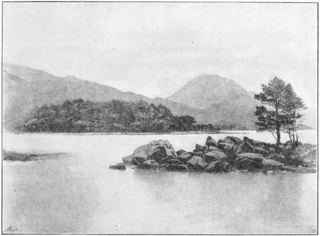
Slioch is a mountain in the Scottish Highlands situated in Wester Ross, eight kilometres north of the village of Kinlochewe. Slioch reaches a height of 981 metres (3218 feet) and towers above the south east end of Loch Maree to give one of the best known and most photographed sights in the Highlands. VisitScotland, the Scottish national tourist agency, has used video footage of Slioch in its television advertisements.
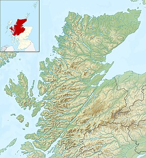
The Northwest Highlands are located in the northern third of Scotland that is separated from the Grampian Mountains by the Great Glen. The region comprises Wester Ross, Assynt, Sutherland and part of Caithness. The Caledonian Canal, which extends from Loch Linnhe in the south-west, via Loch Ness to the Moray Firth in the north-east splits this area from the rest of the country. The city of Inverness and the town of Fort William serve as gateways to the region from the south.

Glen Docherty is a glen in Wester Ross in Scotland, between Loch Maree and Kinlochewe to the west and Loch a'Chroisg and Achnasheen to the east.
Longa Island is a small uninhabited island at the mouth of Loch Gairloch, on the west coast of Scotland.

The A832 is a road in the Scottish Highlands, linking Cromarty, on the east coast, to Gairloch on the west coast, and beyond Gairloch to Braemore Junction. It is 126 miles (203 km) long and runs entirely in the former county of Ross and Cromarty. The road forms part of the Wester Ross Coastal Trail.

Ben Tee is a Scottish mountain situated in the Lochaber area of the Highland council area, some 15 kilometres north of Spean Bridge. It is rated as one of the best of Scotland's smaller mountains with Hamish Brown saying:
Isle Maree is an island in Loch Maree, Scotland.
Eilean Sùbhainn is the largest of several small islands in Loch Maree, Wester Ross, Scotland. It is the second largest freshwater island in Scotland after Inchmurrin.
Garbh Eilean is a forested island in Loch Maree, Wester Ross, Scotland.
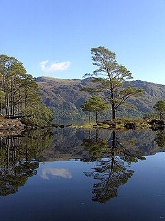
Eilean Ruairidh Mòr is a forested island in Loch Maree, Wester Ross, Scotland. Its name was formerly anglicised as "Ellan-Rorymore".
Taagan is a hamlet in Ross and Cromarty, in the Highland council area of Scotland. It is situated about 2 km north west of Kinlochewe, at the south east end of Loch Maree, next to the A832 road. It is the location of a small, basic campsite, operated by Scottish Natural Heritage.
Letterewe is a large estate of several tens of thousands of acres on the north-eastern shore of Loch Maree, South-East of Poolewe, in Wester Ross, Scotland. It is one of the wildest, most remote and least populated areas in the United Kingdom.
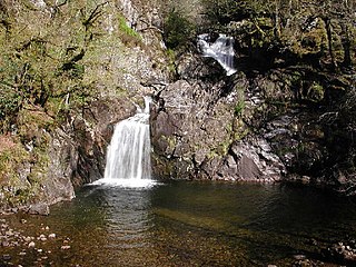
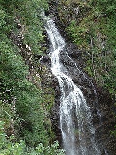
Eas Chia-aig is a waterfall on the Abhainn Chia-aig, in the Highlands of Scotland. The falls are located between Loch Lochy and Loch Arkaig, near Achnacarry and Clunes.

Eas na Dabhaich is a waterfall on the Isle of Mull in Scotland. The falls lie on a burn that flows from Loch Fraing on the Ross of Mull over high cliffs above Carsaig Bay. There are several more unnamed waterfalls above and along the 200 metres (660 ft) cliffs that stretch from east of Carsaig along to Malcolm's Point and the Carsaig Arches 5 kilometres (3.1 mi) to the west where they are called Aoineadh Mòr and beyond where the height is reduced to about 130 metres (430 ft) and they are known as Aoineadh Beag.
Falls of Divach is a waterfall of Scotland. Pronounced 'Jeevach', the Divach Burn falls 100 feet to the River Coiltie, which continues its course through Lewiston village, the "Cover", then into Urquhart Bay, half way along the northern shore of Loch Ness.
Falls of Glas Allt is a 50-metre (160 ft) waterfall near the head of Loch Muick, Aberdeenshire, Scotland. Queen Victoria liked to take walks here beside the stream flowing from Lochnagar down to Loch Muick. After the death of Prince Albert she had a cottage, Glas-allt-Shiel, rebuilt for her on the delta where the stream flows into the loch.
Rubha Mòr is a remote peninsula in west Scotland, in the western region of Ross and Cromarty. The peninsula stretches from Greenstone Point in the north to the villages of Poolewe on the southern coastline and Laide on the northern coastline. The region immediately to the east of the peninsula contains Inchgarve Forest and Fionn Loch, which feeds via the Little Gruinard River into Gruinard Bay to the north. Further south are the forests of Letterewe overlooking Loch Maree, and northeast of Fionn Loch are the forests of Fisherfield and Strathnasheallag overlooking Loch Na Sealga.


