Peter I Island is an uninhabited volcanic island in the Bellingshausen Sea, 450 kilometres (280 mi) from continental Antarctica. It is claimed as a dependency of Norway, and along with Bouvet Island and Queen Maud Land comprises one of the three Norwegian dependent territories in the Antarctic and Subantarctic. Peter I Island is 11 by 19 kilometres long and 156 square kilometres (60 sq mi), slightly larger than Staten Island as an example. The tallest peak is the ultra and 1,640-meter (5,380 ft) tall Lars Christensen Peak. Nearly all of the island is covered by a glacier and it is surrounded most of the year by pack ice, making it inaccessible during these times. There is little vertebrate animal life on the island apart from some seabirds and seals.
Kvitsøy is an island municipality in Rogaland county, Norway. At only 6.29-square-kilometre (2.43 sq mi), it is the smallest municipality in Norway by area and one of the smallest by population. Kvitsøy is located in the traditional district of Ryfylke. The administrative centre of the municipality is the village of Ydstebøhamn on the island of Kvitsøy. The municipality is an archipelago located at the entrance to the large Boknafjorden. It sits about 2 nautical miles northwest of the mainland Stavanger peninsula. There are plans for the Rogfast tunnel to eventually connect Kvitsøy to the mainland road network.

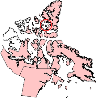
Bear Island is the southernmost island of the Norwegian Svalbard archipelago. The island is located in the western part of the Barents Sea, approximately halfway between Spitsbergen and the North Cape.
Måløy is a town and the administrative centre of the municipality of Vågsøy in Sogn og Fjordane county, Norway. Måløy is located on the southeastern side of the island of Vågsøy, about 3 kilometres (1.9 mi) northeast of the village of Holvika and about 6 kilometres (3.7 mi) south of the village of Raudeberg. The Måløy Bridge connects the town centre to the area of Deknepollen on the mainland. Sør-Vågsøy Church is located in Måløy.
Graham Island is an uninhabited island in Qikiqtaaluk Region, Nunavut, Canada. A member of the Queen Elizabeth Islands and Canadian Arctic Archipelago, it is located in Norwegian Bay off the coast of Ellesmere Island. Located at 77°25'N 90°30'W it has an area of 1,378 km2 (532 sq mi), 55 kilometres (34 mi) long and 40 kilometres (25 mi) wide. It was named in 1910.

Leknes (help·info) is a town in Nordland county, Norway. The town is also the administrative centre of the municipality of Vestvågøy. Leknes was designated a "town" in 2002. The 2.52-square-kilometre (620-acre) town has a population (2018) of 3,556 which gives the town a population density of 1,411 inhabitants per square kilometre (3,650/sq mi).

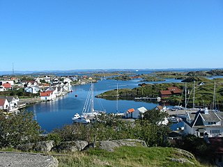
Åkrehamn (help·info) or Åkrahamn is a small town in Karmøy municipality in Rogaland county, Norway. The town is located on the west side of the island of Karmøy in the traditional district of Haugaland. The town sits about 5 kilometres (3.1 mi) west of the town of Kopervik, about 12 kilometres (7.5 mi) north of the town of Skudeneshavn, and about 25 kilometres (16 mi) southwest of the town of Haugesund. The village of Veavågen lies immediately to the northeast of Åkrehamn.

Boknafjord or Boknafjorden is a fjord located in Rogaland county, Norway. The huge fjord lies between the cities Stavanger and Haugesund, and the main part of the fjord is shared between the municipalities of Kvitsøy, Rennesøy, Finnøy, Tysvær, Bokn, and Karmøy. There are dozens of smaller fjords that branch off the main part of the fjord, reaching most municipalities in the county. At its longest, the Boknafjord reaches about 96 kilometres (60 mi) into the mainland at the innermost point of the Hylsfjorden. Other notable branches include the Saudafjorden, Sandsfjorden, Vindafjorden, Hervikfjorden, Førresfjorden, Erfjorden, Jøsenfjorden, Årdalsfjorden, Idsefjorden, Høgsfjorden, Lysefjorden, and Gandsfjorden.

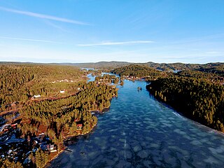
Alsvågvatnet is a lake which lies in Øksnes Municipality in Nordland county, Norway. It is on the island of Langøya in the Vesterålen archipelago. There is birch woodland and bogland nearby. The 2.36-square-kilometre (0.91 sq mi) lake sits at an elevation of 8 metres (26 ft) above sea level, about 1.3 kilometres (0.81 mi) west of the village of Alsvåg, along the road to Myre.
Vegår is a lake in the municipality of Vegårshei in Aust-Agder county, Norway. The 17.7-square-kilometre (6.8 sq mi) lake is located about 3 kilometres (1.9 mi) north of the municipal center of Myra and about 12 kilometres (7.5 mi) east of the village of Åmli in the neighboring municipality of Åmli.

Ogge is a lake in the municipalities of Birkenes and Iveland in Aust-Agder county, Norway. It is located about 40 kilometres (25 mi) north of the city of Kristiansand, just east of the villages of Vatnestrøm and Oggevatn. The 6.71-square-kilometre (2.59 sq mi) lake includes about 360 islands and reefs. The overall length of the lake is approximately 16 kilometres (9.9 mi). The Sørlandsbanen railway line and the Norwegian County Road 405 both run along the west side of the lake.
Hillesøy is a former municipality in Troms county in Norway. The municipality existed from 1855 until its dissolution in 1964. It was located on both sides of the Malangen fjord in what is now the present-day municipalities of Tromsø and Lenvik. The administrative centre was located at Brensholmen on the western shore of the island of Kvaløya. Brensholmen is also the location of Hillesøy Church, the main church for the municipality.
Bouvet Island is an uninhabited subantarctic high island and dependency of Norway located in the South Atlantic Ocean at 54°25′S3°22′E, thus locating it north of and outside the Antarctic Treaty System. It lies at the southern end of the Mid-Atlantic Ridge and is the most remote island in the world, approximately 1,700 kilometres (1,100 mi) north of the Princess Astrid Coast of Queen Maud Land, Antarctica, 1,160 kilometres (720 mi) east of the South Sandwich Islands and 2,600 kilometres (1,600 mi) south-southwest of the coast of South Africa.
Norway has three dependent territories, all uninhabited and located in the Southern Hemisphere. Bouvetøya is a Subantarctic island in the South Atlantic Ocean. Queen Maud Land is a sector of Antarctica which spans between 20° west and 45° east. Peter I Island is a volcanic island located 450 kilometres (280 mi) off the coast of Ellsworth Land of continental Antarctica.

Lysvatnet (Norwegian) or Čáhppesjávri (Northern Sami) is a lake in Lenvik Municipality in Troms county, Norway. The lake lies in the Helvetesdalen valley on the island of Senja. The 6-kilometre (3.7 mi) long lake covers an area of 3.67 square kilometres (1.42 sq mi). The lake lies about 10 kilometres (6.2 mi) west of the village of Gibostad.
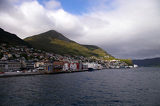
Brusdalsvatnet is a large lake on the island of Oksenøya in Møre og Romsdal county, Norway. The lake sits on the border between Ålesund Municipality and Skodje Municipality. The lake is a reservoir that is the water supply for the nearby city of Ålesund. The 7.3-square-kilometre (2.8 sq mi) lake is about 9.5 by 1.3 kilometres.

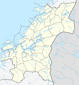
Bjørøya is an island in the Folda sea, just south of the Namsenfjorden in the municipality of Flatanger in Trøndelag county, Norway. The 3.8-square-kilometre (1.5 sq mi) island lies about 5 kilometres (3.1 mi) east of the island of Villa and about 5 kilometres (3.1 mi) north of the island of Lauvøya. The island has several large peat bogs as well as a farm. Ellingråsa Lighthouse is located on the northwest part of the island. There island has had no permanent residents since the 1970s.

Byrknesøyna is an island in Gulen Municipality in Sogn og Fjordane county, Norway. The 18-square-kilometre (6.9 sq mi) island lies between the Sognesjøen and the Fensfjorden, just west of the island of Mjømna. It is located about 13 kilometres (8.1 mi) straight southwest of the municipal centre of Eivindvik and about 80 kilometres (50 mi) north of the city of Bergen.

Dverberg is a former municipality in Nordland county, Norway. The municipality existed from 1838 until its dissolution in 1964. The municipality encompassed areas on the island of Andøya in what is now Andøy Municipality. Starting out at about 616 square kilometres (238 sq mi) in 1838, it was reduced in size in 1924. Upon its dissolution in 1964, the municipality was only 279 square kilometres (108 sq mi). The administrative centre was the village of Dverberg where Dverberg Church is located.