| Villa Estense | |
|---|---|
| Comune | |
| Comune di Villa Estense | |
 Villa Estense Location of Villa Estense in Italy | |
| Coordinates: 45°10′N11°40′E / 45.167°N 11.667°E Coordinates: 45°10′N11°40′E / 45.167°N 11.667°E | |
| Country | Italy |
| Region | Veneto |
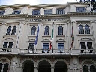
| Province | Province of Padua (PD) |
| Area | |
| • Total | 16.0 km2 (6.2 sq mi) |
| Population (Dec. 2004) | |
| • Total | 2,407 |
| • Density | 150/km2 (390/sq mi) |
| Time zone | CET (UTC+1) |
| • Summer (DST) | CEST (UTC+2) |
| Postal code | 35040 |
| Dialing code | 0429 |

Villa Estense is a comune (municipality) in the Province of Padua in the Italian region Veneto, located about 60 kilometres (37 mi) southwest of Venice and about 30 kilometres (19 mi) southwest of Padua. As of 31 December 2004, it had a population of 2,407 and an area of 16.0 square kilometres (6.2 sq mi). [1]

The comune is a basic administrative division in Italy, roughly equivalent to a township or municipality.
The Province of Padua is a province in the Veneto region of Italy. Its capital is the city of Padua.

Italy, officially the Italian Republic, is a country in Southern Europe. Located in the middle of the Mediterranean Sea, Italy shares open land borders with France, Switzerland, Austria, Slovenia and the enclaved microstates San Marino and Vatican City. Italy covers an area of 301,340 km2 (116,350 sq mi) and has a largely temperate seasonal and Mediterranean climate. With around 61 million inhabitants, it is the fourth-most populous EU member state and the most populous country in Southern Europe.
Villa Estense borders the following municipalities: Este, Granze, Sant'Elena, Sant'Urbano, Vescovana, Vighizzolo d'Este.

Granze is a comune (municipality) in the Province of Padua in the Italian region Veneto, located about 50 kilometres (31 mi) southwest of Venice and about 30 kilometres (19 mi) southwest of Padua. As of 31 December 2004, it had a population of 1,803 and an area of 11.4 square kilometres (4.4 sq mi).
Sant'Urbano is a comune (municipality) in the Province of Padua in the Italian region Veneto, located about 60 kilometres (37 mi) southwest of Venice and about 35 kilometres (22 mi) southwest of Padua. As of 31 December 2004, it had a population of 2,189 and an area of 31.8 square kilometres (12.3 sq mi).
Vescovana is a comune (municipality) in the Province of Padua in the Italian region Veneto, located about 60 kilometres (37 mi) southwest of Venice and about 35 kilometres (22 mi) southwest of Padua. As of 31 December 2004, it had a population of 1,601 and an area of 22.3 square kilometres (8.6 sq mi).


