The geography of Egypt relates to two regions: North Africa and Southwest Asia.
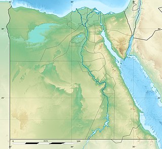
The Qattara Depression is a depression in northwestern Egypt, specifically in the Matruh Governorate. The depression is part of the Western Desert of Egypt. The Qattara Depression lies below sea level, and its bottom is covered with salt pans, sand dunes, and salt marshes. The depression extends between the latitudes of 28°35' and 30°25' north and the longitudes of 26°20' and 29°02' east.

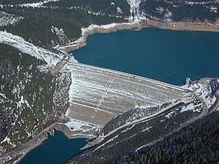
A dam is a barrier that stops or restricts the flow of water or underground streams. Reservoirs created by dams not only suppress floods but also provide water for activities such as irrigation, human consumption, industrial use, aquaculture, and navigability. Hydropower is often used in conjunction with dams to generate electricity. A dam can also be used to collect water or for storage of water which can be evenly distributed between locations. Dams generally serve the primary purpose of retaining water, while other structures such as floodgates or levees are used to manage or prevent water flow into specific land regions. The earliest known dam is the Jawa Dam in Jordan, dating to 3,000 BC.

Burrendong Dam is a rock-fill embankment major gated dam with a clay core across the Macquarie River upstream of Wellington in the central west region of New South Wales, Australia. The dam's purpose includes flood mitigation, irrigation, water supply and hydro-electric power generation. The dam impounds Lake Burrendong and is filled by the waters from the Macquarie, and Cudgegong rivers as well as Meroo Creek.
The Wolf Creek Dam is a multi-purpose dam on the Cumberland River in the western part of Russell County, Kentucky, United States. The dam serves at once four distinct purposes: it generates hydroelectricity; it regulates and limits flooding; it releases stored water to permit year-round navigation on the lower Cumberland River; and it creates Lake Cumberland for recreation, which has become a popular tourist attraction. Because of seepage problems in the dam's foundation, it has become the U.S. Army Corps of Engineers's top dam priority. U.S. Route 127 is built on top of the dam.
André Coyne was a French civil engineer who designed 70 dams in 14 countries. He received his education at École Polytechnique and its School of Civil Engineering afterwards.

The Ilısu Dam is a concrete-face rock-fill dam on the Tigris near the village of Ilısu and along the border of Mardin and Şırnak Provinces in Turkey. It is one of the 22 dams of the Southeastern Anatolia Project and its purpose is hydroelectric power production, flood control and water storage. When operational, the dam will support a 1,200 MW power station and will form a 10.4 billion m3 reservoir. Construction of the dam began in 2006 and was originally expected to be completed by 2016. As part of the project, the much smaller Cizre Dam is to be constructed downstream for irrigation and power. The dam has drawn international controversy, because it will flood portions of ancient Hasankeyf and necessitate the relocation of people living in the region. Because of this, the dam lost international funding in 2008. Kurdish Kurdistan Workers' Party militants have also attacked infrastructure associated with the dam which led to construction delays.

The Haditha Dam or Qadisiya Dam is an earth-fill dam on the Euphrates, north of Haditha (Iraq), creating Lake Qadisiyah. The dam is just over 9 kilometres (5.6 mi) long and 57 metres (187 ft) high. The purpose of the dam is to generate hydroelectricity, regulate the flow of the Euphrates and provide water for irrigation. It is the second-largest hydroelectric contributor to the power system in Iraq behind the Mosul Dam.

The Wyaralong Dam is a mass concrete gravity dam with an un-gated spillway across the Teviot Brook that is located in the South East region of Queensland, Australia. The main purpose of the dam is for supply of potable water for the Scenic Rim region. The impounded reservoir is also called Wyaralong Dam. The dam was initiated by the Queensland Government in 2006 as a result of a prolonged drought which saw the catchment areas of South East Queensland's dams receive record low rain.

The Goronyo Dam impounds the Rima River in Goronyo local government area of Sokoto State in the north of Nigeria. It was completed in 1984 and commissioned in 1992. The dam is a sand-fill structure with a height of 21 m and a total length of 12.5 km. It has a storage capacity of 976 million cubic meters. The dam will be important in controlling floods and releasing water in the dry season for the planned Zauro polder project downstream in Kebbi State.
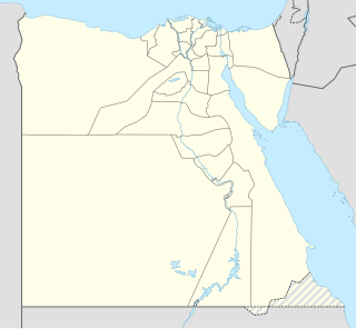
Sadd el-Kafara was a masonry embankment dam on Wadi al-Garawi 10 km southeast of Helwan in Helwan Governorate, Egypt. The dam was built in the first half of the third millennium BC by the ancient Egyptians for flood control and is the oldest dam of such size in the world. Never completed, the dam was under construction for 10–12 years before being destroyed by a flood. It was rediscovered by Georg Schweinfurth in 1885.

The Grand Ethiopian Renaissance Dam, formerly known as the Millennium Dam and sometimes referred to as Hidase Dam, is a gravity dam on the Blue Nile River in Ethiopia that has been under construction since 2011. It is in the Benishangul-Gumuz Region of Ethiopia, about 15 km (9 mi) east of the border with Sudan. At 6.45 gigawatts, the dam will be the largest hydroelectric power plant in Africa when completed, as well as the 7th largest in the world. As of August 2017, the work stood at 60% completion. Once completed, the reservoir will take from 5 to 15 years to fill with water.

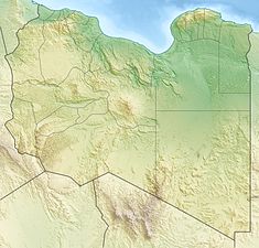
The Wadi Ghan Dam is a rock-fill embankment dam located on Wadi Al-Hira, 14 km (9 mi) northeast of Gharyan in the Jabal al Gharbi District of Libya. Completed in 1982, the primary purpose of the dam is water supply for irrigation.
The Wadi Wishka Dam is a concrete-face rock-fill embankment dam located on Wadi Wishka, 29 km (18 mi) southwest of Sokna in the Fezzan region of Libya. The primary purpose of the dam is flood control and water. Construction on the dam began in 2004 and it was completed in 2006 at a cost of $5 million USD.
The Wadi Mejenin Dam is an embankment dam located on Wadi Mejenin, 64 km (40 mi) south of Tripoli in the Jabal al Gharbi District of Libya. Completed in 1972, the primary purpose of the dam is water supply for irrigation and flood control.
The Wadi Lebda Dam is an embankment dam located on Wadi Lebda, 5 km (3 mi) south of Khoms in the Murqub District, Libya. Completed in 1982, the primary purpose of the dam is water supply for irrigation and flood control.

The Jatigede Dam is an embankment dam on the Cimanuk River in Sumedang Regency, West Java, Indonesia. It is located 19 km (12 mi) east of the town of Sumedang. Construction on the dam began in 2008 and it was completed in 2015. The power station is expected to be commissioned in 2019. The primary purpose of the dam is irrigation but it will also provide for flood control, water supply and hydroelectric power generation. Water in the reservoir will be used to help irrigate 90,000 ha of farmland and the power station is expected to have a 110 MW capacity. The project has been become controversial, primarily due to the relocation of people in the future reservoir zone.

The Kantale Dam Tamil: கந்தளாய் அணை, translit. Kantaḷāy Aṇai) is a large embankment dam built in Kantale, Trincomalee District, Sri Lanka, used for irrigation. It is 14,000 ft (4,267 m) long, and over 50 ft (15 m) high. The dam breached on April 20, 1986, killing more than 120 people. It has since been reconstructed. The dam impounds the Per Aru, a small river discharging into the Koddiyar Bay, at Trincomalee Harbour.

The Yaté Dam is an arch dam on the Yaté River in Yaté commune of New Caledonia, France. The primary purpose of the dam is hydroelectric power generation and it supports a 68 MW power station. Plans for the project began in the early 1950s and the dam was designed by Coyne et Bellier. The owner and operator of the project, New Caledonian Society Energy (ENERCAL), was established on 27 August 1955 to implement the project. Construction began that year and the power station was commissioned in 1958. The dam and entire scheme was inaugurated by Jacques Soustelle, then Minister of State in charge of Overseas Departments, on 21 September 1959. It is the tallest dam and creates the largest reservoir in New Caledonia.