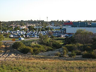
Balga is a suburb of Perth, the capital city of Western Australia, 13 kilometres (8 mi) north of Perth city's central business district (CBD). Its local government area is the City of Stirling. Mark Irwin is the current mayor.

Hamersley is a residential suburb 14 kilometres north-northwest of the central business district of Perth, the capital of Western Australia, and six kilometres (4 mi) from the Indian Ocean. The suburb adjoins two major arterial roads—Mitchell Freeway to the west and Reid Highway to the south—and is within the City of Stirling local government area. It was built during the late 1960s and 1970s as part of the Government of Western Australia's response to rapidly increasing land prices across the metropolitan area.

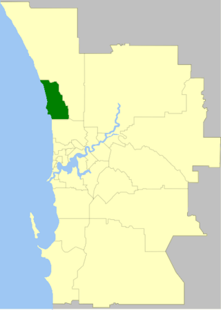
The City of Wanneroo is a local government area with city status in the northern suburbs of Perth, Western Australia. It is centred approximately 25 kilometres (15.5 mi) north of Perth's central business district and forms part of the northern boundary of the Perth metropolitan area. Wangara encompasses the federal divisions of Cowan, Moore and Pearce.
Ashby is a suburb of Perth, the capital city of Western Australia 26 kilometres (16 mi) north of Perth's central business district. Its local government area is the City of Wanneroo.

Clarkson is an outer northern suburb of Perth, Western Australia, located 34 kilometres north of Perth's central business district in the City of Wanneroo.
Madeley is a suburb of Perth, the capital city of Western Australia 20 kilometres (12 mi) north of Perth's central business district. Its local government area is the City of Wanneroo. Previously part of Landsdale, much of the suburb was rural in character until the 1990s, with market gardening a common activity. From 2001 onwards, extensive property development resulted in massive population growth, with the Property Investor Magazine of December 2007 estimating a growth rate of 33.3% per year.
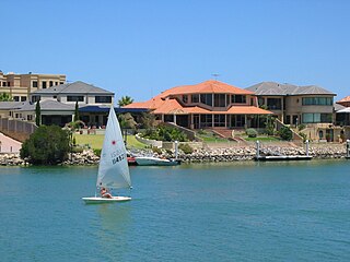
Mindarie is an outer coastal suburb of Perth, Western Australia. It is located 36 kilometres (22 mi) north of Perth's central business district, and forms part of the City of Wanneroo local government area.

Ridgewood is an outer suburb of Perth, Western Australia, located 37 kilometres north of Perth's central business district. It is part of the City of Wanneroo local government area.
Tamala Park is an unpopulated locality in Perth, Western Australia. It sits on the border between the City of Wanneroo and the City of Joondalup local authorities, and separates the Clarkson-Butler region from the suburbs of Joondalup.

Merriwa is a coastal, northern suburb of Perth, Western Australia, 36 kilometres (22 mi) north of the central business district. It is part of the City of Wanneroo local government area. It is a predominantly residential suburb, containing two RAAF retirement villages.

Woodvale is a suburb of Perth, Western Australia, located within the City of Joondalup and the City of Wanneroo. At the 2016 census Woodvale had a population of 9,276.

Wanneroo Road is a 44-kilometre (27 mi) arterial highway in the northern suburbs of Perth, Western Australia linking Joondanna and Yokine in the south with Wanneroo and Yanchep in the north. As part of State Route 60, it begins from Charles Street in the inner city and becomes Indian Ocean Drive up to Dongara.
The City of Joondalup is a local government area in Perth, Western Australia. Its central business district is located in the suburb Joondalup, and it includes the town centres of Hillarys and Warwick.

Marmion Avenue is a 40-kilometre (25 mi) arterial road in the northern coastal suburbs of Perth, Western Australia, linking Trigg in the south with Yanchep in the north. It forms part of State Route 71 along with West Coast Highway, which it joins onto at its southern terminus.
Wanneroo is a suburb of Perth, Western Australia, located within the City of Wanneroo.

Alexander Drive is a major north–south arterial road in the northern suburbs of Perth, Western Australia, connecting Perth's central business district (CBD) with Edith Cowan University's Mount Lawley campus and the Malaga industrial area, as well as newer development suburbs to Perth's north. It is used by Transperth bus routes, including the 360, 361 and 362. Alexander Drive was named after Mr S.B. Alexander, a former Wanneroo Road Board member. Alexander Drive runs through the following local government areas City of Wanneroo, City of Swan, City of Bayswater and City of Stirling.
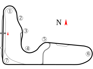
Wanneroo Raceway, currently known as CARCO.com.au Raceway for naming rights reasons, is a 2.411 km (1.498 mi) motorsport circuit located in Neerabup, approximately 50 km (31 mi) north of Perth in Western Australia. It was built by the WA Sporting Car Club.

Yellagonga Regional Park is in Perth, Western Australia, in the City of Wanneroo and the City of Joondalup. The park was established in 1989 by the Western Australian government and protects 1,400 hectares of land, including 550 hectares of Wanneroo wetlands – including Lake Joondalup, Beenup Swamp, Walluburnup Swamp and Lake Goollelal.
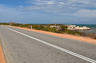
Indian Ocean Drive is a coastal highway in the Australian state of Western Australia which services the coastal communities along the Indian Ocean immediately north of the state capital Perth, linking the northern suburb of Yanchep with the Brand Highway, just south of Dongara. In terms of regions, most of it exists in the Wheatbelt coastal region. The road provides travellers between Perth and Geraldton a 30-minute shorter and more scenic route than the inland Brand Highway which mainly services heavy traffic.
Charles Street is a major road in the inner northern suburbs of Perth, Western Australia. It runs from Newcastle Street and extends up to London Street, providing a connection between Mitchell Freeway and Wanneroo Road. It is the southern section of part of State Route 60, which continues north along Wanneroo Road.