Hemel Hempstead is a town in the Dacorum district in Hertfordshire, England. It is 24 miles (39 km) northwest of London, and is part of the Greater London Urban Area. The population at the 2011 census was 97,500.

Dacorum is a local government district with borough status in Hertfordshire, England. The council is based in Hemel Hempstead. The borough also includes the towns of Berkhamsted and Tring and surrounding villages. The borough had a population of 155,081 in 2021. Dacorum was created in 1974 and is named after the ancient hundred of Dacorum which had covered a similar area. The borough of Dacorum is the westernmost of Hertfordshire's ten districts. It borders St Albans, Three Rivers, Buckinghamshire and Central Bedfordshire.
Nash Mills is a civil parish within Hemel Hempstead and Dacorum Borough Council on the northern side of the Grand Union Canal, formerly the River Gade, and in the southernmost corner of Hemel Hempstead. There is evidence of a mill in this location since the 11th century and the row of 16th century mill cottages still remain. John Dickinson established a number of papermaking mills in the area in the 19th century.
Adeyfield was the first planned neighbourhood to be built in the postwar new town expansion of Hemel Hempstead, in the English county of Hertfordshire. The keys to the first houses to be occupied, in Homefield Road, were handed over to their tenants in February 1950. The Queens Square shopping parade was visited by Queen Elizabeth II on 20 July 1952, to lay the first foundation slab of St. Barnabas Church.

The River Gade is a river running almost entirely through Hertfordshire. It rises from a spring in the chalk of the Chiltern Hills at Dagnall, Buckinghamshire and flows through Hemel Hempstead, Kings Langley, then along the west side of Watford through Cassiobury Park. After passing Croxley Green it reaches Rickmansworth, where it joins the River Colne. For its whole course the Gade is unnavigable.

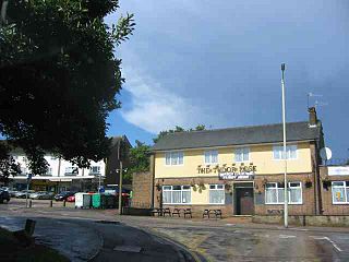
Boxmoor is part of Hemel Hempstead in Hertfordshire. It is within the district of Dacorum and comprises mainly 19th-century housing and meadowland, with transport links from London to the Midlands. At the 2011 Census, the population of Boxmoor was included in the Dacorum ward of Bovingdon, Flaunden and Chipperfield.

Hemel Hempstead Rural District was a rural district in Hertfordshire, England from 1894 to 1974.
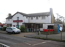
Woodhall Farm is a neighbourhood on the northern tip of Hemel Hempstead in the county of Hertfordshire. It was built on the former Brocks Fireworks site.

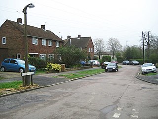
Bennetts End is a neighbourhood within Hemel Hempstead in Hertfordshire, England. It is located in the southeast of the town and consists almost entirely of public housing built as part of the new town in the 1950s. It was the second neighbourhood to have construction commenced by the New Town corporation, after the nearby Adeyfield.

The Hemel Hempstead School is a coeducational secondary school and sixth form located in the town of Hemel Hempstead, Hertfordshire, England.
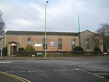
West Herts College is a college for further education in Watford, Hertfordshire, United Kingdom. The college has campuses in Watford and Hemel Hempstead. As of 2017 the college has 5,900 students on study programmes or apprenticeships.
This article gives brief information on schools that cater for pupils up to the age of 11 in the Dacorum district of Hertfordshire, England. Most are county maintained primary schools, sometimes known as "junior mixed infant" (JMI). A small number are voluntary aided church schools or independent (fee-paying). The Local Education Authority is Hertfordshire County Council.

Fields End is a hamlet to the North West of Hemel Hempstead, just beyond Warner's End on Boxted Road, in Hertfordshire, England. At the 2011 Census the population of the hamlet was included in the Dacorum ward of Chaulden and Warner's End.
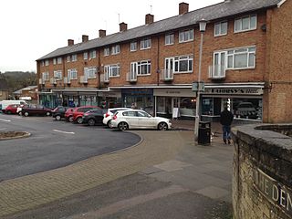
Chaulden is a residential district in Hemel Hempstead, Hertfordshire, England located west of the town centre and bordering on open countryside. It was an early development in the construction of Hemel Hempstead new town, commenced in 1953 and has its own neighbourhood shopping centre.
Highfield is a neighbourhood district in Hemel Hempstead, Hertfordshire, United Kingdom. It was constructed on a green field site as part of the construction of the postwar newtown expansion of Hemel Hempstead. It is located north of the old town centre. It is most likely named from Highfield House which still exists, although ultimately derived from an old field name which reflects the altitude of the district which reaches 469 feet above sea level. At the 2011 census the population of the district was included in the civil parish of Hazlemere

Gadebridge is a district of Hemel Hempstead in Hertfordshire, UK, located north west of Hemel Hempstead old town. It was developed in the 1960s on land that once formed part of Gadebridge House.
The Bury is a building of historical significance in Hemel Hempstead in the county of Hertfordshire, England. It was erected in about 1790 by an attorney who worked in the town. It was the residence for the next two centuries of many notable people. It is now owned by the Dacorum Borough Council and is Grade II* listed.

Boxmoor Roman Villa is a ruined Roman Villa at Boxmoor, Hemel Hempstead, Hertfordshire. The remains have been excavated, but they are now buried. The Roman villa was occupied from the first century AD up to the Fourth century.
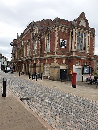
The Old Town Hall is a municipal building in the High Street, Hemel Hempstead, Hertfordshire, England. The town hall, which was the meeting place of Hemel Hempstead Borough Council, is a Grade II listed building.

The Forum is a municipal building in Marlowes, Hemel Hempstead, Hertfordshire, England. The building accommodates the meeting place and offices of Dacorum Borough Council as well as the local library.