
The Xiao River is the Main Stream of the upper Xiang River located in Yongzhou, Hunan. As of 2011 Water Census of China, it has a length of 346 kilometres (215 mi) from the headwaters to the confluence in the Ping Island of Yongzhou with the Xiang River West Branch originating from Guangxi. With the tributaries, its drainage basin area is 12,094 square kilometres (4,670 sq mi).
Xixi is a river in Tong'an District of Xiamen City, in Fujian Province of China. Said to be "Xiamen's largest river", it is 34 kilometres (21 mi) long and has a drainage basin of 494 square kilometres (191 sq mi).
The Wei or Weishui River, begins in Weishan Township, is 117.2 kilometres (72.8 mi) long, and has a drainage basin of 2,125 square kilometres (820 sq mi). It is the largest river in Ningxiang City and one of the largest tributaries of the Xiang River.
The Liuyang River, also known as Liu River or Liuwei River, is a right-bank tributary of Xiang River, the largest tributary of Xiang River in Changsha, Hunan Province, China. The river has a length of 234.8 kilometres (145.9 mi) with its drainage area of 4,665 square kilometres (1,801 sq mi), accounting for 39.47% of the total area of Changsha, with surface water resources of 4,506 million cubic meters, accounting for 41.08% of that. It flows through Liuyang City, Changsha County, Yuhua, Furong and Kaifu Districts, and merges into Xiang River at Xinhe Delta Mouth of Kaifu District.

Jinggang is a town of Wangcheng district, Changsha, China. The town is located on the west bank of Xiang river, and bordered by Qiaokou to the north, Zhuliangqiao and Shuangjiangkou of Ningxiang to the west, Gaotangling to the south, Tongguan across the Xiang river to the east. It covers 92.47 km2 (35.70 sq mi) with 67.3 thousand of population. The Jinggang town was formed by the former Jinggang and Getang towns on November 19, 2015. According to the result of 2016 adjustment programmes on village-level divisions (村级区划调整), the town has 2 residential communities and 10 villages under its jurisdiction; the administrative office is at Nongxi village (农溪村).
The You River is the largest tributary of the Yuan River, one of main rivers in the Wuling Mountains in Southwest China. Its other name is Gengshi River ; it was called Youxi River in ancient times. Its trunk stream flows through Hubei, Chongqing and Hunan, and its drainage basin reaches into Guizhou. Its watershed covers an area of 19,254.3 square kilometres (7,434.1 sq mi), including 2,680.7 square kilometres (1,035.0 sq mi) of Hubei, 10,485.7 square kilometres (4,048.6 sq mi) of Hunan, 4,658.4 square kilometres (1,798.6 sq mi) of Chongqing and 1,519.5 square kilometres (586.7 sq mi) of Guizhou; it has a length of 484 kilometres (301 mi).
Shahe River, also known as Xianing River, is a right-bank tributary of Xiang River in Hunan, China. It rises in Fenshui'ao, Chuanshanping Town, southwest of Miluo City, The river runs Qiaoyi Town and Dingziwan Subdistrict of Wangcheng District and Qingzhuhu Subdistrict of Kaifu District through Changsha before linking up with the Xiang River.
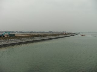
Huanglong River, historically known as Zengzigang River, is a right-bank tributary of Xiang River in Wangcheng District and the northernmost one of right-bank tributaries in Changsha section of Xiang River in Hunan, China. It has a length of 10 kilometres (6.2 mi) with a rough drainage basin area of 50 square kilometres (19 sq mi). Huanglong River rises in Shiziling of Chating Town, flows through Shiziling, Yangjiaping, Dongcheng and Dalong four villages of Chating Town and Huashi Village of Tongguan Subdistrict, merging into Xiang River at Zengzigang Mouth located between Dalong and Huashi villages.
Shizhu River is a right-bank tributary of Xiang River in Wangcheng District of Changsha, Hunan Province, China. The river has three sources merging into the trunk stream at Daigongqiao. The right branch is its main stream which rises in the Jiufeng Mountain, the headwaters are a group of reservoirs including Chating Reservoir, Sichong Reservoir and Nanchong Reservoir located in Chating Town. The main river runs through Chating and Qiaoyi 2 towns and Tongguan Subdistrict before linking up with the Xiang River. It has a length of 25 kilometres (16 mi) with a drainage basin area of rough 60 square kilometres (23 sq mi). Its drainage basin covers Shizhu, Caitaoyuan, Heqiao, Gguoliang villages of Tongguan Subdistrict, Baishi of Qiaoyi Town, Xihusi, Shiziling, Daigongqiao, Wangqun, Meihualing, Tanjiayuan and Jiufengshan villages of Chating Town.
Muyungang River is the southernmost one of right-bank tributaries in Changsha section of Xiang River in Hunan, China. The river has two branches of headwaters risen in Tiaoma Town of Yuhua District, of which the right (western) source originates from Xiyu, the left (eastern) source rises in Xintian. the two streams intersect at Sanxianling. From the confluence with two branches of headwaters at Sanxianling, The drainage basin of the river covers an area of about 90 square kilometres (35 sq mi), the trunk stream of the river flows 7.94 kilometres (4.93 mi) southwest through Tiaoma Town of Yuhua District and Muyun Subdistrict of Tianxin District before merging into Xiang River at the river mouth between Dawantang and Maziling.
The Guanyin Creek is a seasonal river located in the left (western) bank of Xiang River, Pingtang Subdistrict of Yuelu District, Changsha, Hunan, China. The creek has a length of about 6 kilometres (3.7 mi) with a drainage area of about 10 square kilometres (3.9 sq mi), its headwaters rise in Huangtuping of Lianhuashan Village. The creek flows east through Hongqiao Village and Guanyingang Community, the creek joins Xiang River at Yangjiazui.
Longwanggang River is a left-bank tributary of the Changsha section of Xiang River in Hunan Province, China. The river has two source streams, the north and south sources. Leifeng River is the north source stream, which rises in Liaojiaping. The south source is regarded as the main stream, it originates from Nanjiaoling, which is located in the eastern side of Wufeng Mountain of Lianhua, Yuelu District.
The Lianshui River, also known as Luoma River or Ganxi River, is a left-bank tributary in the middle reaches of the Xiang River in Hunan. The river rises in Pingshang Town of Xinshao County. Its main stream runs generally west to east through Xinshao, Lianyuan, Louxing, Shuangfeng, Xiangxiang, Yuhu and Xiangtan counties and joins the Xiang at Hekou of Xiangtan. The Lianshui River has a length of 224 kilometres (139 mi); its drainage basin covers an area of 7,150 square kilometres (2,760 sq mi).
The Juan River, also known as Baiguo River, Yisu River and Xingle River, is a left-bank tributary in the middle reaches of the Xiang River in Hunan, China. The river rises in the Changshan Mountains of Shuangfeng County, and its main stream runs generally southwest to northeast through Shuangfeng, Hengshan and Xiangtan counties, joining the Xiang at Yisuhe of Xiangtan. The Juan River has a length of 103 kilometres (64 mi), and its drainage basin covers an area of 1,764 square kilometres (681 sq mi).
The Mi River is one of three largest tributaries of the Xiang River and a right-bank tributary in the middle reaches of the Xiang in Hunan, China. The river rises in Tianxin Village of Xiacun Township, Yanling County. Its main stream runs generally southeast to northwest through Yanling, Chaling, You and Hengdong counties, and it joins the Xiang in Xintang Town of Hengdong. The Mi River has a length of 296 kilometres (184 mi); its drainage basin covers an area of 10,305 square kilometres (3,979 sq mi).
The Chongling River, also known as Jiao River and Lingyuan River, is a right-bank tributary and one of the largest tributaries of the middle Xiang River in Hunan, China. The river rises in the Renxingling Mountains of Lanshan County. Its main stream runs generally south to north through Lansghan, Jiahe, Xintian, Xintian, Leiyang, Changning and Hengnan counties, and it joins the Xiang at Jiaohekou of Hengnan. The Chongling River has a length of 223 kilometres (139 mi), with its tributaries, and the drainage basin covers an area of 6,623 square kilometres (2,557 sq mi).
The Lei River is a right-bank tributary of the middle Xiang River in Hunan, China. It is also the longest tributary and has the second largest drainage system of the Xiang tributaries after the Xiao River. The Lei River has two sources: the Zhejiang River, which rises in the Leishan Mountains in the south of Rucheng County, and the Ou River, which rises in the Wanyang Mountains in the north of Guidong County. The two rivers join at Huangcaoping, Zixing City. The main stream of the Lei River runs generally south to northwest through Rucheng, Zixing, Suxian, Yongxing, Leiyang, Hengnan and Zhuhui counties and joins the Xiang at Leihekou of Zhuhui District of Hengyang. The main stream of the Lei River has a length of 453 kilometres (281 mi), with its tributaries, and the drainage basin covers an area of 11,783 square kilometres (4,549 sq mi).
The Yishui River, also known as Yi River, is a right-bank tributary of the middle Xiang River in Hunan, China. It is the largest and longest river in Changning City. The Yi River rises in Xiaoyangquan of Baishui Township of Guiyang County. Its main stream runs generally south to north and joins the Xiang at Jiangkoutang of Xinhe Town. The Yi River has a length of 86 kilometres (53 mi), with its tributaries, and its drainage basin covers an area of 1,056 square kilometres (408 sq mi).
The Luhong River, also known as Ying River, is a left-bank tributary of the upper Xiang River in Yongzhou Prefecture, Hunan Province, China. Luhong River rises in Lishuichong of Dasheng Town in the east of the Huanghua Mountains, Dong'an County. The main stream of the Luhong River runs generally northwest to southeast, and it joins the Xiang at Shuijiangkou of Gaoxishi Town, Lengshuitan. The main stream of the Luhong River has a length of about 80 kilometres (50 mi), with its tributaries; the drainage basin covers an area of 1,076 square kilometres (415 sq mi).


