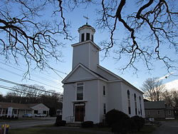
West Congregational Church
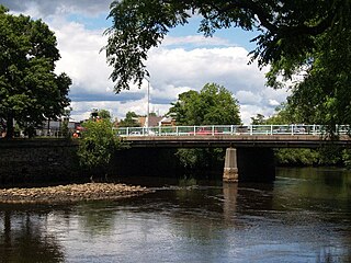
Westville is one of five primary historic neighborhoods of the city of Taunton, Massachusetts. Although these neighborhoods are not census-designated areas, they are municipally designated populated regions of the city.
Westville is one of five primary historic neighborhoods of the city of Taunton, Massachusetts. Although these neighborhoods are not census-designated areas, they are municipally designated populated regions of the city.
Westville is located on the west end of the city bordering the Oakland and Weir neighborhoods, and the towns of Rehoboth and Dighton.
US Route 44 is the only major route within the Westville neighborhood. Route 44 serves as the main connecting road between Taunton and Providence, Rhode Island.
41°53′10″N71°08′08″W / 41.88611°N 71.13556°W
| | This Bristol County, Massachusetts geography–related article is a stub. You can help Wikipedia by expanding it. |

Route 44 is a state highway located in Gloucester County in the U.S. state of New Jersey. It runs 10.28 mi (16.54 km) from Barker Avenue in Bridgeport to a cul-de-sac at a ramp from southbound Interstate 295 (I-295) and U.S. Route 130 in Thorofare. The route, which is mostly a two-lane undivided road, passes through the communities of Gibbstown and Paulsboro in the northern part of the county, a short distance south of the Delaware River. Route 44 generally runs a short distance to the north of I-295/US 130 for much of its length.

The Taunton River, historically also called the Taunton Great River, is a river in southeastern Massachusetts in the United States. It arises from the confluence of the Town River and Matfield River, in the town of Bridgewater. From there it meanders through the towns of Halifax, Middleborough and Raynham, through the city of Taunton for which it is named, the towns of Berkley, Dighton, Somerset, and the Assonet section of Freetown, to Fall River where it joins Mount Hope Bay, an arm of Narragansett Bay.
Montrose is an unincorporated community on the border between Bath Township, Copley Township, and the city of Fairlawn in Summit County, Ohio, United States. It is an area of restaurants, stores, and businesses located along a stretch of State Route 18 near Interstate 77. The community is served by the Fairlawn (44333) post office. It is included in the Montrose-Ghent census-designated place. It had been a quiet hamlet for much of its history, with such establishments as a drive-in theater, golf courses, and a church. It became a busy retail area in the 1990s as new commercial development moved in.

The Assonet River is located in Bristol County, Massachusetts. It flows 7.4 miles (11.9 km) in a westerly direction through Freetown and joins the Taunton River near Assonet Neck in Berkley, Massachusetts.

Westville is a neighborhood of the city of New Haven, Connecticut. The area is positively reviewed for its walkability, diverse population, and livability. It is more expensive than the average American city, has lower crime rates, and graduates children from high school at rates above the national average.
The Cotley River is a small river in Taunton and Berkley, Massachusetts that is a tributary of the Taunton River. It flows approximately 5.8 miles (9.2 km) in a northwesterly direction from the southeast part of Taunton near Seekell Street to Barstows Pond near the village of East Taunton where it joins the Taunton River.

The Three Mile River or Threemile River is a river in Bristol County, Massachusetts. It is formed by the junction of the Rumford and Wading rivers in the town of Norton. It flows in a southeasterly direction for 13.5 miles (21.7 km) through the towns of Norton, Taunton and Dighton, where it joins the Taunton River.

Oakland is one of five primary historic neighborhoods of the city of Taunton, Massachusetts, United States. Although these neighborhoods are not census-designated areas, they are municipally designated populated regions of the city.

The Forge River is a 5.1-mile-long (8.2 km) river in the town of Raynham in southeastern Massachusetts. It is a tributary of the Taunton River. It rises from Gushee Pond near Interstate 495 and flows northwest through Titicut Swamp, then turns southwest for the rest of its course. It flows through Hewitt Pond, passes the neighborhood of Tracy Corner, then continues through Johnson Pond and the village of Raynham Center to its junction with the Taunton River.

Apponaug is a neighborhood in central Warwick, Rhode Island, United States, situated on Apponaug Cove, a tributary to Greenwich Bay and nearby Narragansett Bay. The name Apponaug is a derivation of the Narragansett Indian word for "place of oysters". Indeed, Apponaug Cove holds one of the richest shellfish beds in the United States and was densely populated by the Narragansett people for many centuries prior to the arrival of European settlers.
East Taunton is a suburban neighborhood of Taunton, Massachusetts, United States.
Amity is a residential and commercial neighborhood of the city of New Haven, Connecticut, United States. It is bounded on the northeast by West Rock Ridge, on the south by the Westville neighborhood of New Haven, and on the northwest by the Flats in the town of Woodbridge, Connecticut. The official New Haven neighborhood planning maps include the traditionally separate neighborhoods of West Hills and Beverly Hills within the Amity neighborhood. The neighborhood lies in the glacier-carved valley of the West River. The river flows in a southerly direction, bisecting the neighborhood.
The Canoe River is a river in southeastern Massachusetts. It is 14.4 miles (23.2 km) long and part of the Taunton River Watershed.
The Runnins River is a river in the U.S. states of Massachusetts and Rhode Island. It flows approximately 14 km (9 mi).
West Plymouth is a village in Plymouth, Plymouth County, Massachusetts, United States. It is located beyond the Colony Place retail development and the Plymouth Industrial Park off U.S. Route 44 and north of Myles Standish State Forest. It stretches west to the Carver town line and north to the Kingston town line. The villages within this section include Micajah Heights, a community surrounding Micajah Pond, Billington Sea, a village along the southern shore of the pond, Darby, a village surrounding Darby Pond, and the portion of East Carver that extends into Plymouth.
Weir Village is a village of the city of Taunton in Bristol County, Massachusetts, United States, located approximately one mile south of the city center on the banks of the Taunton River, near the point where it becomes tidal. The village takes its name from fishing weirs which were placed across the Taunton River from pre-colonial times until the early 20th century, to catch herring. While much of the commercial part of the village lies on the west side of the river, along Weir Street, a dense residential area extends in an easterly direction across the river along Plain and Berkley Streets.

North Taunton is an unofficial neighborhood in the city of Taunton, Massachusetts, United States. It is not a census-designated area, but is considered by local residents as a municipally designated populated region of the city.
The Cedar Swamp River is a small river in Lakeville, Massachusetts that flows 4.6 miles (7.4 km) in a northwesterly direction through the western part of the town to where it forms the Assonet River near the Freetown line, just south of the village of Myricks. It is a tributary of the Taunton River.
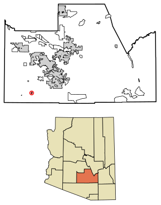
Tat Momoli is a census-designated place located in Pinal County, Arizona, United States, on the Tohono Oʼodham Indian Reservation. As of the Census of 2010 it had a population of 10 with a population density of 4.16 people per km2.
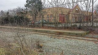
Taunton station was a passenger rail station located south of Oak Street in downtown Taunton, Massachusetts. As Taunton Central station, it served local and Boston-focused routes from 1836 to 1964. A later station at the same site served Amtrak's Cape Codder from 1986 to 1996, and Cape Cod and Hyannis Railroad commuter trains in 1988.