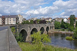
Templecombe is a village in Somerset, England, situated on the A357 road five miles south of Wincanton, twelve miles east of Yeovil, and 30 miles west of Salisbury. The village has a population of 1,560. Along with the hamlet of Combe Throop it forms the parish of Abbas and Templecombe.
Bottesford Preceptory was sited at Bottesford, just to the south of Scunthorpe, in Lindsey, England. It was on low-lying land, near the Bottesford Beck, about 3 miles (5 km) to the west of the escarpment of the Lincoln Cliff limestone upland, and about the same distance to the east of the River Trent. A preceptory was a community of the Knights Templar who lived on one of that order's estates in the charge of its preceptor. A preceptory also referred to the estate and its buildings. The present Bottesford Manor is believed to have been the gatehouse to the preceptory.

Aslackby Preceptory in Lincolnshire lay to the south-east of Aslackby Church. Until about 1891 a tower, possibly of the preceptory church, together with a vaulted undercroft, survived as part the Temple farmhouse. Temple farmhouse was subsequently rebuilt and a 15th-century window and a stone pinnacle remain in the garden
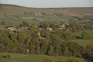
Westerdale is a village, civil parish and dale within the Scarborough district of North Yorkshire, England. The Esk Valley Walk runs through part of the village. The village is at the confluence of three streams (Esklets) which combine as the head of the River Esk.
The Faxfleet Preceptory is a former community of the Knights Templar located in what is now the East Riding of Yorkshire, England. It stood on lands which are now part of Thorpe Grange Farm and are largely buried under a field to the west of the farm known today as Temple Garth. The location is west of Kingston upon Hull, approximately 20 miles south of Youlthorpe and 25 miles south-west of Beswick.

Aslackby and Laughton is a civil parish in the South Kesteven district of Lincolnshire, England. According to the 2001 census the parish had a population of 243, in 102 households. increasing slightly to 251 in 118 households at the 2011 census. It consists of the village of Aslackby, the hamlet of Laughton, and scattered farms.

Templecombe Preceptory was established in 1185 in Templecombe, Somerset, England.
Temple Guiting Preceptory was a medieval monastic house of the Knights Templar in Gloucestershire, England. It was founded around the middle of the twelfth century, receiving grants of land from Gilbert de Lacy and Roger de Waterville. Following the closure of the order in 1308-1309, the last preceptor of Guiting was sent to a monastery in the Diocese of Worcester with a small maintenance charged upon the lands of Temple Guiting.
Great Limber Preceptory, Limber Magna was a Camera (farm) of the Knights Templar and later the Knights Hospitaller in the village of Great Limber, Lincolnshire, England.
Maltby Preceptory was a house of the Knights Hospitaller in the village of Maltby, Lincolnshire, England. There are two differing accounts regarding its history.
Ribston Preceptory was a priory just east of the village of Little Ribston, in North Yorkshire, England on the east bank of the River Nidd. The preceptory at Ribston was founded in 1217, when Robert de Ros donated the land and advowson of Ribston to the Knights Templar.
Snainton Preceptory was a priory, just south of the village of Snainton, in North Yorkshire, England. The preceptory was started by the Knights Templar at Foulbridge which sits 1-mile (2 km) to the east of a Benedictine Priory at Yedingham. Both houses were on the River Derwent.
Westerdale Preceptory was a priory in Westerdale, North Yorkshire, England. The land was donated to the Knights Templar by Guido de Bovingcourt in 1203, and was one of ten preceptories owned by the Knights Templar in Yorkshire. The Templars worked the land and farmed at Westerdale until their suppression for heresy in 1307-1308.
Copmanthorpe Preceptory, York was a medieval monastic house in North Yorkshire, England.
Keele Preceptory was a preceptory, in Keele, Staffordshire, England. Owned by the Knights Templar until their suppression in the early 14th century, it then passed through a number of owners before falling into the hands of the Knights Hospitaller.
Temple Hirst Preceptory was a priory in North Yorkshire, England.

The site of the former preceptory at Temple Hill, South Witham. It 'has been largely under pasture' since the Knights Templar left in 1308.]] Withham Preceptory, one of the smallest Knights Templar preceptories in England, was founded, before 1164, at Temple Hill, near South Witham, Lincolnshire, and was abandoned in the early 14th century.
Temple Hirst is a village and civil parish in the Selby District of North Yorkshire, England. It was formerly in the Barkston Ash wapentake in the West Riding of Yorkshire. The village is located on the north bank of the River Aire. In the 2011 census the population was 120.