Wildsee (Kaltenbronn)

Last updated
Wildsee
Wildsee Bad Wildbad.jpg
Location Black Forest, Baden-Württemberg
Coordinates 48°43′6″N8°27′33″E / 48.71833°N 8.45917°E / 48.71833; 8.45917 Coordinates: 48°43′6″N8°27′33″E / 48.71833°N 8.45917°E / 48.71833; 8.45917
Primary inflows Seegraben
Primary outflows Seegraben → Brotenaubach
Basin  countries Germany
Surface area 1.15 ha (2.8 acres) [1]
Surface elevation 909 m (2,982 ft)

The Wildsee is a small lake within an area of bog between Bad Wildbad and Gernsbach, high in the Northern Black Forest mountain range in southwestern Germany. The lake is fed by rain water. It is part of the Kaltenbronn Nature Reserve.

Lake A body of relatively still water, in a basin surrounded by land

A lake is an area filled with water, localized in a basin, that is surrounded by land, apart from any river or other outlet that serves to feed or drain the lake. Lakes lie on land and are not part of the ocean, and therefore are distinct from lagoons, and are also larger and deeper than ponds, though there are no official or scientific definitions. Lakes can be contrasted with rivers or streams, which are usually flowing. Most lakes are fed and drained by rivers and streams.

Bog wetland that accumulates peat due to incomplete decomposition of plant leftovers

A bog or bogland is a wetland that accumulates peat, a deposit of dead plant material—often mosses, and in a majority of cases, sphagnum moss. It is one of the four main types of wetlands. Other names for bogs include mire, quagmire, and muskeg; alkaline mires are called fens. They are frequently covered in ericaceous shrubs rooted in the sphagnum moss and peat. The gradual accumulation of decayed plant material in a bog functions as a carbon sink.

Bad Wildbad Place in Baden-Württemberg, Germany

Bad Wildbad is a town in Germany, in the state of Baden-Württemberg. It is located in the government district (Regierungsbezirk) of Karlsruhe and in the district (Landkreis) of Calw. Its coordinates are 48° 45' N, 8° 33' E. About 11,250 people live there. The current mayor is Klaus Mack.

Contents

The area has a geological base of sandstone. The sandstone developed a rich brown soil, which originally allowed the European Beech to grow. In the later development of forestry, the Norway Spruce and European Pine (Pinus sylvestris) were introduced. These three tree species can be found in the vicinity of the lake.

Location

Board walk by the Wildsee Wildsee-pjt1.jpg
Board walk by the Wildsee

The Wildsee is located at a height of 909 m above  sea level (NN) on a plateau between Bad Wildbad, Gernsbach and Forbach. The surface area of the lake has been estimated as 2.3 hectares since work in the early 20th century by Karl Müller. More recent data from the Baden-Württemberg State Office for the Environment, Survey and Conservation estimates its area as 1.15 hectares. [1] Immediately adjacent is the smaller Hornsee (0.43 hectares). The nearest settlement with road links is Kaltenbronn, about 2 kilometres to the southwest. The boundary between the municipalities of Gernsbach (county of Rastatt) and Bad Wildbad (county of Calw) runs through the Wildsee and its associated nature reserve. The Hornsee belongs to Gernsbach.

Normalnull

Normalnull or Normal-Null is an outdated official vertical datum used in Germany. Elevations using this reference system were to be marked "Meter über Normal-Null". Normalnull has been replaced by Normalhöhennull.

Forbach (Baden) Place in Baden-Württemberg, Germany

Forbach is a village in Baden-Württemberg, Germany. It lies in the district of Rastatt. It is located in the Murg river valley, in the northern part of the Black Forest mountains. Forbach is further broken down into the following districts: Langenbrand, Bermersbach, Gausbach, Hundsbach, Herrenwies, Kirschbaumwasen, Erbersbronn, Raumünzach and Schwarzenbach.

Kaltenbronn (Gernsbach) human settlement in Germany

Kaltenbronn is a hamlet and old parish in the Black Forest in Germany that belongs to the parish of Reichental in the municipality of Gernsbach in Baden-Württemberg. The hamlet in the northern Black Forest with its hotel, forester’s lodge and former Baden hunting lodge lies a little below the top of the Schwarzmiss Pass (933 m) between the Murg and Enz valleys at a height of about 860 metres above sea level (NN) in the centre of the largest contiguous woodland in Baden-Württemberg.

Formation

At the end of the last ice age (about 10,000 years ago), impervious, bunter sandstone beds and high levels of precipitation caused the formation of the boggy terrain in this area. As a result of incomplete decomposition, a peat layer, up to eight metres thick, was formed in the Wildsee Bog (Wildseemoor). The thicker the peat layer, the lower the supply of nutrients for plants growing on it. The result is a vegetation of relatively undemanding plants (shrubs, mosses, cottongrasses).

Shrub type of plant

A shrub or bush is a small- to medium-sized woody plant. Unlike herbaceous plants, shrubs have persistent woody stems above the ground. They are distinguished from trees by their multiple stems and shorter height, and are usually under 6 m (20 ft) tall. Plants of many species may grow either into shrubs or trees, depending on their growing conditions. Small, low shrubs, generally less than 2 m (6.6 ft) tall, such as lavender, periwinkle and most small garden varieties of rose, are often termed "subshrubs".

Moss division of plants

Mosses are small flowerless plants that typically grow in dense green clumps or mats, often in damp or shady locations. The individual plants are usually composed of simple leaves that are generally only one cell thick, attached to a stem that may be branched or unbranched and has only a limited role in conducting water and nutrients. Although some species have conducting tissues, these are generally poorly developed and structurally different from similar tissue found in vascular plants. Mosses do not have seeds and after fertilisation develop sporophytes with unbranched stalks topped with single capsules containing spores. They are typically 0.2–10 cm (0.1–3.9 in) tall, though some species are much larger. Dawsonia, the tallest moss in the world, can grow to 50 cm (20 in) in height.

Conservation

The bog landscape, including the Wildsee and the Hornsee, is a near-natural raised bog with bog forests that have been placed under protection (Wildseemoor Nature Reserve, 183.2 ha), in order to encourage the development of the raised bog, and pine and spruce forest ecosystems on its perimeter, with their special animal and plant species. In addition, the region around the lake is protected as Bannwald (Wildseemoor Bannwald, 291 ha). With the Hohlohsee Nature Reserve and surrounding areas of protected forest, the Wildseemoor has been merged since 2000 into the Kaltenbronn Nature and Forest Reserve (1,750 ha). [2]

Raised bog

Raised bogs, also called ombrotrophic bogs, are acidic, wet habitats that are poor in mineral salts and are home to flora and fauna that can cope with such extreme conditions. Raised bogs, unlike fens are exclusively fed by precipitation (ombrotrophy) and from mineral salts introduced from the air. They thus represent a special type of bog, hydrologically, ecologically and in terms of their development history, in which the growth of peat mosses over centuries or millennia plays a decisive role. They also differ in character from blanket bogs which are much thinner and occur in wetter, cloudier climatic zones.

<i>Bannwald</i> In the middle age a reserved forest, today a protective forest

Bannwald is a German word used in parts of Germany and Austria to designate an area of protected forest. Its precise meaning has varied by location and over time.

Tourism

The moorland landscape is crossed by a board walk built by the Black Forest Club, which passes directly over the lake. The waymarks of the Middle Way hiking trail from Pforzheim to Waldshut lead around the nature reserve.

Middle Way Buddhist doctrine

The Middle Way or Middle Path is the term that Gautama Buddha used to describe the character of the Noble Eightfold Path he discovered that leads to liberation.

Pforzheim Place in Baden-Württemberg, Germany

Pforzheim is a city of over 120,000 inhabitants in the federal state of Baden-Württemberg, in the southwest of Germany. It is known for its jewelry and watch-making industry, and as such has gained the nickname "Goldstadt". With an area of 97.8 km2 (38 sq mi), it is situated between the cities of Stuttgart and Karlsruhe at the confluence of three rivers. It marks the frontier between Baden and Württemberg, being located on Baden territory. From 1535 to 1565, it was the home to the Margraves of Baden-Pforzheim.

Waldshut-Tiengen Place in Baden-Württemberg, Germany

Waldshut-Tiengen is a city in southwestern Baden-Württemberg right at the Swiss border. It is the district seat and at the same time the biggest city in Waldshut district and a "middle centre" in the area of the "high centre" Lörrach/Weil am Rhein to whose middle area most towns and communities in Waldshut district belong. There are furthermore complexities arising from cross-border traffic between this area and the Swiss cantons of Aargau, Schaffhausen and Zürich. This classification relates to Walter Christaller's Central Place Theory, however, and not to any official administrative scheme.

See also

Related Research Articles

Black Forest mountain range in Baden-Württemberg, southwestern Germany

The Black Forest is a large forested mountain range in the state of Baden-Württemberg in southwest Germany. It is bounded by the Rhine valley to the west and south. Its highest peak is the Feldberg with an elevation of 1,493 metres (4,898 ft). The region is roughly oblong in shape with a length of 160 km (99 mi) and breadth of up to 50 km (31 mi).

Murg (Northern Black Forest) river and right tributary of the Upper Rhine in Baden-Württemberg, Germany

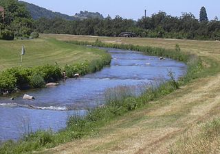
The Murg is an 80.2-kilometre-long river and a right tributary of the Rhine in Baden-Württemberg, Germany. It flows through the Northern Black Forest into the Upper Rhine Plain, crossing the counties of Freudenstadt and Rastatt.

Rench river in Germany

The Rench is a right-hand tributary of the Rhine in the Ortenau. It rises on the southern edge of the Northern Black Forest at Kniebis near Bad Griesbach im Schwarzwald. The source farthest from the mouth is that of the Schöngrundbächle which rises at a height of around 915 m above NN in the parish of Zuflucht near the old youth hostel. After flowing through its steep mountainside klinge it is joined by other streams to form, first, the Old (Alter), then the Wild Rench, which first becomes the Rench below Bad Griesbach. The Rench runs in a prominent southerly arc through the Central Black Forest and crosses the hilly region of Ortenau with its orchards and vineyards before breaking out into the Rhine Plain. After just under 57 km it discharges, together with the Mühlbach, into the Rhine at 314.7km between Helmlingen (Rheinau) and Lichtenau.

Gernsbach Place in Baden-Württemberg, Germany

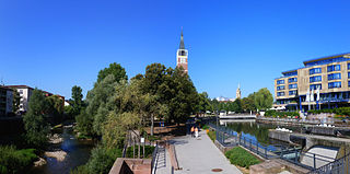
Gernsbach is a town in the district of Rastatt, in Baden-Württemberg, Germany. It is located on the river Murg, 7 km (4.35 mi) east of Baden-Baden in the Black Forest. Twin towns are Baccarat in France and Pergola, Marche in Italy. The town is the historic centre of the lower Murg Valley and forms a central place of mid-size with Gaggenau. It is located in the Region Mittlerer Oberrhein, one of the twelve spatial planning regions of Baden-Württemberg. Gernsbach is an officially recognised climatic spa with a historic centre. Furthermore, Gernsbach is noted for its paper industry and Paper Centre, a service provider in the field of training, staff qualification and management consultancy for the German and Swiss paper and pulp industry.

Northern Black Forest German forest

The Northern Black Forest refers to the northern third of the Black Forest in Germany or, less commonly today, to the northern half of this mountain region.

Missen are small, shallow, forest bogs in pine -dominated woods that form on crests, saddles, hollows or plateaus in the hills or mountains. They only have a thin layer of peat of between 30 and 100 centimetres thick. The term misse is local to the Northern Black Forest and also surfaces as Miß, Müsse or Müß. These names probably derive from the German Moos ("moss") because peat mosses (Sphagnum) play a key role in their development. Due to the poor tree growth associated with them, however, it could also stand for mies ("bad").

Grinde (landform)

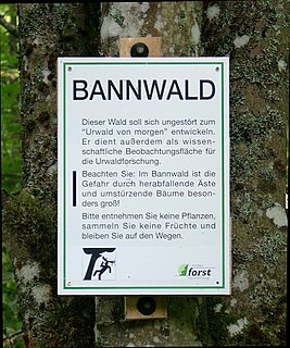
A grinde is an almost treeless area of wet heathland found on the rounded bunter sandstone ridges of the Northern Black Forest in Germany. The grinden reached their greatest extent in the early 19th century when they ran from the Kniebis mountain near Freudenstadt in the south to the heights near Dobel in the north. Today they are restricted to the highest parts of the Northern Black Forest around the summits of the Hornisgrinde, Schliffkopf and Kniebis. They still cover an area of about 180 ha. Conservation measures and careful grazing by robust breeds of cattle, goats and sheep should enable the remaining grinden to be preserved for their great ecological value and as an important feature of the landscape. Most of them are under conservation orders.

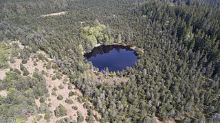
Wildsee may refer to the following lakes:

Southern Black Forest Nature Park nature park in Baden-Württemberg, Germany

The Southern Black Forest Nature Park covers an area of 394,000 hectares and is, at present, the largest nature park in Germany.

Feldsee lake in Breisgau-Hochschwarzwald district, Baden-Württemberg, Germany

The Feldsee is a lake in southern Baden-Württemberg at the foot of the Feldberg east of Freiburg im Breisgau in Germany. It is part of the Southern Black Forest Nature Park.

Hoher Ochsenkopf mountain

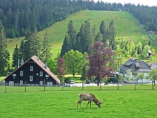
The Hoher Ochsenkopf is a mountain in the Northern Black Forest in the municipality of Forbach in south Germany. At 1,054.5 m above sea level (NHN) it is the highest point in Forbach and also in the county of Rastatt. The mountain, whose domed summit or kuppe was already a nature reserve lies in the Black Forest National Park which was founded in 2014. Its name recalls its former use as wood pasture.

Hohloh mountain

The Hohloh is a mountain, 988.3 m above sea level (NHN), on the eastern main ridge of the Northern Black Forest in Germany. It lies near the village of Kaltenbronn in the borough of Gernsbach, a town in the county of Rastatt in the German state of Baden-Württemberg. Its summit is the highest point in the borough of Gernsbach and the eastern chain of the Northern Black Forest, the ridge between the rivers Murg and Enz. A mountain pass runs northeast of the summit plateau between the two river valleys passing over the saddle of Schwarzmiss.

Nonnenmattweiher nature reserve in Baden-Württemberg, Germany

The Nonnenmattweiher is a lake that has been impounded by an embankment in the Southern Black Forest in Germany. Together with the surrounding area it forms a nature reserve of the same name in the High Black Forest in the state of Baden-Württemberg.

Glaswaldsee lake in Baden-Württemberg, Germany

The Glaswaldsee near the spa town of Bad Rippoldsau-Schapbach in the Central Black Forest in Germany lies in a cirque that is sunk into the steep eastern mountainside of the Lettstädter Höhe. It is part of the nature reserve of the same name that was established in 1960.

Blindensee lake in Germany

The Blindensee is a raised bog lake on the territory of Schönwald im Schwarzwald in the Black Forest in Germany. It lies within the county of Schwarzwald-Baar-Kreis in the state of Baden-Württemberg. It is only accessible on a board walk and lies with raised bog area that has been designated as a nature reserved near the watershed between the rivers Gutach and Elz.

Lothar Path

The Lothar Path is a forest experience and educational path in the Schliffkopf Nature Reserve by the Black Forest High Road between Oppenau and Baiersbronn on the B 500 in the Northern Black Forest. The name of the windthrow educational trail is derived from Hurricane Lothar, which tore through the forest here on 26 December 1999 with wind velocities of up to 200 km/h creating a wide swathe of debris.

Mathisleweiher

The Mathisleweiher is a large bog lake, under 2 hectares in area, in the Black Forest in southern Germany. It lies in the High Black Forest between Feldberg in the west and the Titisee in the east on the territory of Hinterzarten at about 999 m above NN southwest of the village in the Eschengrundmoos Nature Reserve. The pond impounds the Zartenbach which flows through it from west-southwest to east-northeast. The stream rises on the eastern slopes of the Ramselehöhe at about 1,055 m above NN, picks up the Eschengrundmoosbach from the right from the protected bog and runs for less than a kilometre before entering the lake. A shorter stream runs from the north from the woods of the Stuckwald. It has a catchment of 1.0 km2

References

  1. 1 2 Ma service of the LUBW, theme "Stehendes Gewässer", retrieved 22 January 2015.
  2. Schutzgebietssteckbrief Natur- und Waldschutzgebiet „Kaltenbronn“, LUBW, retrieved 3 April 2014

Literature