Highway 97 is the longest continuously numbered route in the Canadian province of British Columbia, running 2,081 km (1,293 mi) from the Canada–United States border near Osoyoos in the south to the British Columbia/Yukon boundary in the north at Watson Lake, Yukon. The route takes its number from U.S. Route 97, with which it connects at the international border. The highway was initially designated '97' in 1953.

The Cariboo Road was a project initiated in 1860 by the Governor of the Colony of British Columbia, James Douglas. It was a feat of engineering stretching from Fort Yale to Barkerville in the Canadian province of British Columbia through extremely hazardous canyon territory in the Interior of B.C.

The Cariboo Gold Rush was a gold rush in the Colony of British Columbia, which earlier joined the Canadian province of British Columbia. The first gold discovery was made at Hills Bar in 1858, followed by more strikes in 1859 on the Horsefly River, and on Keithley Creek and Antler Creek in 1860. The actual rush didn’t begin until 1861, when these discoveries were widely publicized. By 1865, following the strikes along Williams Creek, the rush was in full swing.

Bowron Lake Provincial Park is a provincial park located in northern British Columbia, Canada, about 117 km (73 mi) east of the city of Quesnel. Other nearby towns include Wells and the historic destination of Barkerville. The park is known for its rugged glaciated mountains, cold deep lakes, waterfalls, and abundant wildlife. The main attraction is the 116 km (72 mi) canoe circuit through the Cariboo Mountains, which follows lakes, rivers, and short portages between waterways. This trip takes about a week to complete. An alternative to this trip is the shorter Westside route, which traverses Bowron, Swan, Spectacle, Skoi, Babcock, Unna and Rum lakes. This circuit takes two to four days.
Williams Lake Indian Reserve, also called the Williams Lake Band Reservation and commonly referred to locally as the Sugarcane Reserve, aka Sugarcane or The Cane or SCB, is an Indian Reserve in British Columbia, Canada, located at the east end of Williams Lake and 12 km east of the city of the same name, on the right bank of the San Jose River. and is home to the Williams Lake Indian Band. The band is part of the Northern Shuswap Tribal Council, also known as the Cariboo Tribal Council, which is one of two tribal councils of the Secwepemc peoples.

Port Douglas, sometimes referred to simply as Douglas, is a remote community in British Columbia, Canada at east of the mouth of the Lillooet River, and at the head of Harrison Lake, which is the head of river navigation from the Strait of Georgia. Port Douglas was the second major settlement of any size on the British Columbia mainland during the Fraser Canyon Gold Rush.
Cariboo was one of the twelve original electoral districts created when British Columbia became a Canadian province in 1871. Roughly corresponding to the old colonial electoral administrative district of the same name, it was a three-member riding until the 1894 election, when it was reduced through reapportionment and became a two-member riding until the 1916 election, after which it has been a single-member riding. It produced many notable Members of the Legislative Assembly (MLAs), including George Anthony Boomer Walkem, third and fifth holder of the office of Premier of British Columbia and who was one of the first representatives elected from the riding; John Robson, ninth Premier of British Columbia; and Robert Bonner, a powerful minister in the W.A.C. Bennett cabinet, and later CEO of MacMillan Bloedel and BC Hydro.
Mount Currie is a small, mostly First Nations, community in British Columbia, 164 kilometres north of Vancouver and 40 kilometres north-east of Whistler along Highway 99. "The Mount Currie settlement and mountain were named after Scottish settler John Currie, who located to Quebec in 1851. After failure as a gold seeker in California and the Cariboo, Currie turned to ranching and finally settled near Pemberton with his Lillooet Indian wife in 1885." The area is traditional territory of the Lil'wat, a subgroup of the St'at'imc people who with the communities of Skatin, Samahquam and Xa'xtsa to the south comprise the Lower St'at'imc or Lower Lillooet. The Mount Currie Indian Reserve hosts most of the population of Mount Currie, who are known as the Lil'wat, their name for the spot, but west of the reserve there are non-native farms, industrial sites and tourist resorts, and on the mountain shoulder immediately north of the reserve is Owl Creek, the site of the original Catholic mission school which drew the Lil'wat from their former homebase at Pemberton Meadows so as to be close to their children. Owl Creek today is the name of a modern subdivision of mostly non-natives, though Owl Creek remains on the rail crossing on the CNR just outside the reserve.
The Williams Lake Indian Band is a First Nations government of the Secwepemc (Shuswap) Nation, located in the Cariboo region of the Central Interior region of the Canadian province of British Columbia, at the city of Williams Lake. It was created when the government of the then-Colony of British Columbia established an Indian Reserve system in the 1860s. It is a member government of the Northern Shuswap Tribal Council. Its main Indian Reserve is Williams Lake Indian Reserve No. 1, a.k.a. "Sugarcane" or "The Cane" or "SCB".
The High Bar First Nation is a First Nations government of the Secwepemc (Shuswap) Nation, located in the Fraser Canyon-Cariboo region of the Central Interior of the Canadian province of British Columbia. It was created when the government of the then-Colony of British Columbia established an Indian Reserve system in the 1860s. It is one of three Secwepemc bands that is not a member of either the Shuswap Nation Tribal Council or the Northern Shuswap Tribal Council. The High Bar people are also partly Tsilhqot'in and have links with some Chilcotin First Nations.
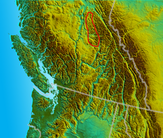
The Quesnel Highland is a geographic area in the Central Interior of the Canadian province of British Columbia. As defined by BC government geographer in Landforms of British Columbia, an account and analysis of British Columbia geography that is often cited as authoritative, the Highland is a complex of upland hill and plateau areas forming and defined as being the buffer between the Cariboo Plateau and the Cariboo Mountains, as a sort of highland foothills along the eastern edge of the Interior Plateau running southeast from a certain point southeast of the city of Prince George to the Mahood Lake area at the southeast corner of the Cariboo. Beyond Mahood Lake lies another separately classified area dubbed by Holland the Shuswap Highland which spans similar terrain across the North Thompson and Shuswap Lake-Adams River drainage basins, forming a similar upland-area buffer between the Thompson Plateau and the Monashee Mountains. A third area, the Okanagan Highland, extends from the southern end of the Shuswap Highland in the area of Vernon and Enderby in the northern Okanagan region into Washington State, and also abuts the Monashee Mountains.
150 Mile House is an unincorporated community of 893 people in the Cariboo region of British Columbia. It is located 15 km southeast of Williams Lake on Highway 97.

The Shuswap Highland is a plateau-like hilly area of 14,511 km2 (5,603 sq mi) in British Columbia, Canada. It spans the upland area between the Bonaparte and Thompson Plateaus from the area of Mahood Lake, at the southeast corner of the Cariboo Plateau, southeast towards the lower Shuswap River east of Vernon in the Okanagan. The highland is not a unified range, but a combination of small uplands broken up by the valleys of the Clearwater, North Thompson and Adams Rivers and also by the lowlands in the southwest flanking Shuswap Lake. In that area of the valley are the towns of Falkland, Westwold, and Monte Creek along Highway 97. This area also includes the Spa Hills, and the other isolated pockets of hills and mini-plateaus between the Thompson Plateau proper and Shuswap Lake. The highest point of the Highland is Matterhorn Peak in the Dunn Peak massif at 2636 meters.
The Little River, also known as the Little Shuswap River, is a 3.6-kilometre (2.2 mi) river in the Shuswap Country region of British Columbia, Canada. It drains Shuswap Lake just below the mouth of the Adams River and feeds Little Shuswap Lake, which is the head of the South Thompson River. The Little River is essentially the same stream as the South Thompson, as there are no other major streams feeding Little Shuswap Lake. The river is spanned by Squilax Bridge which connects the Trans-Canada Highway to the communities around Adams Lake and the north shore of Shuswap Lake.
Pemberton Pass, 505 m (1,657 ft), also formerly known as Mosquito Pass, is the lowest point on the divide between the Lillooet and Fraser River drainages, located at Birken, British Columbia, Canada, in the principal valley connecting and between Pemberton and Lillooet. The pass is a steep-sided but flat-bottomed valley adjacent to Mount Birkenhead and forming a divide between Poole Creek, a tributary of the Birkenhead River, which joins the Lillooet at Lillooet Lake, and the Gates River which flows northeast from Gates Lake, at the summit of the pass, which flows to the Fraser via Anderson and Seton Lakes and the Seton River.
Alkali Lake is an unincorporated community in the Cariboo region of the Central Interior of British Columbia, Canada, located 40 kilometres south of the city of Williams Lake en route to Dog Creek and the Gang Ranch, at about 780 m (2560 ft) above sea level. The settlement, and the adjoining reserves of the Alkali Lake Indian Band, get their name from Alkali Lake, which gets its name from an outcrop of alkali on the hillside above it; the lake itself is not an alkali lake.
Burton is a settlement on the Arrow Lakes in the West Kootenay region of southeastern British Columbia, Canada.


