Yamaltu/Deba

Last updated

Yamaltu/Deba
LGA and town
Nigeria location map.svg
Red pog.svg
Yamaltu/Deba
Location in Nigeria
Coordinates: 10°13′N11°23′E / 10.217°N 11.383°E / 10.217; 11.383
CountryFlag of Nigeria.svg  Nigeria
State Gombe State
Area
  Total1,981 km2 (765 sq mi)
Population
 (2006 census)
  Total255,248
  Ethnicities
Tera Fulani
  Religion
Islam
Time zone UTC+1 (WAT)
3-digit postal code prefix
761
ISO 3166 code NG.GO.YD
Yamaltu/Deba

Yamaltu/Deba is a Local Government Area of Gombe State, Nigeria. Its headquarters is in the town of Deba (or Deba Habe), at the southeastern part of the state capital, Gombe. [1]

Contents

It is inhabited by mainly Tera and Fulani people. [2]

The postal code of the area is 761. [3]

History

Deba's history began in 1375 AD with the appointment of the first Kuji Sovereign Chief. Pre-Mishelku, Mishelku, Fulani Jihad, Colonial, and Post-Independence periods make up Deba's history. The Local Government was already in place before Gombe State was established, but it later became a Local Government inside Gombe State. [4]

The headquarters of the LGA are in the town of Deba and the LGA is bordered by parts of Borno and Yobe states. [5]

Yamaltu /Deba. has Population of 255,248. [6] according to 2006 census.


Geography

Yamaltu/Deba LGA has a total area of 1,981 square kilometers with an average temperature of 31 degrees Celsius. The LGA is home to a portion of the well-known Lake Dadin Kowa, as well as the Kilang Hills and Bima Rock. [7]

Economy

The Yamaltu/Deba LGA is home to a number of markets, including the Kwodom market, where a wide range of goods are bought and sold. Residents of Yamaltu/Deba LGA also make farming a significant part of their lives by growing crops like rice, brown beans, millet, onions, and sorghum there. In the Yamaltu/Deba LGA, additional businesses include fishing, leatherworking, farming, and crafting. [7] [8]

Wards

List of wards in Yamaltu/Deba. [9] [10]

Healthcare

Healthcare in Yamaltu include

  1. Dasa Health Clinic
  2. Jagali Health Clinic
  3. Jauro Gotel Health Clinic
  4. Jauro Musa Kadi Health Post
  5. Maikaho Primary Health Centre
  6. Tsandon Dan Dela Health Post


Localities

Area, Towns and Villages in Yelmatu/Deba. [11] [12]

Deba

Kunnuwal

Jara Area

Dahirma

DasaNahuta

Garin Nabawa

Jagali

Jarawa

Jauro Gotel

Jigawa

Kadi

Kurjale

Maikaho

Pata

Tashar Kuka

Tsandom Dele

Tudun Wada

Yelmatul Area

Notable people

Schools in Deba include

Asas Primary school of JIBWIS. [13]

Model Primary School, Deba. [14]

Government Day Junior Secondary School Deba Central. [15]

Government Comprehensive Secondary School. [16]

GSTC Deba. [17]

Amtas Community Secondary School. [18]

Climate

Dadin Kowa, the headquarter of Yamaltu emirate, which is 0 feet 0 meters above sea level, has a tropical wet and dry or savanna climate . The district averages a yearly temperature of 31.55 oC 88.79 oF, which is 2.09% higher than the national average for Nigeria. 69.05 millimeters 2.72 inches of precipitation and 99.44 rainy days 27.24 percent of the time are typical yearly totals for Dadin Kowa. [19]

Country Nigeria

State Gombe

LGA Yamaltu/Deba


Location: 11.1786358

Longitude: 11.1107517

Latitude: 11.1106358

Attitude/Elevation: 0 feet

See also

Related Research Articles

<span class="mw-page-title-main">Gombe State</span> State of Nigeria

Gombe State is a state in northeastern Nigeria, bordered to the north and northeast by the states of Borno for 93 km in the vicinity of Gongola River and Lake Dadin Kowa and Yobe in the vicinity of Gongola River for 140 km, to the south by Taraba State for 58 km, to the southeast by Adamawa State for 95 km, and to the west by Bauchi State for 277 km. Gombe is the state capital of Gombe state and it was formed from a part of Bauchi State on 1 October 1996. Of the 36 states in Nigeria, Gombe is the 21st largest in area and the 32nd most populous, with an estimated population of about 3.25 million as of 2016. The state bears a slogan "Jewel in the Savannah".

<span class="mw-page-title-main">Gombe, Nigeria</span> Capital city of Gombe State, Nigeria

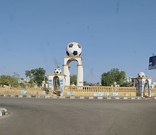
Gombe is the capital city of Gombe State, north-eastern Nigeria, with an estimated population of around 450,000. The major spoken languages in Gombe are Hausa and Fulfulɗe, Tera and Tangale.

Deba, sometimes known as Deba Habe, is a town in Gombe State in northern Nigeria. It is headquarter of the Yamaltu/Deba local government area, Gombe State. As of 1995, it had an estimated population of 135,400.

Bajoga is a town and headquarters of Funakaye, a local government area located in the northern part of Gombe State, Nigeria. Bajoga is 9 km south of the Ashaka cement factory.

<span class="mw-page-title-main">Akko, Nigeria</span> LGA in Gombe State, Nigeria

Akko is a local government area of Gombe, Gombe State, Nigeria. Its headquarters is in Kumo town on the A345 highway south of the state capital Gombe, about 40 km away. Kumo (headquarter) is a cosmopolitan communities of more than 30 differents tribes, ranging from the dominant Fulani tribe to Tangale, Tera, Hausa and other minorities.

Balanga is one of the eleven local government areas in Gombe State, Nigeria. It falls under the southern senatorial district of the state. Its administrative headquarters is located at Talasse town. The LGA is bordered by Yemaltu-Deba LGA to the north while to the south and east by Adamawa state and to the west by Shongom, Kaltungo and Akko LGA.

Funakaye is a Local Government Area of Gombe State, Nigeria. Its headquarters is in the town of Bajoga. Its current chairman is Alhaji Ibrahim Cheldu of the All Progressives Congress. Funakaye is bounded in the east by the Gongola River and Lake Dadin Kowa, beyond which lie Yobe State and Borno State.

<span class="mw-page-title-main">Kaltungo</span> LGA and town in Gombe State, Nigeria

Kaltungo is one among the 11 Local Governments Area of Gombe State, Nigeria. Its headquarters is in the town of Kaltungo in the western part of the Local Government Area on the A345 highway at 9°48′51″N11°18′32″E.

<span class="mw-page-title-main">Kwami</span> LGA in Gombe State, Nigeria

Kwami is a Local Government Area of Gombe State, Nigeria. It has its headquarters in the town of Mallam Sidi. Kwami is bordered in the east by Lake Dadin Kowa, in the north by Funakaye and Gombe in the south. The postal code of the area is 760.

<span class="mw-page-title-main">Nafada</span> LGA and town in Gombe State, Nigeria

Nafada is one of the eleven Local Government Areas (LGA) of Gombe State, Nigeria. Its headquarter is in the town of Nafada in the east of the area at 11°05′44″N11°19′58″E, on the Gongola River which traverses the area. According to the 2006 census, the LGA covers 1,586 square kilometers and has a population of 138,185 people. Nafada has ten wards namely: Nafada East, Nafada Central, Nafada West, Jigawa, Birnin Fulani East, Birnin Bolewa, Birnin Fulani West, Gudukku, Barwo/Nasarawo and Barwo Winde.

Shongom is a Local Government Area (LGA) of Gombe State, Nigeria. Its headquarters is in the town of Boh in the northern part of the Local Government Area

<span class="mw-page-title-main">Dadin Kowa Dam</span> Dam in Gombe State, Nigeria

The Dadin Kowa Dam is located in Yamaltu Deba local government area of Gombe State in the North east part of Nigeria. Dadin Kowa is 41.6 kilometers from Gombe metropolis. The dam is located about 37 kilometers to the east of the town Gombe and 5 km from the Dadin Kowa village, and provides drinking water for the town. The dam was completed by the federal government in 1984, with the goal of providing irrigation and electricity for the planned Gongola sugar plantation project.

<span class="mw-page-title-main">Gombe State House of Assembly</span> Legislative arm of the government of Gombe State of Nigeria

The Gombe State House of Assembly is the legislative arm of the government of Gombe State of Nigeria. It is a unicameral legislature with 24 members elected from the 11 local government areas of the state delineated into 24 state constituencies. Local government areas with considerably larger populations are delineated into two constituencies to give equal representation. This makes the number of legislators in the Gombe State House of Assembly 24.

The 2023 Gombe State gubernatorial election will take place on 18 March 2023, to elect the Governor of Gombe State, concurrent with elections to the Gombe State House of Assembly as well as twenty-seven other gubernatorial elections and elections to all other state houses of assembly. The election—which was postponed from its original 11 March date—will be held three weeks after the presidential election and National Assembly elections. Incumbent APC Governor Muhammad Inuwa Yahaya is running for a second term and was renominated by his party.

<span class="mw-page-title-main">Federal College of Horticultural Technology, Dadin Kowa</span>

Federal College of Horticultural Technology is a government-owned tertiary institution of learning located at Dadin Kowa, Yamaltu Deba local government area of Gombe state, Nigeria.

Bima Hill is a hill in Gombe State, Nigeria located in the Yamaltu/Deba Local Government area. It has a prominence of 404 m. Bima Hill is the fourth most elevated hill in Gombe State out of 23. It is also the first out of two in Yamaltu/Deba. By prominence, Bima Hill is the 80th in Nigeria, the second in Gombe and first in Yamaltu/Deba.

Jekadefari area of Gombe State: is the combination of two different words "jeka" is a Hausa word meaning follow and "defari" meaning white. Jekadefari means "follow the white men". It was the area that white men settled then after they conquered the emir of Gombe in 1903.

Pantami is a district head ward in Gombe Local Government Area of Gombe State, Nigeria. Pantami is located at the terminal southern part of Gombe Local Government area, with Associated Zip Code: 760253. Pantami is one of the largest wards in Gombe local government area with eighteen major polling units.

References

  1. Daniels, Ajiri (8 May 2023). "We're in support of Goje, others expulsion - Gombe State APC executives". The Sun Nigeria. Retrieved 25 May 2023.
  2. Nigeria, Media (27 April 2022). "History Of Yamaltu/Deba LGA, Gombe State". Media Nigeria. Retrieved 15 August 2023.
  3. "Post Offices- with map of LGA". NIPOST. Retrieved 20 October 2009.
  4. https://wap.org.ng/read/history-of-deba/
  5. "Yalmaltu / Deba Local Government Area". www.manpower.com.ng. Retrieved 16 August 2023.
  6. places (1 January 1970). "Towns & Villages in Yamaltu/Deba « Gombe State « Nigeria". Towns & Villages. Retrieved 16 August 2023.
  7. 1 2 "Yalmaltu / Deba Local Government Area". www.manpower.com.ng. Retrieved 15 August 2023.
  8. "Deba Habe | Niger Delta, Oil Industry & Rivers | Britannica". www.britannica.com. Retrieved 16 August 2023.
  9. "YALMALTU DEBA ward New and exsiting polling unit - eduweb". 4 February 2023. Retrieved 15 August 2023.
  10. Nigeria, Media (24 April 2018). "Yamaltu/Deba L.G.A Polling Units/Wards". Media Nigeria. Retrieved 15 August 2023.
  11. Nigeria, Media (19 April 2018). "List Of Towns And Villages In Yamaltu/Deba L.G.A, Gombe State". Media Nigeria. Retrieved 15 August 2023.
  12. "List of Towns and Villages in Yamaltu/Delta LGA". Nigeria Zip Codes. 11 March 2014. Retrieved 15 August 2023.
  13. "ASAS PRIMARY SCHOOL OF JIBWIS Deba Habe - Google Search". www.google.com. Retrieved 25 December 2022.
  14. "Model Primary School, Deba Deba Habe - Google Search". www.google.com. Retrieved 25 December 2022.
  15. "GDJSS Deba Central Deba Habe - Google Search". www.google.com. Retrieved 25 December 2022.
  16. "Government Comprehensive Secondary school Deba Habe - Google Search". www.google.com. Retrieved 25 December 2022.
  17. "GSTC Deba Deba Habe - Google Search". www.google.com. Retrieved 25 December 2022.
  18. "Amtas community secondary school Deba Habe - Google Search". www.google.com. Retrieved 25 December 2022.
  19. "Dadin Kowa, Gombe, NG Climate Zone, Monthly Averages, Historical Weather Data". tcktcktck.org. Retrieved 8 July 2023.