Kingsthorpe is a suburb and civil parish of Northampton, England. It is situated to the north of Northampton town centre and is served by the A508 and A5199 roads which join at Kingsthorpe's centre. The 2011 Census recorded the population of the district council ward as 4,477.[1]
For centuries, Kingsthorpe was a rural village, with a parish of 1,020 acres (410ha) and history dating back to the 9th century. In the 19th century, it was made a civil parish.[2] Most of the parish was absorbed into the borough of Northampton in 1900; the remainder of it followed in 1931.[3] Kingsthorpe continued to grow into the 20th century as residential development moved further northwards and either side of the A508 and A5199 roads.
Kingsthorpe is now a large residential area of Northampton which is made up of several neighbourhoods that surround its central shopping front. In 2020, Kingsthorpe Parish Council was formed.[4]
Geography
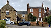
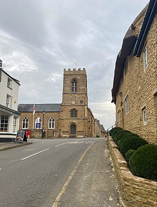
A street scene in the village
Kingsthorpe lies approximately two miles north of Northampton town centre as well as being placed to the west of Abington, to the east of Duston and to the south of Boughton. It is situated on sloping land overlooking the tributary of the River Nene called the Naseby Source, or Brampton Nene, which flows through the area to the west from north to south.
The original village retains a semi-rural character, away from the main roads, overlooked by the parish church and vernacular cottages. The suburb's amenities are centred on the main A508 and A5199 roads that link central Northampton with Market Harborough and Leicester respectively.
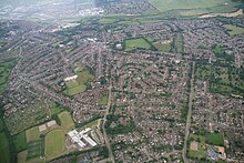
Aerial view of Kingsthorpe in 2014
Areas considered part of Kingsthorpe have since grown around the original village, with residential development mainly to the north and either side of the A508 and A5199 roads. The parish of Kingsthorpe covers a large area split into 5 wards: Kingsthorpe, Obelisk, St Davids, Spring Park and Sunnyside.
History
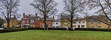
Houses surrounding the village green
Kingsthorpe was listed in the Domesday Book in 1085 as Torp;[5] at this time it formed part of the demesne of the Crown.[6] This evolved into Thorp during the 12th and 13th centuries. By the 14th century, it was known as Kyngesthorpe.[3] The name is derived from the Old Englishcyning and Old Danishtorp, meaning the King's hamlet or farmstead.
The Domesday Book also made reference to three watermills, which were later known as North (or Farre) Mill (being furthest from the village), the Nether Mill in the village, and the South Mill nearer to Northampton.[7] Milling in Kingsthorpe continued into the 20th century, when all the mills were demolished.
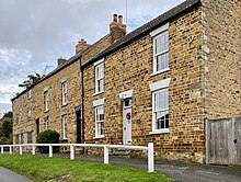
A row of stone houses in the village
The historic core of the village is centred on the village green and the 12th-century Church of St John the Baptist. The original parish of Kingsthorpe was large and extended to approximately 1743 acres in 1767,[7] incorporating areas that would now be considered neighbourhoods of present-day Kingsthorpe, as well as parts of Abington and Kingsley to the east, and parts of the Queen's Park and Semilong estates to the south.[7]
Some of the oldest buildings in the village, which date back to the 17th century, include Kingswell Cottage on The Green;[8] stone cottages in Well Yard;[9] and the Home Farm farmhouse, Dovecote and Barn on Kingswell Road.[10]
The Queen Adelaide public house on Manor Road dates back to the 18th century,[11] while the Cock Hotel public house on the Harborough Road dates back to 1893. The present Cock Hotel building replaced an older coaching inn which dated back to the 16th century.[12] Opposite the Cock sits the Kingsthorpe War Memorial dating back to 1921.[13]
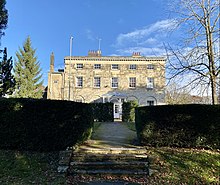
Kingsthorpe Hall was built c. 1775
Kingsthorpe Hall (formerly Thornton Hall) was built circa 1775. The hall and surrounding parkland was sold to the local council in 1937. Thornton Park is now a popular public park.[14] The stables of the former hall also date back to the 18th century; both the stables and hall have since been converted into private residences.[15]
In 1835, the Kingsthorpe Baptist Chapel opened on the High Street.[16] The Catholic Church of St Aidan on Manor Road opened in 1964.[17]
The Dallington Iron Ore Co Ltd briefly quarried iron ore north of the village. The quarry was between what is now the A5199 and the then railway to Market Harborough (now disused). The quarry operated from 1859 to 1861 or slightly longer. The ore was taken away by rail. The site of the quarry is now covered by housing.[18]
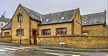
The old Kingsthorpe National School was built in 1840
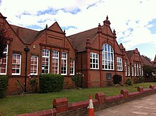
Kingsthorpe had provisions for education during the 17th century; the first recorded school building was on the corner of the High Street where it meets The Rise.[7] The building was rebuilt in 1870.[7] The old Kingsthorpe National School on the junction of High Street and Knights Lane was established in 1840.[7] Both buildings have since been converted in private residences.[7] By 1905, Kingsthorpe Grove School was established; the red brick building and its moulded terracotta dressings is listed.[19]
Kingsthorpe Grove Primary School in 2013
In 1882, the current St Davids Hospital was constructed on the site of the original hospital founded in 1200.[20] The building was later used as a school and is now a rehabilitation care home for adults with brain injuries.[7]
In 1891, a hospital was erected on the western side of Harborough Road used to treat infectious diseases. Just opposite, the Kingsthorpe Cemetery opened in 1898 on the eastern side of the road, where it has remained and enlarged since. The cemetery is part of the Commonwealth War Graves Commission. In 1899, a second hospital to treat infectious diseases was erected at the northern end of the Welford Road.[7]
19th century map of Kingsthorpe
In 1900, the village was incorporated into the County Borough administrative area. In 1912, the local council acquired 21 acres on the east of the Welford Road from the Thornton estate, which later became the Recreation Ground (or 'The Rec' for short) where there were facilities for cricket, football, tennis and bowls as well as a children's playground.[7]
By the 1930s, there was a parade of shops on the Harborough Road, known as Alexandra Terrace, with the Bective shoe and boot factory on the other side of the road.[7] There were also facilities for croquet and tennis at the junction of the A508 and A5199 roads. Housing development had been completed in Kingswell Road, Washington Street, Lincoln Street and Garfield Street.[7] There were also dwellings in Bective Road, Newington Road and parts of Yelvertoft and Norton Roads.[7] Houses had been built on the south side of Boughton Green Road and Ruskin Road had been developed as well as the beginning of St Davids estate to the west of Eastern Avenue.[7]
In the early part of the 20th century, more housing was also built along the west side of Welford Road as well as on parts of North Western Avenue, Foxgrove Avenue and Kingsway. On the Harborough Road, Glan-y-mor Terrace had been built.[7] Further along, opposite the Cemetery, the White Hills estate had started to be built. During the second half of the 20th century, housing estates and some industrial developments filled the remaining portions of land within the boundaries of the old parish.[7] In the 1960s, the Chalcombe Avenue and Hinton Road estates were built.
Between the late 1960s and 1970s, the Spring Park estate (which includes Acre Lane, Rookery Lane and Sherwood Avenue) was developed in the west, followed in the east by Obelisk estate, which ushered in the construction of Holly Lodge Drive.
In 1972, the College of Education was opened by Margaret Thatcher. The college, located off the Boughton Green Road, later became the main campus for the University of Northampton, before it moved to its new town centre campus in 2018.[21] The old campus was demolished for new housing. In 1974, the Kingsthorpe Shopping Centre opened. It included shops, a post office, a pub and a Waitrose supermarket. In the early 2000s, alterations were made to demolish part of the centre to extend Waitrose and its car park. In 2021, a Starbucks coffee shop opened and Waitrose completed a refurbishment. A second supermarket was built next to Waitrose in 1986; it operated as Safeway for a number of years but is now an Asda supermarket. In 2023, a COOK shop opened next to Waitrose.
Newer housing developments, including Tollgate Close, Brampton Park and Cedrus Court, were also completed by the 1980s. Residential development has continued into the 21st century: Bective Close, Lime Tree Gardens and Scholars Court were built on former brownfield land. Buckton Fields, a large new housing estate built land directly to the north of the border of the Kingsthorpe parish, is still in development.
The north chapel and north and south aisles were added about 1170–80.[23] The church had a south chapel by about 1180. Part of the chancel was built in about 1220. In the 14th century the crypt was built, the chapels were extended eastward and most of the current windows were inserted.[22]
The west tower and recessed spire are 14th-[24] or 15th-century.[22] The tower has a ring of six bells. Robert Atton of Buckingham cast the second bell in 1621 and the fifth bell in 1622. Henry I Bagley of Chacombe cast the tenor bell in 1671 and Henry II Bagley cast the third bell in 1680. Alfred Bowell of Ipswich, Suffolk cast the treble and fourth bells in 1911.[25]
The pulpit is Jacobean. There is a monument to Edward Reynolds, who died in 1698.[24]
Market Harborough is a market town in the Harborough district of Leicestershire, England, close to the border with Northamptonshire. The town's population was 24,779 in the 2021 census. It is the administrative headquarters of the Harborough district.
Meanwood is a suburb and former village in north-west Leeds, West Yorkshire, England.
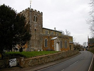
Welford is a village and civil parish in the West Northamptonshire unitary authority area of Northamptonshire, England, just south of the River Avon and the border with Leicestershire. At the 2011 Census, the population of the parish was 1,043.
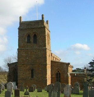
Boughton is a village and civil parish in West Northamptonshire, England. It is situated approximately 4 miles (6 km) from Northampton town centre along the A508 road between Northampton and Market Harborough.
Brixworth is a village and civil parish in West Northamptonshire, England. The 2001 census recorded a parish population of 5,162, increasing to 5,228 at the 2011 census. The village's All Saints' Church is of Anglo-Saxon origin.
Spratton is a village and civil parish in the English county of Northamptonshire. The local government authority is West Northamptonshire. Before changes in 2021 it was governed by Daventry District Council. At the time of the 2001 census, the parish's population was 1,099 people, increasing to 1,150 at the 2011 Census. Spratton is 7.1 miles north of Northampton, 6.5 miles from Long Buckby and 11.4 miles from Daventry. The village is situated on the A5199 road.
Pitsford is a village and civil parish in West Northamptonshire in the United Kingdom. According to 2001 census, the parish's population was 636 people, increasing to 671 at the 2011 census.
Lamport is a village and civil parish in West Northamptonshire, England. The village is on the A508, about 8 miles (13 km) south of Market Harborough and 8 miles (13 km) north of Northampton. Nearby is Lamport Hall. At the time of the 2001 census, the parish's population was 207 people, including Hanging Houghton and increasing to 225 at the 2011 Census.
Harlestone is a small village and civil parish in West Northamptonshire, England. The village had a recorded population of 445 in the 2011 census.
Great Oxendon is a linear village and civil parish in West Northamptonshire in England. At the time of the 2001 census, the parish's population was 307 people, increasing to 331 at the 2011 Census.
Creaton is a village and civil parish in West Northamptonshire, England.
Newbold-on-Avon is a suburb of Rugby in Warwickshire, England, located around 1½ miles north-west of the town centre, it is adjacent to the River Avon from which the suffix is derived. Newbold was historically a village in its own right, but was incorporated into Rugby in 1932. The name is derived from the Saxon Niowebold.
Duston is a suburb of Northampton and a civil parish in West Northamptonshire, England.
Wootton is a former village about 3 miles (4.8 km) south of Northampton town centre that is now part of Northampton.
Drayton is a small village and civil parish in the Harborough district of south-east Leicestershire, bordering Northamptonshire and Rutland. It is situated 6.7 miles (11 km) northeast of Market Harborough and 5 miles (7.5 km) southwest of Uppingham on the north side of the Welland valley. Nearby villages are Bringhurst, Great Easton and Nevill Holt. The church of St James in Drayton is one of the smallest churches in England.
Milton Malsor is a village and civil parish in West Northamptonshire, England. The population of the civil parish at the 2011 census was 761. It is 4 miles (6.4 km) south of Northampton town centre, 45 miles (72 km) south-east of Birmingham, and 66 miles (106 km) north of central London; junction 15 of the M1 motorway is 2 miles (3.2 km) east by road. The area of the Milton Malsor civil parish is about 1,650 acres (670 ha), stretching from north of the M1 motorway between junctions 15 and 15A, south to the West Coast Main Line, east to the A508 and A45 roads, and west to the A43 road.
Shearsby is a rural village in the English county of Leicestershire. Shearsby is in the Harborough district around nine miles due south of Leicester and north east of Lutterworth. The population of the civil parish at the 2011 census was 240.
Earls Barton is a village and civil parish in Northamptonshire, notable for its Anglo-Saxon church and shoe-making heritage. The village is in North Northamptonshire and was previously in the Borough of Wellingborough until 2021. At the time of the 2011 census, the population was 5,387. Earls Barton is renowned for its remarkable Anglo-Saxon heritage.
The A508 is a 50.961 kilometres (31.666 mi), A-class road for north–south journeys in central and south central England, forming the route from Market Harborough in Leicestershire, via Northampton, to Old Stratford in Northamptonshire, just outside Milton Keynes.
St. James End, also known as St. James, colloquially as Jimmy's End, and historically as St James's End, is a district west of the town centre in Northampton, in the West Northamptonshire district, in the ceremonial county of Northamptonshire, England. The area developed from the mid to late 19th century particularly with the expansion of the shoe manufacturing and engineering industries, and also the extension of the railway from London in June 1882.
Tonks, Eric (April 1989). The Ironstone Quarries of the Midlands Part 3: The Northampton Area. Cheltenham: Runpast Publishing. p.151–152. ISBN1-870-754-034.
This page is based on this Wikipedia article Text is available under the CC BY-SA 4.0 license; additional terms may apply. Images, videos and audio are available under their respective licenses.