Bloomsbury is a district in the West End of London, part of the London Borough of Camden in England. It is considered a fashionable residential area, and is the location of numerous cultural, intellectual, and educational institutions. Bloomsbury is home of the British Museum, the largest museum in the United Kingdom, and several educational institutions, including University College London and a number of other colleges and institutes of the University of London as well as its central headquarters, the New College of the Humanities, the University of Law, the Royal Academy of Dramatic Art, the British Medical Association and many others. Bloomsbury is an intellectual and literary hub for London, as home of world-known Bloomsbury Publishing, publishers of the Harry Potter series, and namesake of the Bloomsbury Group, a group of British intellectuals which included author Virginia Woolf, biographer Lytton Strachey, and economist John Maynard Keynes.

Clerkenwell is an area of central London, England.

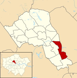
Holborn is an area in central London, which covers the south-eastern part of the London Borough of Camden and a part of the Ward of Farringdon Without in the City of London.
St Pancras is a district in central London. It was originally a medieval ancient parish and subsequently became a metropolitan borough. The metropolitan borough then merged with neighbouring boroughs and the area it covered now forms around half of the modern London Borough of Camden. The area of the parish and borough includes the sub-districts of Camden Town, Kentish Town, Gospel Oak, Somers Town, King's Cross, Chalk Farm, Dartmouth Park, the core area of Fitzrovia and a part of Highgate.
The River Fleet is the largest of London's subterranean rivers, all of which today contain foul water for treatment. It has been used as a sewer since the development of Joseph Bazalgette's London sewer system in the mid-19th century with the water being treated at Beckton Sewage Treatment Works. Its headwaters are two streams on Hampstead Heath, each of which was dammed into a series of ponds—the Hampstead Ponds and the Highgate Ponds—in the 18th century. At the southern edge of Hampstead Heath these descend underground as sewers and join in Camden Town. The waters flow 4 miles (6 km) from the ponds.
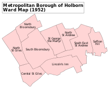
The Metropolitan Borough of Holborn was a metropolitan borough in the County of London between 1900 and 1965. The borough included most of Holborn as well as Bloomsbury and St Giles.

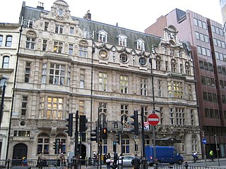
Hatton Garden is a street and commercial zone in the Holborn district of the London Borough of Camden, abutting the narrow precinct of Saffron Hill which then abuts the City of London. It takes its name from Sir Christopher Hatton, a favourite of Queen Elizabeth I, who established a mansion here and gained possession of the garden and orchard of Ely Place, the London seat of the Bishops of Ely. It remained in the Hatton family and was built up as a stylish residential development in the reign of King Charles II. For some decades it often went, outside of the main street, by an alternative name St Alban's Holborn, after the local church built in 1861.

Holborn and St Pancras is a parliamentary constituency in Greater London that was created in 1983. It has been represented in the House of Commons of the Parliament of the United Kingdom since 2015 by Sir Keir Starmer, the current Leader of the Labour Party and Leader of the Opposition.
Bleeding Heart Yard is a cobbled courtyard off Greville Street in the Holborn area of the London Borough of Camden. The courtyard is probably named after a 16th-century inn sign dating back to the Reformation that was displayed on a pub called the Bleeding Heart in nearby Charles Street. The inn sign showed the heart of the Virgin Mary pierced by five swords.
The Holborn Division was one of four divisions of the Hundred of Ossulstone, in the county of Middlesex, England. The other divisions were named Finsbury, Kensington and Tower.
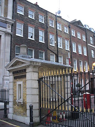
Ely Place is a gated road of multi-storey terraces at the southern tip of the London Borough of Camden in London, England. It hosts a 1773-rebuilt public house, Ye Olde Mitre, of Tudor origin and is adjacent to Hatton Garden.

Holborn was a parliamentary constituency centred on the Holborn district of Central London. It returned one Member of Parliament (MP) to the House of Commons of the Parliament of the United Kingdom.

Holborn was a local government district in the metropolitan area of London to the north west of the City of London from 1855 to 1900.
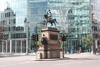
Holborn Circus is a five-way junction at the western extreme of the City of London, specifically between Holborn and its Hatton Garden part. Its main, east–west, route is the inchoate A40 road. It was designed by the engineer William Haywood and opened in 1867. The term circus describes how the frontages of the buildings facing curved round in a concave chamfer. These, in part replaced with glass and metal-clad buildings, remain well set back.

Holborn and Covent Garden is a ward of the London borough of Camden, in the United Kingdom. As the name suggests, it covers the parts of Holborn and Covent Garden that lie in Camden; the eastern part of Holborn lies in the City of London and the southern part of Covent Garden lies in the City of Westminster. For elections to Parliament, Holborn and Covent Garden is part of Holborn and St Pancras.
King's Cross is a ward of the London borough of Camden, in the United Kingdom. The ward has existed since the creation of the borough on 1 April 1965 and was first used in the 1964 elections. The population of the ward at the 2011 Census was 11,843. In 2018, the ward had an electorate of 7,274. The Boundary Commission projects the electorate to rise to 8,459 in 2025.

The London Borough of Camden is a London borough in Inner London, England. Camden Town Hall, on Euston Road, lies 1.4 mi (2.3 km) north of Charing Cross. The borough was established on 1 April 1965 and includes the former Central London borough of Holborn, and St Pancras and Hampstead.
St Andrew Holborn was an ancient English parish that until 1767 was partly in the City of London and mainly in the county of Middlesex. Its City, thus southern, part retained its former name or was sometimes officially referred to as St Andrew Holborn Below the Bars.

Saffron Hill, Hatton Garden, Ely Rents and Ely Place was a liberty and from 1866 to 1930 a civil parish in the metropolitan area of London, England. It was part of the ancient parish of St Andrew Holborn.

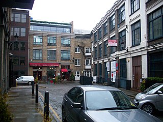
Little Italy, London was an Italian ethnic enclave in London. Little Italy’s core historical borders are usually placed at Clerkenwell Road, Farringdon Road and Rosebery Avenue – the Saffron Hill area of Clerkenwell. Clerkenwell spans Camden Borough & Islington Borough. Saffron Hill & the Italian Church fall within the Camden side.