Northumberland is a ceremonial county in North East England, bordering Scotland. It is bordered by the Scottish Borders to the north, the North Sea to the east, Tyne and Wear and County Durham to the south, and Cumbria to the west. The town of Blyth is the largest settlement.

Newcastle upon Tyne, or simply Newcastle, is a city and metropolitan borough in Tyne and Wear, England. It is located on the River Tyne's northern bank and is the largest part of the Tyneside. With a population of 286,445 it is North East England's most populated settlement in the census.

Tyne and Wear is a ceremonial county in North East England. It borders Northumberland to the north and County Durham to the south, and the largest settlement is the city of Newcastle-upon-Tyne.

Wallsend is a town in North Tyneside, Tyne and Wear, England, at the eastern end of Hadrian's Wall. It has a population of 43,842 and lies 4 miles east of Newcastle upon Tyne.

Gateshead is a town in the Metropolitan Borough of Gateshead in Tyne and Wear, England. It is on the River Tyne's southern bank, opposite Newcastle to which it is joined by seven bridges. The town contains the Millennium Bridge, The Sage, and the Baltic Centre for Contemporary Art, and has on its outskirts the twenty metre tall Angel of the North sculpture.

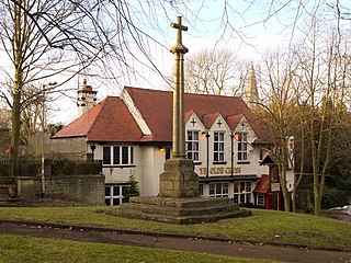
Rothbury is a market town and civil parish in Northumberland, England, on the River Coquet. It is 14 miles (22.5 km) northwest of Morpeth and 26 miles (42 km) of Newcastle upon Tyne. At the 2011 Census, it had a population of 2,107.
Rowlands Gill is a village on the north bank of the River Derwent, in the Metropolitan Borough of Gateshead, Tyne and Wear, England. The Gibside Estate is near the town.

The history of Newcastle upon Tyne dates back almost 2,000 years, during which it has been controlled by the Romans, the Angles and the Norsemen amongst others. Originally known by its Roman name Pons Aelius, the name "Newcastle" has been used since the Norman conquest of England. Due to its prime location on the River Tyne, the town developed greatly during the Middle Ages and it was to play a major role in the Industrial Revolution, being granted city status in 1882. Today, the city is a major retail, commercial and cultural centre.
Ryton is a village in Tyne and Wear, England. It is in the Metropolitan Borough of Gateshead, formerly governed under the county of Durham. In 2011, the population of the Ryton, Crookhill and Stella ward was 8,146. It is 6 miles (9.7 km) west of Newcastle upon Tyne.

Walker is a residential suburb and electoral ward in the south-east of Newcastle upon Tyne, England.

Byker is a district in the east of the city and metropolitan borough of Newcastle upon Tyne. Home to the Byker Wall estate, made famous by TV series Byker Grove, Byker's population was recorded at 12,206 in the 2011 census. Byker is bordered by Heaton to the north and by Shieldfield to the north east.

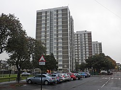
Gosforth is a suburb of the city and metropolitan borough of Newcastle upon Tyne, England. It constituted a separate urban district from 1895 until 1974 before officially merging with the city of Newcastle upon Tyne. In 2001, it had a population of 23,620.

Heaton is a district and suburb in the city of Newcastle upon Tyne, England, two miles east of the city centre. It is bordered by the neighbouring areas of Walkergate to the east, Jesmond to the north west, Byker to the south, and Sandyford to the west. The name Heaton means high town, referring to the area "being situated on hills above the Ouseburn, a tributary of the River Tyne." The area is divided into South Heaton, and High Heaton, representing the north, respectively. For city council elections, the area is split between three wards: Heaton, Manor Park and Ouseburn.

The Great North Museum: Hancock is a museum of natural history and ancient civilisations in Newcastle upon Tyne, England.

Kenton is a suburb and electoral ward in the north west of Newcastle upon Tyne, England. It borders the Town Moor and Gosforth. Kenton also has close road links to Newcastle Airport. The ward population at the 2011 Census was 11,605.
Spital Tongues is a district of Newcastle upon Tyne, located due north-west of the Newcastle City Centre. Its unusual name is believed to be derived from spital – a corruption of the word hospital, commonly found in British place names - and tongues, meaning outlying pieces of land. North of Spital Tongues is Leazes Park and the Town Moor.
West Gosforth was an electoral ward in the north of Newcastle upon Tyne, Tyne and Wear, England. It was created in 2004 and abolished in 2018. The population of the ward is 9,681, increasing to 9,991 at the 2011 Census, 3.7% of the total population of Newcastle upon Tyne. Car ownership in the area is 78.1%, higher than the city average of 54.7%.

Jesmond is a suburb of Newcastle upon Tyne, situated north of the city centre and to the east of the Town Moor. Jesmond is considered to be one of the most affluent suburbs of Newcastle upon Tyne, with higher average house prices than most other areas of the city.

Monument is an electoral ward and area of Newcastle upon Tyne. It was established as an electoral ward in 2018. It takes its name from Grey's Monument. It replaced most of Westgate ward, parts of South Jesmond and some of Ouseburn.

Robert Burns Dick (1868–1954) was a British architect, city planner and artist. Mainly working in the Newcastle upon Tyne area, he designed municipal buildings, churches and over one hundred houses and housing schemes in the North East of England.