The Park, University of Gloucestershire

Last updated

The Park, University of Gloucestershire
Orobanche hederae1.jpg
Example - ivy broomrape (Orobanche hederae)
Gloucestershire UK location map.svg
Red pog.svg
The Park shown within Gloucestershire
TypeCommunity green space
LocationCheltenham
Coordinates 51°53′16.7″N2°5′16.29″W / 51.887972°N 2.0878583°W / 51.887972; -2.0878583 Coordinates: 51°53′16.7″N2°5′16.29″W / 51.887972°N 2.0878583°W / 51.887972; -2.0878583
Area23 acres (9.3 ha)
CreatedPartnership arrangements 2009
Operated byUniversity of Gloucestershire
StatusOpen all year

The Park, University of Gloucestershire (grid reference SO940210 ) is a 9.5-hectare (23-acre) community green space in Cheltenham, Gloucestershire. [1]

Contents

The site is owned and managed by the University of Gloucestershire.

History of The Park Estate

A local solicitor called Thomas Billings purchased the site in 1831 and put plans in train for Gloucestershire Zoological, Botanical and Horticultural Gardens. This was an ambitious project which eventually failed. It is reported that it was to be opened officially on the day of Queen Victoria's coronation in 1838. Elements of the original plans remain which include the Elephant Walk and the lake which is in the shape of Africa. [2] [3]

Cornerways building at the point of the teardrop, to be entrance to the Gardens House on The Park - geograph.org.uk - 1127222.jpg
Cornerways building at the point of the teardrop, to be entrance to the Gardens

The Park is teardrop shaped and at the point of the teardrop is the building which was to be the entrance to the Gardens, which is called Cornerways and has a high tower. [3] The original design included a grand promenade and a crescent of villas and was engraved by J. Fisher. [4]

The site was sold to architect Samuel Whitfield Daukes in 1839. Dawkes developed The Park as 'pleasure grounds' and designed and had built the villas around it. [2] There are a set of entrance gates which remain from this period, and Fullwood House in the grounds provides a point of interest within the landscape. [3]

Daukes also designed a number of other buildings in Cheltenham. [3]

Example - common kingfisher (Alcedo atthis) Alcedo atthis-8b.jpg
Example - common kingfisher (Alcedo atthis)
Example - mallard (Anas platyrhynchos) Mallard 1c (5371256024).jpg
Example - mallard (Anas platyrhynchos)
Example - European yew (Taxus baccata) Taxus baccata 01 ies.jpg
Example - European yew (Taxus baccata)
Example - yarrow (Achillea millefolium) Achillea millefolium.jpg
Example - yarrow (Achillea millefolium)
Example - tulip tree (Liriodendron-tulipifera) Liriodendron-tulipifera-flower3.jpg
Example - tulip tree (Liriodendron-tulipifera)

A publication provides a graphical image of the teardrop layout, historical information and species information. [5]

Habitat

The site includes grassland meadow, wooded glades, shrubberies, and hedgerows. It has an ornamental lake. The site is relatively secluded and quiet. It attracts a range of fauna and supports interesting flora. [2]

There are some 900 trees in The Park which are native and non-native species. This is considered to be a locally unique collection. Some of the trees date back to the early 1800s. They are generally numbered or marked with a small yellow dot. [2] The trees have been obtained from different parts of the world including the United States of America and Europe. A publication details and illustrates a range of some 43 trees of interest and lists shrubs. [6]

Trees and shrubs

The trees include evergreen conifers, deciduous conifers and broad-leaved trees and are detailed in two publications. [2] [6] Evergreen conifers of interest include common yew (planted c. 1831), giant sequoia (planted c. 1889), cedar of Lebanon (planted c. 1944), cedars (planted c. 1979), blue Atlas cedar (planted c. 1969), and common oak (planted 1839 - 1859). Deciduous conifers of interest include dawn redwoods (planted c. 1989) and European larch. Broad-leaved trees include the tulip tree (planted c. 1964), false acacia or locust tree (planted c. 1869 - 1889), London plane (planted c. 1879) and strawberry tree (planted 1959).

Old hazel coppice stools exist in some of the shrubs borders. [2]

Flowers

An important species (nationally scarce) found on the site is ivy broomrape. This parasitic plant is already recorded in Gloucestershire in various localities. It grows on ivy. [2] There are thick areas of 'Irish ivy' within the grounds. Wooded areas and hedgerow areas support hybrid bluebells ( Hyacinthoides non-scripta and Hyacinthoides hispanica ). [2]

The meadow areas support a range of species which include red campion, primrose, nettle-leaved bellflower, enchanter's nightshade, garlic mustard, hedge woundwort, upright hedge parsley and green alkanet. The car park areas have been constructed of 'grass pavers' and support species such as yarrow, black medick and wild strawberry. [2]

Bird life

The ornamental lake, with its boathouse, is a focus for birds such as mallard and geese and the common kingfisher visits the site. The green woodpecker is a recorded species. [3]

Bats

The grounds and trees of The Park are home to various bat species. [3]

Walks

The community green space has interpretation boards, and defined walking areas for enjoyment of this open parkland with its meadow areas, woodland glades and lake. [7] A publication supporting exploration of The Park is available online. [8]

Publications

Related Research Articles

<span class="mw-page-title-main">Hedge</span> Planted row of shrubs

A hedge or hedgerow is a line of closely spaced shrubs and sometimes trees, planted and trained to form a barrier or to mark the boundary of an area, such as between neighbouring properties. Hedges that are used to separate a road from adjoining fields or one field from another, and are of sufficient age to incorporate larger trees, are known as hedgerows. Often they serve as windbreaks to improve conditions for the adjacent crops, as in bocage country. When clipped and maintained, hedges are also a simple form of topiary.

<span class="mw-page-title-main">Gloucestershire Wildlife Trust</span> Organization

The Gloucestershire Wildlife Trust is the Gloucestershire local partner in a conservation network of 46 Wildlife Trusts. The Wildlife Trusts are local charities with the specific aim of protecting the United Kingdom's natural heritage. The Gloucestershire Wildlife Trust is managed by a Board of Trustees elected from its membership who provide overall direction for the development of the trust and there are advisory committees. The work of the trust is carried out through staff and volunteers.

<span class="mw-page-title-main">Cotswold Water Park</span>

The Cotswold Water Park is the United Kingdom's largest marl lake system, straddling the Wiltshire–Gloucestershire border, northwest of Cricklade and south of Cirencester. There are 180 lakes, spread over 42 square miles (110 km2).

<span class="mw-page-title-main">Coombe Hill Canal</span> Canal in the United Kingdom

Coombe Hill Canal lies in the Vale of Gloucester, south west England, north of Leigh and runs west 2.75 miles (4.43 km) from Coombe Hill Basin to the River Severn near Wainlode Hill. It opened in 1796 and closed 80 years later in 1876, after the only lock was damaged by flooding. The Gloucestershire Wildlife Trust purchased the Coombe Hill Canal nature reserve in 1985 and the area is managed by the trust. Adjacent to the Coombe Hill Canal is a large area of wet meadowland situated midway between Gloucester and Tewkesbury to the west of the A38, which was purchased by the trust in 1999. There is a north and a south meadow. This land and the Canal itself often flood in winter, which attracts hundreds of wildfowl.

Lower Woods

Lower Woods is a 280.1-hectare (692-acre) biological and geological Site of Special Scientific Interest near the village of Wickwar, South Gloucestershire, notified in 1966 and renotified in 1985. The site area has increased at last revision in 1974 to a 284.1-hectare (702-acre) site. The site is a nature reserve managed by the Gloucestershire Wildlife Trust.

Dowdeswell Reservoir

Dowdeswell Reservoir and former water treatment works lie below the parish of Dowdeswell in Gloucestershire. They were originally built by Cheltenham Corporation to supply the town of Cheltenham with drinking water and subsequently became part of the Severn Trent network.

<span class="mw-page-title-main">Gunnersbury Triangle</span> A 2.57-hectare (6.4-acre) local nature reserve in the London boroughs of Ealing and Hounslow

Gunnersbury Triangle is a 2.57-hectare (6.4-acre) local nature reserve in Chiswick, in the London boroughs of Ealing and Hounslow, immediately to the east of Gunnersbury. It was created in 1983 when, for the first time in Britain, a public inquiry ruled that a planned development of the land could not go ahead because of its value for nature. It opened as a nature reserve in 1985.

Wotton Hill Hill in Gloucestershire, England

Wotton Hill is a hill on the edge of the Cotswold Hills in Gloucestershire, England, 0.5 miles (0.80 km) north of Wotton-under-Edge. The Cotswold Way passes over the hill.

Dymock Woods SSSI Biological Site of Special Scientific Interest in Gloucestershire, England

Dymock Woods is a 53-hectare (130-acre) biological Site of Special Scientific Interest in Gloucestershire, notified in 1990. The site is listed in the 'Forest of Dean Local Plan Review' as a Key Wildlife Site (KWS).

Collinpark Wood SSSI Biological Site of Special Scientific Interest in Gloucestershire, England

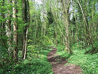
Collinpark Wood is a 66.69-hectare (164.8-acre) biological Site of Special Scientific Interest in Gloucestershire, notified in 1966, revised in 1974 and renotified in 1983. There was a boundary change in 1983. There are seven units of assessment. Unit 1 is a 15-hectare (37-acre) area owned and managed by the Gloucestershire Wildlife Trust. The trust purchased this part of the wood in 1979 with grant aid from WWF. The site is listed in the 'Forest of Dean Local Plan Review' as a Key Wildlife Site (KWS).

<span class="mw-page-title-main">Salmonsbury Meadows SSSI</span>

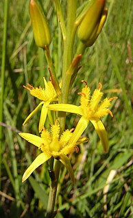
Salmonsbury Meadows is an 18-hectare (44-acre) biological and geological Site of Special Scientific Interest in Gloucestershire, notified in 1985. The site is listed in the 'Cotswold District' Local Plan 2001-2011 as a Key Wildlife Site (KWS).

<span class="mw-page-title-main">Bull Cross, The Frith and Juniper Hill</span> Site of Special Scientific Interest in Gloucestershire, England

Bull Cross, The Frith and Juniper Hill is a 42.33-hectare (104.6-acre) biological and geological Site of Special Scientific Interest in Gloucestershire, notified in 1954. The site is listed in the ‘Stroud District’ Local Plan, adopted November 2005, Appendix 6 as an SSSI and Regionally Important Geological Site (RIGS).

<span class="mw-page-title-main">Leckhampton Hill and Charlton Kings Common</span>

Leckhampton Hill and Charlton Kings Common is a 63.8-hectare (158-acre) biological and geological Site of Special Scientific Interest in Gloucestershire, notified in 1954. There are five units of assessment.

Lineover Wood

Lineover Wood is a 20.3-hectare (50-acre) biological Site of Special Scientific Interest in Gloucestershire, notified in 1986.

<span class="mw-page-title-main">Shorn Cliff and Caswell Woods</span> Biological Site of Special Scientific Interest in Gloucestershire, England

Shorn Cliff And Caswell Woods is a 69.2-hectare (171-acre) biological Site of Special Scientific Interest in Gloucestershire, notified in 1986. The site is listed in the 'Forest of Dean Local Plan Review' as a Key Wildlife Site (KWS).

Ridley Bottom, Tidenham Nature reserve in Gloucestershire, England

Ridley Bottom is a 1.1-hectare (2.7-acre) nature reserve in Gloucestershire. The site is listed in the 'Forest of Dean Local Plan Review' as a Key Wildlife Site (KWS).

Vell Mill Daffodil Meadow Nature reserve in Gloucestershire, England

Vell Mill Daffodil Meadow is a 2.1-hectare (5.2-acre) nature reserve in Gloucestershire.

<span class="mw-page-title-main">Wigpool</span>

Wigpool is a 7.5-hectare (19-acre) nature reserve in Gloucestershire in the Forest of Dean, England.

Mitcheldean Meend Marsh

Mitcheldean Meend Marsh is a 0.7-hectare (1.7-acre) nature reserve in Gloucestershire in the Forest of Dean. The site is listed in the 'Forest of Dean Local Plan Review' as a Key Wildlife Site (KWS).

<span class="mw-page-title-main">Draycote Meadows</span> Site of scientific interest in Warwickshire. UK

Draycote Meadows SSSI is a 10 acres (4.0 ha) Site of Special Scientific Interest, notified in 1973. The site is 4 miles (6.4 km) southwest of Rugby immediately to the north of Draycote village. It is accessed from the B4453, close to the A45's London Road interchange. The site is managed by the Warwickshire Wildlife Trust and is well known for its flower rich hay meadows and variety of butterflies.

References

  1. Gloucestershire Wildlife Trust online on The Park
  2. 1 2 3 4 5 6 7 8 9 'Exploring the grounds of The Park – The history and wildlife of this beautiful University of Gloucestershire site', (undated), Gloucestershire Wildlife Trust and University of Gloucestershire joint publication
  3. 1 2 3 4 5 6 'History of The Park Estate', April 2009, University of Gloucestershire/Gloucestershire Wildlife Trust
  4. Griffith, Samuel Young, 1838, 'Griffiths History of Cheltenham and its Vicinity', 3rd edition, London: Longman, Hurst and Co.
  5. University of Gloucestershire online download of a graphical representation of The Park and historical and species summaries
  6. 1 2 Hickey, M, 1991, 'Trees & Shrubs of The Park', Cheltenham & Gloucester College of Higher Education
  7. 'New Partnership Launched at University', 21 April 2009, University of Gloucestershire
  8. University of Gloucestershire/Gloucestershire Wildlife Trust joint brochure