Related Research Articles

Carl Heinrich Maria Orff was a German composer and music educator, best known for his cantata Carmina Burana (1937). The concepts of his Schulwerk were influential for children's music education.
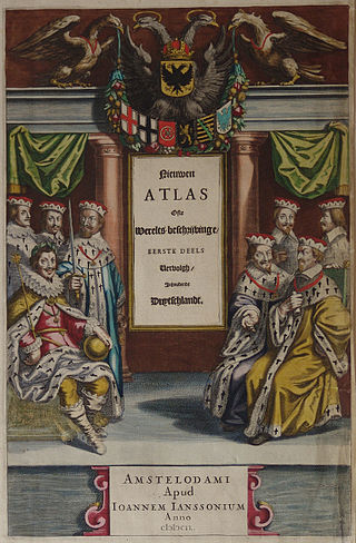
Johannes Janssonius was a Dutch cartographer and publisher who lived and worked in Amsterdam in the 17th century.
The year 1612 in science and technology involved some significant events.

Jodocus Hondius was a Flemish and Dutch engraver and cartographer. He is sometimes called Jodocus Hondius the Elder to distinguish him from his son Jodocus Hondius II. Hondius is best known for his early maps of the New World and Europe, for re-establishing the reputation of the work of Gerard Mercator, and for his portraits of Francis Drake. He inherited and republished the plates of Mercator, thus reviving his legacy, also making sure to include independent revisions to his work. One of the notable figures in the Golden Age of Dutch cartography, he helped establish Amsterdam as the center of cartography in Europe in the 17th century.
Pieter Dirkszoon Keyser was a Dutch navigator and celestial cartographer who mapped several constellations on the southern celestial hemisphere.
The Atlas Maior is the final version of Joan Blaeu's atlas, published in Amsterdam between 1662 and 1672, in Latin, French, Dutch, German and Spanish, containing 594 maps and around 3,000 pages of text. It was the largest and most expensive book published in the seventeenth century. Earlier, much smaller versions, titled Theatrum Orbis Terrarum, sive, Atlas Novus, were published from 1634 onwards. Like Abraham Ortelius's Theatrum Orbis Terrarum (1570), the Atlas Maior is widely considered a masterpiece of the Golden Age of Dutch/Netherlandish cartography.

Theatrum Artis Scribendi is a book about calligraphy by Jodocus Hondius. The first edition was published in Amsterdam in 1594; a second edition was published in 1614 by his son-in-law, Johannes Janssonius.
Henricus Hondius II was a Dutch engraver, cartographer, and publisher.

Emery Molyneux was an English Elizabethan maker of globes, mathematical instruments and ordnance. His terrestrial and celestial globes, first published in 1592, were the first to be made in England and the first to be made by an Englishman.

Robert Hues was an English mathematician and geographer. He attended St. Mary Hall at Oxford, and graduated in 1578. Hues became interested in geography and mathematics, and studied navigation at a school set up by Walter Raleigh. During a trip to Newfoundland, he made observations which caused him to doubt the accepted published values for variations of the compass. Between 1586 and 1588, Hues travelled with Thomas Cavendish on a circumnavigation of the globe, performing astronomical observations and taking the latitudes of places they visited. Beginning in August 1591, Hues and Cavendish again set out on another circumnavigation of the globe. During the voyage, Hues made astronomical observations in the South Atlantic, and continued his observations of the variation of the compass at various latitudes and at the Equator. Cavendish died on the journey in 1592, and Hues returned to England the following year.

Claes Janszoon Visscher was a Dutch Golden Age draughtsman, engraver, mapmaker, and publisher. He was the founder of the successful Visscher family mapmaking business. The firm that he established in Amsterdam would be passed down his generations until it was sold to Peter Schenk.

Augustine Ryther was an English engraver and translator. He engraved some of Christopher Saxton's maps of English counties. He also made scientific instruments.

Hendrik Hondius I was a Flemish-born and trained engraver, cartographer, and publisher who settled in the Dutch Republic in 1597.

Joseph Fischer, S.J. was a German clergyman and cartographer. Fischer had an eminently successful career as a cartographer, publishing old maps. In 1901, while he was investigating the Vikings' discovery of America, he accidentally discovered the long-lost map of Martin Waldseemüller, dated 1507. This map, which claims to update Ptolemy with the voyages of Amerigo Vespucci, is the first known to display the word America. The map was purchased from its owner by the United States Library of Congress in 2001 for ten million dollars.

Cambriae Typus, the "model image of Wales", is the earliest published map of Wales as a separate country from the rest of Great Britain. Made by Elizabethan polymath Humphrey Llwyd in 1573, the map shows Wales stretching to the River Severn, including large areas of what is now England.

Pieter van den Keere was a Flemish engraver, publisher and globe maker who worked for the most part of his career in England and the Dutch Republic.

Abraham Goos was a Dutch cartographer, publisher, and engraver. He made globes, maps of North America, a comprehensive map of European coastlines, and the first printed Hebrew language map of The Holy Land.

Hondius Inlet is the 5.7 km wide ice-filled inlet indenting for 6.7 km the tip of Joerg Peninsula, Bowman Coast on the Antarctic Peninsula southeast of Three Slice Nunatak. Its head is fed by Getman Ice Piedmont.

Felix van Sambix was a Netherlandish schoolmaster and calligrapher. During his lifetime, he was considered one of the finest writers of the Dutch Republic.

Jacomina Hondius was a Flemish and Dutch calligrapher notable for being the first female European calligrapher to have signed examples of her work published.
References
- ↑ Palmer, Alan; Palmer, Veronica (1992). The Chronology of British History. London: Century Ltd. pp. 153–156. ISBN 0-7126-5616-2.
- ↑ Lorenz, Josef (1940). Der Chirurg Felix Wirtz: sein Leben und sein Werk. Düsseldorf. p. 6.
- ↑ Steinbrecher in Gerabek, Werner E. et al. (ed) (2005), Enzyklopädie Medizingeschichte (Berlin) p. 1503.
- ↑ "Jodocus Hondius". brbl-dl.library.yale.edu. Retrieved 3 April 2018.