The 4.2-kiloyear (thousand years) BP aridification event (long-term drought), also known as the 4.2 ka event, [2] was one of the most severe climatic events of the Holocene epoch. [3] It defines the beginning of the current Meghalayan age in the Holocene epoch.
Starting around 2200 BC, it probably lasted the entire 22nd century BC. It has been hypothesised to have caused the collapse of the Old Kingdom in Egypt, the Akkadian Empire in Mesopotamia, and the Liangzhu culture in the lower Yangtze River area. [4] [5] The drought may also have initiated the collapse of the Indus Valley Civilisation, with some of its population moving southeastward to follow the movement of their desired habitat, [6] as well as the migration of Indo-European-speaking people into India. [7] Some scientists disagree with that conclusion, citing evidence that the event was not a global drought and did not happen in a clear timeline. [8]
Modelling evidence suggests that the 4.2 ka event was the result of a significant weakening of the Atlantic meridional overturning circulation (AMOC), disrupting global ocean currents and generating precipitation and temperature changes in various regions. [9] [10] The Intertropical Convergence Zone (ITCZ) abruptly shifted southward. [11] [12] Evidence suggests increased El Niño–Southern Oscillation (ENSO) variability also played a role in generating the climatic conditions associated with the event. [13] Explosive volcanism in Iceland has also been proposed as a cause, [14] though the low sulphur content of Icelandic volcanoes has led other studies to suggest it had a negligible impact on global climate. [15]
A phase of intense aridity about 4.2 ka BP is recorded across North Africa, [16] the Middle East, [17] the Red Sea, [18] the Arabian Peninsula, [19] the Indian subcontinent, [6] and midcontinental North America. [20] Glaciers throughout the mountain ranges of western Canada advanced about that time. [21] Iceland also experienced glacial advance. [15] Evidence has also been found in an Italian cave flowstone, [22] the Kilimanjaro ice sheet, [23] and in Andean glacier ice. [24] The onset of the aridification in Mesopotamia in about 4100 BP also coincided with a cooling event in the North Atlantic, known as Bond event 3. [3] [25] [26] Despite the geographic diversity of these examples, evidence for the 4.2 ka event in Northern Europe is ambiguous, which suggests that the origins and effects of the event are spatially complex. [2]
In 2018, the International Commission on Stratigraphy divided the Holocene epoch into three periods, [27] with the late Holocene from approximately 2250 BC onwards designated as the Meghalayan stage/age. [28] The boundary stratotype is a speleothem in Mawmluh cave in India, [29] and the global auxiliary stratotype is an ice core from Mount Logan in Canada. [30] However, justification for this division is debated as the event was not a global drought and did not happen within a clear timeframe. Jessica Tierney, a paleoclimatologist at the University of Arizona in Tucson, states that proponents of the new partitioning mistakenly "lumped together evidence of other droughts and wet periods, sometimes centuries away from the event." [8]
In Ireland, there is little definitive record of the 4.2 ka event outside of a brief isotopic excursion in some cave speleothem records. The manner in which this climatic event manifested itself in the region is thus unclear. [31] In Great Britain as in Ireland, the nature of the 4.2 ka event is ambiguous and unclear. [2] The yew tree's abundance declined in eastern England. [32]
Analysis of sediments from Lake Spore reveals that in Poland, winters became colder between 4250 and 4000 BP, with this cooling likely responsible for a podzolisation (generation of boreal forest soil type) event around 4200 BP, whereas summer temperatures remained constant. Humidity levels were not affected by the 4.2 ka event. [33]
In the Alboran Sea, the western Mediterranean, a dry phase occurred from about 4400 BP to 4300 BP but was abruptly followed by a shift towards wetter conditions, suggesting a more complex pattern of climate change than other regions during the 4.2 ka event. [34]
On the Iberian Peninsula, the construction of motillas -type settlements in the period after 2200 BC is believed to be the consequence of the severe aridification that affected this area. According to M. Meíjas Moreno, who reported the first palaeohydrogeological interdisciplinary research in La Mancha, Spain, these motillas may represent the oldest, most ancient system of groundwater collection in the Iberian Peninsula and their construction might have been directly connected to the prolonged, harsh drought and other climatic perturbations brought by the 4.2 ka event. The authors' analysis verified a relationship between the geological substrate and the spatial distribution of the motillas. [35]
In the Gulf of Genoa, mean annual temperature dropped, winters became drier, and summers became wetter and cooler, a phenomenon most likely caused by the southward retreat of the ITCZ in summer that weakened the high pressure and reduced ocean warming over the western Mediterranean, which led to retarded evaporation rates in the autumn and early winter. [36] The 4.2 ka event appears to have wettened the climate in the Alps. [37] Lake Petit saw increased precipitation during the ice-free season, evidenced by an increase in δ18Odiatom. [38] Southern Italy, in contrast, experienced intense aridification. [37] A major decline in forests occurred in Italy as a result of the climatic perturbation. [39]
At the site of Sidi Ali in the Middle Atlas, δ18O values indicate not a dry spell but a centennial-scale period of cooler and more humid climate. [40] In c. 2150 BC, Egypt was hit by a series of exceptionally low Nile floods that may have influenced the collapse of the centralised government of the Old Kingdom after a famine. [41]
The south-central Levant experienced two phases of dry climate punctuated by a wet interval in between and thus the 4.2 ka event in the region has been termed a W-shaped event. [42]
Enhanced dust flux coeval with δ18O peaks is recorded in Mesopotamia from 4260 to 3970 BP, reflecting intense aridity. [43] The aridification of Mesopotamia may have been related to the onset of cooler sea-surface temperatures in the North Atlantic (Bond event 3), as analysis of the modern instrumental record shows that large (50%) interannual reductions in Mesopotamian water supply result when subpolar northwest Atlantic sea surface temperatures are anomalously cool. [44] The headwaters of the Tigris and Euphrates rivers are fed by elevation-induced capture of winter Mediterranean rainfall.
The Akkadian Empire in 2300 BC was the second civilization to subsume independent societies into a single state (the first being ancient Egypt in around 3100 BC). It has been claimed that the collapse of the state was influenced by a wide-ranging, centuries-long drought. [45] [46] Archaeological evidence documents widespread abandonment of the agricultural plains of northern Mesopotamia and dramatic influxes of refugees into southern Mesopotamia, around 2170 BC, [47] which may have weakened the Akkadian state. [48] A 180-km-long wall, the "Repeller of the Amorites", was built across central Mesopotamia to stem nomadic incursions to the south. Around 2150 BC, the Gutian people, who originally inhabited the Zagros Mountains, defeated the demoralised Akkadian army, took Akkad and destroyed it around 2115 BC. Widespread agricultural change in the Near East is visible at the end of the 3rd millennium BC. [49] Resettlement of the northern plains by smaller sedentary populations occurred near 1900 BC, three centuries after the collapse. [47]
In the Persian Gulf region, there was a sudden change in settlement pattern, style of pottery and tombs. The 22nd century BC drought marks the end of the Umm Al Nar culture and the change to the Wadi Suq culture. [19] A study of fossil corals in Oman provides evidence that prolonged winter shamal seasons, around 4200 years ago, led to the salinization of the irrigated field, which made a dramatic decrease in crop production trigger a widespread famine and eventually the collapse of the ancient Akkadian Empire. [50] [51]
The Siberian High increased in area and magnitude, which blocked moisture-carrying westerly winds, causing intense aridity in Central Asia. [52]
The Indian Summer Monsoon (ISM) and Indian Winter Monsoon (IWM) both declined in strength, leading to highly arid conditions in northwestern South Asia. [53] The ISM's decline is evident from low Mn/Ti and Mn/Fe values in Rara Lake from this time. [54] The area around PankangTeng Tso Lake in the Tawang district of Arunachal Pradesh had cold and dry conditions and was dominated by subalpine vegetation. [55] Though some proxy records suggest a prolonged, multicentennial dry period, others indicate that the 4.2 ka event was a series of multidecadal droughts instead. [56] [57]
In the 2nd millennium BC, widespread aridification occurred in the Eurasian steppes and in South Asia. [7] [58] On the steppes, the vegetation changed, driving "higher mobility and transition to the nomadic cattle breeding." [58] [note 1] Water shortage also strongly affected South Asia:
This time was one of great upheaval for ecological reasons. Prolonged failure of rains caused acute water shortage in large areas, causing the collapse of sedentary urban cultures in south central Asia, Afghanistan, Iran, and India, and triggering large-scale migrations. Inevitably, the new arrivals came to merge with and dominate the post-urban cultures. [7]
Urban centers of the Indus Valley Civilisation were abandoned and replaced by disparate local cultures because of the same climate change that affected the neighbouring regions to the west. [59] As of 2016 [update] , many scholars believed that drought and a decline in trade with Egypt and Mesopotamia caused the collapse of the Indus civilisation. [60] The Ghaggar-Hakra system was rain-fed, [61] [62] [63] and water supply depended on the monsoons. The Indus Valley climate grew significantly cooler and drier from about 1800 BC, which is linked to a contemporary general weakening of the monsoon. [61] Aridity increased, with the Ghaggar-Hakra River retracting its reach towards the foothills of the Himalayas, [61] [64] [65] leading to erratic and less-extensive floods, which made inundation agriculture less sustainable. Aridification reduced the water supply enough to cause the civilisation's demise, and to scatter its population eastward. [6] [66] [67] [68]
The 4.2 ka event resulted in an enormous reduction in the strength of the East Asian Summer Monsoon (EASM). [69] This profound weakening of the EASM has been postulated to have resulted from a reduction in the strength of the AMOC; [70] the cooling of North Atlantic waters led to retardation of northward movements of the EASM and diminished rainfall on its northern margin. [69] A stark humidity gradient emerged between northern and southern China because of the EASM's southward move. [71] Northeastern China was strongly affected; [72] proxy records from Hulun Lake in Inner Mongolia reveal a major dry event from 4210–3840 BP. [69] δ18O values from Yonglu Cave in Hubei confirm that the region became characterised by increased aridity and show that the onset of the event was gradual but that its end was sudden. [73]
In the Korean Peninsula, the 4.2 ka event was associated with significant aridification, measured by the large decline in arboreal pollen percentage (AP). [74]
The Sannai-Maruyama site in Japan declined during the same period; [75] the growing population of the Jomon culture gradually turned to decline after that. [76]
Rebun Island experienced an abrupt, intense cooling around 4,130 BP believed to be associated with the 4.2 ka event. [77]
The drought may have caused the collapse of Neolithic cultures around Central China in the late 3rd millennium BC. [78] [79] In the Yishu River Basin (a river basin that consists of the Yi River (沂河) of Shandong and Shu River), the flourishing Longshan culture was affected by a cooling that severely reduced rice output and led to a substantial decrease in population and to fewer archaeological sites. [80] In about 2000 BC, Longshan was displaced by the Yueshi culture, which had fewer and less-sophisticated artifacts of ceramic and bronze.The Liangzhu civilization in the lower reaches of the Yangtze River also declined during the same period. [81] The 4.2 ka event is also believed to have helped collapse the Dawenkou culture. [82] The 4.2 ka event had no discernible impact on the spread of millet cultivation in the region. [83]
Stalagmites from northeastern Namibia demonstrate the region became wetter thanks to the southward shift of the ITCZ. [84] The Namibian humidification event had two pulses. [85]
No signal of the 4.2 ka event has been found in Rodrigues. [86]
The Holocene is the current geological epoch, beginning approximately 11,700 years ago. It follows the Last Glacial Period, which concluded with the Holocene glacial retreat. The Holocene and the preceding Pleistocene together form the Quaternary period. The Holocene is an interglacial period within the ongoing glacial cycles of the Quaternary, and is equivalent to Marine Isotope Stage 1.
The Younger Dryas, which occurred circa 12,900 to 11,700 years Before Present (BP), was a stadial (cooling) event which marked a return to glacial conditions, temporarily reversing the climatic warming of the preceding Bølling–Allerød Interstadial. The Younger Dryas was the most severe and longest lasting of several interruptions to the warming of the Earth's climate. The end of the Younger Dryas marks the beginning of the current Holocene epoch.
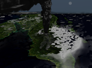
The Toba eruption was a supervolcano eruption that occurred about 74,000 years ago during the Late Pleistocene at the site of present-day Lake Toba in Sumatra, Indonesia. It is one of the largest known explosive eruptions in the Earth's history. The Toba catastrophe theory is that this event caused a severe global volcanic winter of six to ten years and contributed to a 1,000-year-long cooling episode, resulting in a genetic bottleneck in humans. However, some physical evidence disputes the association with the millennium-long cold event and genetic bottleneck, and some consider the theory disproven.
The Last Interglacial, also known as the Eemian among other names was the interglacial period which began about 130,000 years ago at the end of the Penultimate Glacial Period and ended about 115,000 years ago at the beginning of the Last Glacial Period. It corresponds to Marine Isotope Stage 5e. It was the second-to-latest interglacial period of the current Ice Age, the most recent being the Holocene which extends to the present day. During the Last Interglacial, the proportion of CO2 in the atmosphere was about 280 parts per million. The Last Interglacial was one of the warmest periods of the last 800,000 years, with temperatures comparable to and at times warmer than the contemporary Holocene interglacial, with the maximum sea level being up to 6 to 9 metres higher than at present, with global ice volume likely also being smaller than the Holocene interglacial.
The Holocene Climate Optimum (HCO) was a warm period in the first half of the Holocene epoch, that occurred in the interval roughly 9,500 to 5,500 years BP, with a thermal maximum around 8000 years BP. It has also been known by many other names, such as Altithermal, Climatic Optimum, Holocene Megathermal, Holocene Optimum, Holocene Thermal Maximum, Hypsithermal, and Mid-Holocene Warm Period.
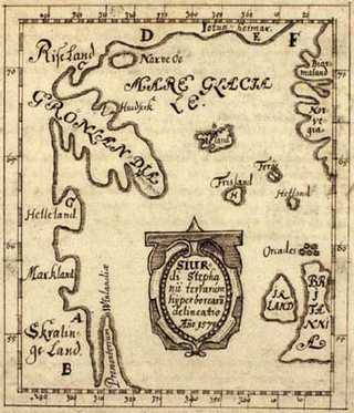
Historical climatology is the study of historical changes in climate and their effect on civilization from the emergence of homininis to the present day. This differs from paleoclimatology which encompasses climate change over the entire history of Earth. These historical impacts of climate change can improve human life and cause societies to flourish, or can be instrumental in civilization's societal collapse. The study seeks to define periods in human history where temperature or precipitation varied from what is observed in the present day.
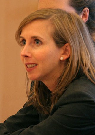
Heidi Cullen is the Director of Communications and Strategic Initiatives at the Monterey Bay Aquarium Research Institute (MBARI). Her efforts there are focused on inspiring the next generation of ocean explorers, communicating about the ocean’s critical role in our climate system, and advancing the use of autonomous technology to protect ocean health. Cullen was previously the Chief Scientist for the non-profit science communication organization Climate Central, where she was part of the team that incubated and launched the World Weather Attribution initiative. She taught a course in science communication at nearby Princeton University and is the author of The Weather of the Future. A climate scientist and science communicator, she served as The Weather Channel's climate expert from 2003 to 2008 and co-hosted Forecast Earth, the first hour-long television show dedicated to communicating climate change science, impacts, and solutions.
In climatology, the 8.2-kiloyear event was a sudden decrease in global temperatures that occurred approximately 8,200 years before the present, or c. 6,200 BC, and which lasted for the next two to four centuries. It defines the start of the Northgrippian age in the Holocene epoch. The cooling was significantly less pronounced than during the Younger Dryas cold period that preceded the beginning of the Holocene. During the event, atmospheric methane concentration decreased by 80 ppb, an emission reduction of 15%, by cooling and drying at a hemispheric scale.
The Piora Oscillation was an abrupt cold and wet period in the climate history of the Holocene Epoch; it is roughly dated to c. 3900-3000 BC. Some researchers associate the Piora Oscillation with the end of the Atlantic climate regime, and the start of the Sub-Boreal, in the Blytt–Sernander sequence of Holocene climates.
Bond events are North Atlantic ice rafting events that are tentatively linked to climate fluctuations in the Holocene. Eight such events have been identified. Bond events were previously believed to exhibit a roughly c. 1,500-year cycle, but the primary period of variability is now put at c. 1,000 years.
The Subboreal is a climatic period, immediately before the present one, of the Holocene. It lasted from 3710 to 450 BCE.
The Weichselian glaciation was the last glacial period and its associated glaciation in northern parts of Europe. In the Alpine region it corresponds to the Würm glaciation. It was characterized by a large ice sheet that spread out from the Scandinavian Mountains and extended as far as the east coast of Schleswig-Holstein, northern Poland and Northwest Russia. This glaciation is also known as the Weichselian ice age, Vistulian glaciation, Weichsel or, less commonly, the Weichsel glaciation, Weichselian cold period (Weichsel-Kaltzeit), Weichselian glacial (Weichsel-Glazial), Weichselian Stage or, rarely, the Weichselian complex (Weichsel-Komplex).
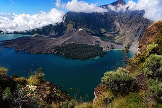
In 1257, a catastrophic eruption occurred at Samalas, a volcano on the Indonesian island of Lombok. The event had a probable Volcanic Explosivity Index of 7, making it one of the largest volcanic eruptions during the Holocene epoch. It left behind a large caldera that contains Lake Segara Anak. Later volcanic activity created more volcanic centres in the caldera, including the Barujari cone, which remains active.
Siwan Davies FLSW is a Welsh professor of Physical Geography in the department of science at Swansea University.
The early Holocene sea level rise (EHSLR) was a significant jump in sea level by about 60 m (197 ft) during the early Holocene, between about 12,000 and 7,000 years ago, spanning the Eurasian Mesolithic. The rapid rise in sea level and associated climate change, notably the 8.2 ka cooling event , and the loss of coastal land favoured by early farmers, may have contributed to the spread of the Neolithic Revolution to Europe in its Neolithic period.
The African humid period is a climate period in Africa during the late Pleistocene and Holocene geologic epochs, when northern Africa was wetter than today. The covering of much of the Sahara desert by grasses, trees and lakes was caused by changes in the Earth's axial tilt; changes in vegetation and dust in the Sahara which strengthened the African monsoon; and increased greenhouse gases. During the preceding Last Glacial Maximum, the Sahara contained extensive dune fields and was mostly uninhabited. It was much larger than today, and its lakes and rivers such as Lake Victoria and the White Nile were either dry or at low levels. The humid period began about 14,600–14,500 years ago at the end of Heinrich event 1, simultaneously to the Bølling–Allerød warming. Rivers and lakes such as Lake Chad formed or expanded, glaciers grew on Mount Kilimanjaro and the Sahara retreated. Two major dry fluctuations occurred; during the Younger Dryas and the short 8.2 kiloyear event. The African humid period ended 6,000–5,000 years ago during the Piora Oscillation cold period. While some evidence points to an end 5,500 years ago, in the Sahel, Arabia and East Africa, the end of the period appears to have taken place in several steps, such as the 4.2-kiloyear event.
The Homeric Minimum is a grand solar minimum that took place between 2,800 and 2,550 years Before Present. It appears to coincide with, and have been the cause of, a phase of climate change at that time, which involved a wetter Western Europe and drier eastern Europe. This had far-reaching effects on human civilization, some of which may be recorded in Greek mythology and the Old Testament.
The Medieval Warm Period (MWP), also known as the Medieval Climate Optimum or the Medieval Climatic Anomaly, was a time of warm climate in the North Atlantic region that lasted from c. 950 to c. 1250. Climate proxy records show peak warmth occurred at different times for different regions, which indicate that the MWP was not a globally uniform event. Some refer to the MWP as the Medieval Climatic Anomaly to emphasize that climatic effects other than temperature were also important.
The Rodwell–Hoskins mechanism is a hypothesis describing a climatic teleconnection between the Indian/Asian summer monsoon and the climate of the Mediterranean. It was formulated in 1996 by Brian Hoskins and Mark J. Rodwell [d]. The hypothesis stipulates that ascending air in the monsoon region induces atmospheric circulation features named Rossby waves that expand westward and interact with the mean westerly winds of the midlatitudes, eventually inducing descent of the air. Descending air warms and its humidity decreases, thus resulting in a drier climate during the summer months. The interaction of this atmospheric flow with topography further modifies the effect.
{{cite journal}}
: CS1 maint: DOI inactive as of March 2024 (link)