Abernethy, Saskatchewan

Last updated
Abernethy
Village of Abernethy
Knox United Church (Abernethy, Saskatchewan 2006).jpg
Abernethy Church
Canada Saskatchewan location map.svg
Red pog.svg
Abernethy
Location of Abernethy in Saskatchewan
Canada location map 2.svg
Red pog.svg
Abernethy
Abernethy (Canada)
Coordinates: 50°26′38″N103°15′07″W / 50.444°N 103.252°W / 50.444; -103.252
Country Canada
Province Saskatchewan
Region Southwest
Census division 6
Rural Municipality Abernethy
Established1904
Government
   Mayor Kevin Stryker
  AdministratorLisa Fayant
  Governing body Abernethy Village Council
Area
  Total1.03 km2 (0.40 sq mi)
Population
 (2021) [1]
  Total190
  Density197.7/km2 (512/sq mi)
Time zone CST
Postal code
S0A 0A0
Area codes 306, 639
Highways Highway 22
Historic Sites Motherwell Homestead
Website Village of Abernethy
[2] [3] [4] [5]

Abernethy (2021 population: 190) is a village in the Canadian province of Saskatchewan within the Rural Municipality of Abernethy No. 186 and Census Division No. 6. It is about one hour east of Regina, one hour west of Yorkton, and approximately five hours northwest of Winnipeg. To the south of Abernethy lies the Qu'Appelle Valley in which Katepwa Beach is located.

Contents

The current mayor is Kevin Stryker, and the village council consists of Janet Englot, Marty Fayant, Mark Harrison, and Colin Ward.

History

Abernethy was incorporated as a village on July 26, 1904. [6] Abernethy celebrated its one hundredth anniversary in the summer of 2004 with a centennial celebration held at the same time as the annual agricultural fair. [7]

Historic sites

Demographics

Population history
(1981–2016)
YearPop.±%
1981300    
1986261−13.0%
1991243−6.9%
1996 232−4.5%
2001 213−8.2%
2006 197−7.5%
2011 196−0.5%
2016 204+4.1%
2021 190−6.9%
Source: Statistics Canada via Saskatchewan Bureau of Statistics [10] [11]

In the 2021 Census of Population conducted by Statistics Canada, Abernethy had a population of 190 living in 86 of its 108 total private dwellings, a change of

In the 2016 Census of Population, Abernethy recorded a population of 204 living in 84 of its 104 total private dwellings, a

Economy

Abernethy is primarily an agricultural community. Businesses in this village include an ice cream store called Grammies, a photographery business named Anela Snaps, a crochet business named Country Cozy Crochet, as well as a CO-OP gas and grocery store. All these local businesses can be found on Facebook.

Education

For schooling, children are bussed to Lemberg and Neudorf in the east and Balcarres in the west. Abernethy School was closed in 1994 and, due to lack of proper maintenance, had to be destroyed in the summer of 2005.[ citation needed ]

See also

Related Research Articles

Abbey is a village in the Canadian province of Saskatchewan within the Rural Municipality of Miry Creek No. 229 and Census Division No. 8. This village is in the south-western region of the province, north-west of the city of Swift Current. Abbey is serviced by Highway 32 near Highway 738.

<span class="mw-page-title-main">Simpson, Saskatchewan</span> Village in Saskatchewan, Canada

Simpson is a village in the Canadian province of Saskatchewan within the Rural Municipality of Wood Creek No. 281 and Census Division No. 11. It is between the cities of Regina and Saskatoon on Highway 2. The administrative office for the Rural Municipality of Wood Creek No. 281 is located in the village. The post office was founded in 1911 by Herman Bergren and Joseph Newman during construction of the Canadian Pacific Railway. It is named after George Simpson, a governor of the Hudson's Bay Company.

<span class="mw-page-title-main">Rural Municipality of Abernethy No. 186</span> Rural Municipality in Saskatchewan, Canada

The Rural Municipality of Abernethy No. 186 is a rural municipality (RM) in the Canadian province of Saskatchewan within Census Division No. 6 and SARM Division No. 1. It is located on the Qu'Appelle River.

<span class="mw-page-title-main">Balcarres, Saskatchewan</span> Town in Saskatchewan, Canada

Balcarres ; 2006 population 598) is a town located in southern Saskatchewan, Canada along Highway 10 and Highway 22, approximately 85 km northeast of Regina. Highway 619 and Highway 310 are nearby highways to this community.

Semans is a village in the Canadian province of Saskatchewan within the Rural Municipality of Mount Hope No. 279 and Census Division No. 10. The village is located approximately 125 km north of the City of Regina and 195 km southeast of the City of Saskatoon.

Neudorf is a village in the Canadian province of Saskatchewan within the Rural Municipality of McLeod No. 185 and Census Division No. 5. It is on Highway 22 east of Lemberg, and Abernethy, and west of Killaly.

Zenon Park is a village in the Canadian province of Saskatchewan within the Rural Municipality of Arborfield No. 456 and Census Division No. 14. Zenon Park is bilingual, using English and French.

<span class="mw-page-title-main">Bladworth</span> Village in Saskatchewan, Canada

Bladworth is a village in the Canadian province of Saskatchewan within the Rural Municipality of McCraney No. 282 and Census Division No. 11. The village is located 99 kilometres (62 mi) south of the City of Saskatoon on Highway 11.

Fosston is a village in the Canadian province of Saskatchewan within the Rural Municipality of Ponass Lake No. 367 and Census Division No. 14. The village was named after Fosston, Minnesota, the original home of five Rustad brothers, who homesteaded there.

Grayson is a village in the Canadian province of Saskatchewan within the Rural Municipality of Grayson No. 184 and Census Division No. 5.

Leross or is a village in the Canadian province of Saskatchewan within the Rural Municipality of Kellross No. 247 and Census Division No. 10.

<span class="mw-page-title-main">Manor, Saskatchewan</span> Village in Saskatchewan, Canada

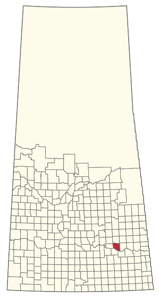
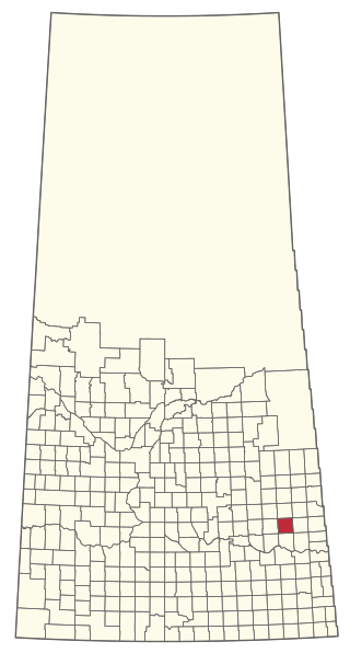
Manor is a village in the Canadian province of Saskatchewan within the RM of Moose Mountain No. 63 and Census Division No. 1. The Manor Museum (1904) is designated a Municipal Heritage Property under the provincial Heritage Property Act.

Spalding is a village in the Canadian province of Saskatchewan within the Rural Municipality of Spalding No. 368 and Census Division No. 14. It is named after Spalding, Lincolnshire, birthplace of the wife of the first postmaster for Spalding. The local economy is dominated by agriculture.

<span class="mw-page-title-main">Rural Municipality of Bayne No. 371</span> Rural Municipality in Saskatchewan, Canada

The Rural Municipality of Bayne No. 371 is a rural municipality (RM) in the Canadian province of Saskatchewan within Census Division No. 15 and SARM Division No. 5. It is located in the north-central portion of the province.

<span class="mw-page-title-main">Rural Municipality of Chester No. 125</span> Rural Municipality in Saskatchewan, Canada

The Rural Municipality of Chester No. 125 is a rural municipality (RM) in the Canadian province of Saskatchewan within Census Division No. 5 and SARM Division No. 1. It is located in the southeast portion of the province.

<span class="mw-page-title-main">Katepwa</span> Resort village in Saskatchewan, Canada

Katepwa is a resort village in the Canadian province of Saskatchewan within Census Division No. 6. It is on the eastern and southern shores of Katepwa Lake in the Rural Municipality of Abernethy No. 186. The name Katepwa likely comes from the Cree word Kahtapwao meaning "What is calling?" The name was given to the last in the chain of four lakes, Katepwa Lake. Legend has it that spirits inhabited the shores of the lake and First Nation people would hear voices on the lake.

<span class="mw-page-title-main">Rural Municipality of Lajord No. 128</span> Rural Municipality in Saskatchewan, Canada

The Rural Municipality of Lajord No. 128 is a rural municipality (RM) in the Canadian province of Saskatchewan within Census Division No. 6 and SARM Division No. 2. It is located in the southeast portion of the province.

<span class="mw-page-title-main">Rural Municipality of Cana No. 214</span> Rural Municipality in Saskatchewan, Canada

The Rural Municipality of Cana No. 214 is a rural municipality (RM) in the Canadian province of Saskatchewan within Census Division No. 5 and SARM Division No. 1. It is located in the southeast portion of the province.

<span class="mw-page-title-main">Rural Municipality of Miry Creek No. 229</span> Rural Municipality in Saskatchewan, Canada

The Rural Municipality of Miry Creek No. 229 is a rural municipality (RM) in the Canadian province of Saskatchewan within Census Division No. 8 and SARM Division No. 3.

<span class="mw-page-title-main">Rural Municipality of Newcombe No. 260</span> Rural Municipality in Saskatchewan, Canada

The Rural Municipality of Newcombe No. 260 is a rural municipality (RM) in the Canadian province of Saskatchewan within Census Division No. 8 and SARM Division No. 3. It is located in the west-central portion of the province.

References

  1. "2021 Community Profiles". Statistics Canada. Government of Canada. Retrieved 2022-09-07.
  2. National Archives, Archivia Net, Post Offices and Postmasters, archived from the original on 2006-10-06
  3. Government of Saskatchewan, MRD Home, Municipal Directory System, archived from the original on 2011-07-06
  4. Canadian Textiles Institute. (2005), CTI Determine your provincial constituency, archived from the original on 2007-09-11
  5. Commissioner of Canada Elections, Chief Electoral Officer of Canada (2005), Elections Canada On-line, archived from the original on 2007-04-21
  6. "Urban Municipality Incorporations". Saskatchewan Ministry of Government Relations. Archived from the original on October 15, 2014. Retrieved June 1, 2020.
  7. Dance on the Bridge: A History of Abernethy and Area. Abernethy Heritage Association, 1983. ISBN   978-0-919533-28-8.
  8. Abernethy and District Memorial Hall Heritage Property Details Archived July 6, 2011, at the Wayback Machine
  9. Christ Anglican Church Heritage Property Details Archived July 6, 2011, at the Wayback Machine
  10. "Saskatchewan Census Population" (PDF). Saskatchewan Bureau of Statistics. Archived from the original (PDF) on September 24, 2015. Retrieved May 31, 2020.
  11. "Saskatchewan Census Population". Saskatchewan Bureau of Statistics. Retrieved May 31, 2020.
  12. "Population and dwelling counts: Canada, provinces and territories, census divisions and census subdivisions (municipalities), Saskatchewan". Statistics Canada. February 9, 2022. Retrieved April 1, 2022.
  13. "Population and dwelling counts, for Canada, provinces and territories, and census subdivisions (municipalities), 2016 and 2011 censuses – 100% data (Saskatchewan)". Statistics Canada. February 8, 2017. Retrieved May 30, 2020.

Coordinates: 50°26′38″N103°15′07″W / 50.444°N 103.252°W / 50.444; -103.252