In aviation, instrument flight rules (IFR) is one of two sets of regulations governing all aspects of civil aviation aircraft operations; the other is visual flight rules (VFR).
In aviation, visual flight rules (VFR) are a set of regulations under which a pilot operates an aircraft in weather conditions generally clear enough to allow the pilot to see where the aircraft is going. Specifically, the weather must be better than basic VFR weather minima, i.e., in visual meteorological conditions (VMC), as specified in the rules of the relevant aviation authority. The pilot must be able to operate the aircraft with visual reference to the ground, and by visually avoiding obstructions and other aircraft.

According to the International Civil Aviation Organization (ICAO), a runway is a "defined rectangular area on a land aerodrome prepared for the landing and takeoff of aircraft". Runways may be a human-made surface or a natural surface. Runways, taxiways and ramps, are sometimes referred to as "tarmac", though very few runways are built using tarmac. Takeoff and landing areas defined on the surface of water for seaplanes are generally referred to as waterways. Runway lengths are now commonly given in meters worldwide, except in North America where feet are commonly used.

Landing is the last part of a flight, where a flying animal, aircraft, or spacecraft returns to the ground. When the flying object returns to water, the process is called alighting, although it is commonly called "landing", "touchdown"a or "splashdown" as well. A normal aircraft flight would include several parts of flight including taxi, takeoff, climb, cruise, descent and landing.

In aviation, the instrument landing system (ILS) is a precision radio navigation system that provides short-range guidance to aircraft to allow them to approach a runway at night or in bad weather. In its original form, it allows an aircraft to approach until it is 200 feet (61 m) over the ground, within a 1⁄2 mile (800 m) of the runway. At that point the runway should be visible to the pilot; if it is not, they perform a missed approach. Bringing the aircraft this close to the runway dramatically increases the range of weather conditions in which a safe landing can be made. Other versions of the system, or "categories", have further reduced the minimum altitudes, runway visual ranges (RVRs), and transmitter and monitoring configurations designed depending on the normal expected weather patterns and airport safety requirements.

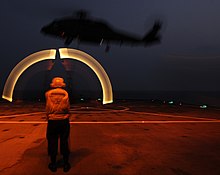
A heliport, sometimes termed a vertiport, is a small airport suitable for use by helicopters and various types of vertical lift aircraft. Designated heliports typically contain one or more touchdown and liftoff areas and may also have limited facilities such as fuel or hangars. In some larger towns and cities, customs facilities may also be available.

Westchester County Airport is a county-owned airport in Westchester County, New York, three miles (6 km) northeast of downtown White Plains, with territory in the towns of North Castle and Harrison, New York, and village of Rye Brook, New York. It is sometimes referred to as the White Plains Airport and is so identified by the Official Airline Guide (OAG).

An airfield traffic pattern is a standard path followed by aircraft when taking off or landing while maintaining visual contact with the airfield.
Aviation is the design, development, production, operation, and use of aircraft, especially heavier-than-air aircraft. Articles related to aviation include:
A sky marshal is a covert law enforcement or counter-terrorist agent on board a commercial aircraft to counter aircraft hijackings. Such an agent is also known as an air marshal, a flight marshal, or an in-flight security officer (IFSO). Sky marshals may be provided by airlines such as El Al, or by government agencies such as the Austrian Einsatzkommando Cobra, Royal Canadian Mounted Police, German Federal Police, National Security Guard in India, Metropolitan Police SO19 from London, Pakistan Airports Security Force, or US Federal Air Marshal Service.

In the case of a radio failure or aircraft not equipped with a radio, or in the case of a deaf pilot, air traffic control may use a signal lamp to direct the aircraft. ICAO regulations require air traffic control towers to possess such signal lamps. The signal lamp has a focused bright beam and is capable of emitting three different colors: red, white and green. These colors may be flashed or steady, and have different meanings to aircraft in flight or on the ground. Planes can acknowledge the instruction by rocking their wings, moving the ailerons if on the ground, or by flashing their landing or navigation lights during hours of darkness. Air traffic control signal light guns are typically specified with a (white) center beam brightness of > 180,000 - 200,000 candela, and are visible for roughly 4 miles in clear daylight conditions. The table below describes the meaning of the signals. The use of handheld combination red/green/white signal lamps for air traffic control dates back to at least the 1930s.

Montgomery Regional Airport is a civil-military airport seven miles southwest of Montgomery, the capital of Alabama. Owned by the Montgomery Airport Authority, it is used for general aviation and military aviation, and sees two airlines.

Central Illinois Regional Airport at Bloomington–Normal is a public airport in McLean County, Illinois, three miles east of Bloomington and southeast of Normal. Owned by the Bloomington–Normal Airport Authority, it is also known as Central Illinois Regional Airport (CIRA).
Taos Regional Airport is a public use airport eight nautical miles (15 km) northwest of the central business district of Taos, in Taos County, New Mexico, United States. It is owned by the Town of Taos. FAA's National Plan of Integrated Airport Systems for 2009–2013 classifies it as a general aviation airport.
West Bend Municipal Airport is a city-owned public-use airport located three nautical miles (6 km) east of the central business district of West Bend, a city in Washington County, Wisconsin, United States. It is included in the Federal Aviation Administration (FAA) National Plan of Integrated Airport Systems for 2023–2027, in which it is categorized as a regional reliever airport facility.

Zamperini Field is a public airport three miles (5 km) southwest of downtown Torrance, in Los Angeles County, California, United States.

Landing lights are lights, mounted on aircraft, that illuminate the terrain and runway ahead during takeoff and landing, as well as being used as a collision avoidance measure against other aircraft and bird strikes. Landing lights must be activated when the aircraft is under 10,000 feet in altitude.
The Next Generation Air Transportation System (NextGen) is an ongoing United States Federal Aviation Administration (FAA) project to modernize the National Airspace System (NAS). The FAA began work on NextGen improvements in 2007 and plans to finish the final implementation segment by 2030. The goals of the modernization include using new technologies and procedures to increase the safety, efficiency, capacity, access, flexibility, predictability, and resilience of the NAS while reducing the environmental impact of aviation.
A contact approach is an approach available to aircraft operating on an instrument flight rules (IFR) flight plan, where the pilot may deviate from the published instrument approach procedure (IAP) and proceed to the destination airport by visual reference to the surface. It is similar to a visual approach, except that the pilot is not required to have the destination airport nor the preceding aircraft in sight at all times during the approach, and the visibility requirements are less stringent.
Airport surveillance and broadcast systems are a set of runway-safety tools that display aircraft on and near an airport.