Alta Vista, Kansas

Last updated

Alta Vista, Kansas
Alta Vista, Kansas (1905).jpg
Fourth of July Parade (1905)
Wabaunsee County Kansas Incorporated and Unincorporated areas Alta Vista Highlighted.svg
Location within Wabaunsee County and Kansas
Map of Wabaunsee Co, Ks, USA.png
Coordinates: 38°51′47″N96°29′20″W / 38.86306°N 96.48889°W / 38.86306; -96.48889 [1]
Country United States
State Kansas
County Wabaunsee
Founded1887
Incorporated 1905 [2]
Government
[2]
  Type Mayor–Council
Area
[3]
  Total0.35 sq mi (0.90 km2)
  Land0.35 sq mi (0.90 km2)
  Water0.00 sq mi (0.00 km2)
Elevation
[1]
1,453 ft (443 m)
Population
 (2020) [4]
  Total409
  Density1,200/sq mi (450/km2)
Time zone UTC-6 (CST)
  Summer (DST) UTC-5 (CDT)
ZIP code
66834
Area code 785
FIPS code 20-01575
GNIS ID 2393931 [1]

Alta Vista is a city in Wabaunsee County, Kansas, United States. [1] As of the 2020 census, the population of the city was 409. [4]

Contents

History

Alta Vista was founded in 1887, and it was incorporated as a city in 1905. [5] Alta Vista is derived from the Spanish word for "high view", and the city was so named from its lofty elevation. [6] [7]

In 1887, the Chicago, Kansas and Nebraska Railway built a main line from Topeka through Alta Vista to Herington. [8] The Chicago, Kansas and Nebraska Railway was foreclosed in 1891 and taken over by Chicago, Rock Island and Pacific Railway, which shut down in 1980 and reorganized as Oklahoma, Kansas and Texas Railroad, merged in 1988 with Missouri Pacific Railroad, merged in 1997 with Union Pacific Railroad. Most locals still refer to this railroad as the "Rock Island".

The first post office in Alta Vista was established in March 1887. [9]

Geography

According to the United States Census Bureau, the city has a total area of 0.36 square miles (0.93 km2), all of it land. [10]

Climate

The climate in this area is characterized by hot, humid summers and generally mild to cool winters. According to the Köppen Climate Classification system, Alta Vista has a humid subtropical climate, abbreviated "Cfa" on climate maps. [11]

Demographics

Historical population
CensusPop.Note
1910 499
1920 484−3.0%
1930 436−9.9%
1940 4615.7%
1950 420−8.9%
1960 400−4.8%
1970 4020.5%
1980 4307.0%
1990 47710.9%
2000 442−7.3%
2010 4440.5%
2020 409−7.9%
U.S. Decennial Census

Alta Vista is part of the Topeka, Kansas Metropolitan Statistical Area.

2020 census

The 2020 United States census counted 409 people, 182 households, and 116 families in Alta Vista. [12] [13] The population density was 1,171.9 per square mile (452.5/km2). There were 202 housing units at an average density of 578.8 per square mile (223.5/km2). [13] [14] The racial makeup was 92.91% (380) white or European American (90.71% non-Hispanic white), 0.73% (3) black or African-American, 1.22% (5) Native American or Alaska Native, 0.0% (0) Asian, 0.0% (0) Pacific Islander or Native Hawaiian, 1.47% (6) from other races, and 3.67% (15) from two or more races. [15] Hispanic or Latino of any race was 4.4% (18) of the population. [16]

Of the 182 households, 28.0% had children under the age of 18; 51.6% were married couples living together; 23.6% had a female householder with no spouse or partner present. 30.8% of households consisted of individuals and 15.4% had someone living alone who was 65 years of age or older. [13] The average household size was 2.1 and the average family size was 2.6. [17] The percent of those with a bachelor’s degree or higher was estimated to be 8.3% of the population. [18]

23.5% of the population was under the age of 18, 7.8% from 18 to 24, 25.2% from 25 to 44, 23.0% from 45 to 64, and 20.5% who were 65 years of age or older. The median age was 37.9 years. For every 100 females, there were 98.5 males. [13] For every 100 females ages 18 and older, there were 104.6 males. [13]

The 2016-2020 5-year American Community Survey estimates show that the median household income was $39,205 (with a margin of error of +/- $6,168) and the median family income was $48,750 (+/- $23,089). [19] Males had a median income of $31,442 (+/- $6,656) versus $30,417 (+/- $8,760) for females. The median income for those above 16 years old was $31,023 (+/- $5,440). [20] Approximately, 12.3% of families and 23.8% of the population were below the poverty line, including 38.1% of those under the age of 18 and 21.3% of those ages 65 or over. [21] [22]

2010 census

As of the census [23] of 2010, there were 444 people, 189 households, and 128 families residing in the city. The population density was 1,233.3 inhabitants per square mile (476.2/km2). There were 211 housing units at an average density of 586.1 per square mile (226.3/km2). The racial makeup of the city was 98.2% White, 0.7% African American, 0.2% Native American, 0.2% Asian, and 0.7% from two or more races. Hispanic or Latino of any race were 4.3% of the population.

There were 189 households, of which 32.3% had children under the age of 18 living with them, 51.9% were married couples living together, 10.6% had a female householder with no husband present, 5.3% had a male householder with no wife present, and 32.3% were non-families. 28.6% of all households were made up of individuals, and 10.5% had someone living alone who was 65 years of age or older. The average household size was 2.35 and the average family size was 2.80.

The median age in the city was 41.5 years. 25% of residents were under the age of 18; 5.5% were between the ages of 18 and 24; 24.4% were from 25 to 44; 29.7% were from 45 to 64; and 15.5% were 65 years of age or older. The gender makeup of the city was 52.3% male and 47.7% female.

2000 census

As of the census [24] of 2000, there were 442 people, 190 households, and 126 families residing in the city. The population density was 1,242.1 inhabitants per square mile (479.6/km2). There were 216 housing units at an average density of 607.0 per square mile (234.4/km2). The racial makeup of the city was 97.29% White, 1.36% Native American, 0.68% Pacific Islander, and 0.68% from two or more races. Hispanic or Latino of any race were 4.07% of the population.

There were 190 households, out of which 30.0% had children under the age of 18 living with them, 52.1% were married couples living together, 10.5% had a female householder with no husband present, and 33.2% were non-families. 31.1% of all households were made up of individuals, and 16.8% had someone living alone who was 65 years of age or older. The average household size was 2.33 and the average family size was 2.90.

In the city, the population was spread out, with 24.0% under the age of 18, 7.7% from 18 to 24, 25.3% from 25 to 44, 27.4% from 45 to 64, and 15.6% who were 65 years of age or older. The median age was 41 years. For every 100 females, there were 113.5 males. For every 100 females age 18 and over, there were 103.6 males.

The median income for a household in the city was $32,159, and the median income for a family was $38,542. Males had a median income of $29,167 versus $20,833 for females. The per capita income for the city was $15,885. About 8.0% of families and 9.9% of the population were below the poverty line, including 15.5% of those under age 18 and 11.4% of those age 65 or over.

Education

The community is served by Morris County USD 417 public school district. [25]

Alta Vista High School was closed through school unification. The Alta Vista High School mascot was Bulldogs. [26]

Infrastructure

Transportation

Alta Vista is served by the Union Pacific Railroad, formerly the Southern Pacific, and prior, the Chicago, Rock Island and Pacific Railroad. Alta Vista is located on UP's Golden State main line to El Paso, Texas. The line was originally built by the Chicago, Kansas and Nebraska Railroad.

Related Research Articles

<span class="mw-page-title-main">Garnett, Kansas</span> City in Anderson County, Kansas

Garnett is a city in and the county seat of Anderson County, Kansas, United States. As of the 2020 census, the population of the city was 3,242.

<span class="mw-page-title-main">Muscotah, Kansas</span> City in Kansas, United States

Muscotah is a city in Atchison County, Kansas, United States. As of the 2020 census, the population of the city was 155. Muscotah was named for the Kickapoo Native American word for "prairie"

<span class="mw-page-title-main">Ellinwood, Kansas</span> City in Barton County, Kansas

Ellinwood is a city in the southeast corner of Barton County, Kansas, United States. As of the 2020 census, the population of the city was 2,011.

<span class="mw-page-title-main">Enterprise, Kansas</span> City in Dickinson County, Kansas

Enterprise is a city in Dickinson County, Kansas, United States. As of the 2020 census, the population of the city was 708.

<span class="mw-page-title-main">Hope, Kansas</span> City in Dickinson County, Kansas

Hope is a city in southern Dickinson County, Kansas, United States. As of the 2020 census, the population of the city was 317.

<span class="mw-page-title-main">Bucklin, Kansas</span> City in Ford County, Kansas

Bucklin is a city in Ford County, Kansas, United States. As of the 2020 census, the population of the city was 727. It is located along U.S. Route 54 highway.

<span class="mw-page-title-main">Hoyt, Kansas</span> City in Jackson County, Kansas

Hoyt is a city in Jackson County, Kansas, United States. As of the 2020 census, the population of the city was 593.

<span class="mw-page-title-main">Meriden, Kansas</span> City in Kansas, United States

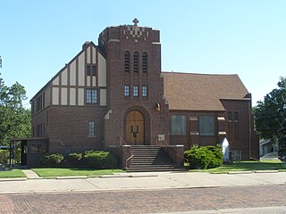
Meriden is a city in Jefferson County, Kansas, United States. As of the 2020 census, the population of the city was 744.

<span class="mw-page-title-main">Dwight, Kansas</span> City in Morris County, Kansas

Dwight is a city in Morris County, Kansas, United States. As of the 2020 census, the population of the city was 217.

<span class="mw-page-title-main">Centralia, Kansas</span> City in Nemaha County, Kansas

Centralia is a city in Nemaha County, Kansas, United States. As of the 2020 census, the population of the city was 485.

<span class="mw-page-title-main">Goff, Kansas</span> City in Nemaha County, Kansas

Goff is a city in Nemaha County, Kansas, United States. As of the 2020 census, the population of the city was 106.

<span class="mw-page-title-main">Ness City, Kansas</span> City in Ness County, Kansas

Ness City is a city in and the county seat of Ness County, Kansas, United States. As of the 2020 census, the population of the city was 1,329. Ness City is famous for its four-story Old Ness County Bank Building located downtown, and nicknamed Skyscraper of the Plains.

<span class="mw-page-title-main">Portis, Kansas</span> City in Osborne County, Kansas

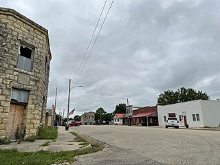
Portis is a city in Osborne County, Kansas, United States. As of the 2020 census, the population of the city was 86.

<span class="mw-page-title-main">Andale, Kansas</span> City in Sedgwick County, Kansas

Andale is a city in Sedgwick County, Kansas, United States. As of the 2020 census, the population of the city was 941.

<span class="mw-page-title-main">Kechi, Kansas</span> City in Sedgwick County, Kansas

Kechi is a city in Sedgwick County, Kansas, United States, and a suburb of Wichita. As of the 2020 census, the population of the city was 2,217.

<span class="mw-page-title-main">Gaylord, Kansas</span> City in Smith County, Kansas

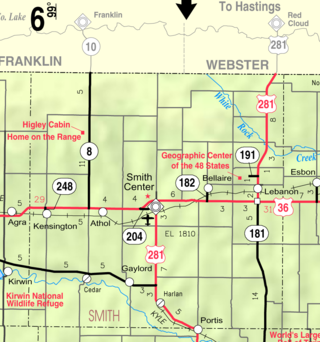
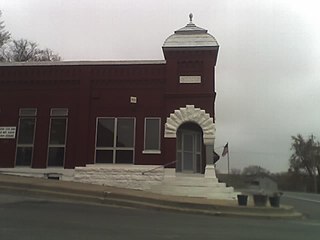
Gaylord is a city in Smith County, Kansas, United States. As of the 2020 census, the population of the city was 87.

<span class="mw-page-title-main">Belle Plaine, Kansas</span> City in Sumner County, Kansas

Belle Plaine is a city in Sumner County, Kansas, United States. As of the 2020 census, the population of the city was 1,467.

<span class="mw-page-title-main">Alma, Kansas</span> City in Wabaunsee County, Kansas

Alma is a city in and the county seat of Wabaunsee County, Kansas, United States. As of the 2020 census, the population of the city was 802.

<span class="mw-page-title-main">Greenleaf, Kansas</span> City in Washington County, Kansas

Greenleaf is a city in Washington County, Kansas, United States. As of the 2020 census, the population of the city was 350.

<span class="mw-page-title-main">Haddam, Kansas</span> City in Washington County, Kansas

Haddam is a city in Washington County, Kansas, United States. It is named after Haddam, Connecticut. As of the 2020 census, the population of the city was 110.

References

  1. 1 2 3 4 U.S. Geological Survey Geographic Names Information System: Alta Vista, Kansas
  2. 1 2 "City of Alta Vista". The League of Kansas Municipalities. May 26, 2019.
  3. "2019 U.S. Gazetteer Files". United States Census Bureau. Retrieved July 24, 2020.
  4. 1 2 "Profile of Alta Vista, Kansas in 2020". United States Census Bureau. Archived from the original on May 14, 2022. Retrieved May 14, 2022.
  5. Blackmar, Frank Wilson (1912). Kansas: A Cyclopedia of State History, Embracing Events, Institutions, Industries, Counties, Cities, Towns, Prominent Persons, Etc. Standard Publishing Company. p. 66. ISBN   9780722249055.
  6. Business Directory and History of Wabaunsee County. Kansas Directory Company. 1907. p. 53.
  7. "Profile for Alta Vista, Kansas". ePodunk . Retrieved June 27, 2014.
  8. "Rock Island Rail History". Archived from the original on June 19, 2011. Retrieved April 18, 2011.
  9. "Kansas Post Offices, 1828-1961". Kansas Historical Society. Archived from the original on October 9, 2013. Retrieved June 27, 2014.
  10. "US Gazetteer files 2010". United States Census Bureau. Archived from the original on January 25, 2012. Retrieved July 6, 2012.
  11. Climate Summary for Alta Vista, Kansas
  12. "US Census Bureau, Table P16: HOUSEHOLD TYPE". data.census.gov. Retrieved December 31, 2023.
  13. 1 2 3 4 5 "US Census Bureau, Table DP1: PROFILE OF GENERAL POPULATION AND HOUSING CHARACTERISTICS". data.census.gov. Retrieved December 31, 2023.
  14. Bureau, US Census. "Gazetteer Files". Census.gov. Retrieved December 30, 2023.
  15. "US Census Bureau, Table P1: RACE". data.census.gov. Retrieved December 31, 2023.
  16. "US Census Bureau, Table P2: HISPANIC OR LATINO, AND NOT HISPANIC OR LATINO BY RACE". data.census.gov. Retrieved December 31, 2023.
  17. "US Census Bureau, Table S1101: HOUSEHOLDS AND FAMILIES". data.census.gov. Retrieved December 31, 2023.
  18. "US Census Bureau, Table S1501: EDUCATIONAL ATTAINMENT". data.census.gov. Retrieved December 31, 2023.
  19. "US Census Bureau, Table S1903: MEDIAN INCOME IN THE PAST 12 MONTHS (IN 2020 INFLATION-ADJUSTED DOLLARS)". data.census.gov. Retrieved December 31, 2023.
  20. "US Census Bureau, Table S2001: EARNINGS IN THE PAST 12 MONTHS (IN 2020 INFLATION-ADJUSTED DOLLARS)". data.census.gov. Retrieved December 31, 2023.
  21. "US Census Bureau, Table S1701: POVERTY STATUS IN THE PAST 12 MONTHS". data.census.gov. Retrieved December 31, 2023.
  22. "US Census Bureau, Table S1702: POVERTY STATUS IN THE PAST 12 MONTHS OF FAMILIES". data.census.gov. Retrieved December 31, 2023.
  23. "U.S. Census website". United States Census Bureau . Retrieved July 6, 2012.
  24. "U.S. Census website". United States Census Bureau . Retrieved January 31, 2008.
  25. USD 417 website.
  26. "Alta Vista High School - Bulldog Yearbook". E-YEARBOOK.COM. Retrieved January 10, 2017.

Further reading