
Gulu District is a district in the Northern Region of Uganda. The district headquarters are located in the city of Gulu, which is also the district's chief commercial centre.
Pader District is a district in Northern Uganda. It is named after Pader, the chief municipal, administrative and commercial town in the district, where the district headquarters are located.

Kitgum is a municipality in Kitgum District in the Northern Region of Uganda. The town is administered by Kitgum Town Council, an urban local government. It is the largest metropolitan area in the district and the site of the district headquarters.
Pakwach is a town in the Northern Region of Uganda. It is the main commercial, political and administrative center of Pakwach District.

Amuru District is a district in Northern Uganda. Like most Ugandan districts, it is named after its 'chief town', Amuru, where the district headquarters are located.
Pabbo, sometimes spelled as Pabo, is a municipality in Amuru District of the Northern Region of Uganda.
Paraa is a location in Northern Uganda.
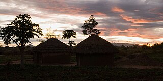
Paranga is a town in Gulu District, in Northern Uganda.

Nwoya District is a district in Northern Uganda. Like most districts in Uganda, it is named after its main municipal, administrative and commercial center, Nwoya, the location of the district headquarters.
Nwoya is a town in Nwoya District in the Northern Region of Uganda. It is the main municipal, administrative, and commercial centre of the district.
Agago District is a district in Northern Uganda.
Kalongo is a town in the Northern Region of Uganda. It is one of the urban centers in Agago District.
The Acholibur–Gulu–Olwiyo Road is a road in the Northern Region of Uganda, connecting the town of Acholibur to the city of Gulu and the town of Olwiyo.
Acholibur is a town in Pader District in the Northern Region of Uganda.
Olwiyo is a town in Nwoya District in the Northern Region of Uganda.
Karuma is a settlement in the Western Region of Uganda.
Anaka General Hospital, also known as Anaka Hospital, is a hospital in the Northern Region of Uganda.
Omoro District is a district in the Northern Region of Uganda.
The Kampala–Gulu Highway, also Kampala–Gulu Road, is a road connecting the capital city of Kampala, in the Buganda Region, with the city of Gulu, the largest urban centre in the Northern Region of Uganda.
Koch-Goma, also Koch Goma, is a human settlement in Nwoya District, in the Northern Region of Uganda.

