The Arctic Archipelago, also known as the Canadian Arctic Archipelago, is an archipelago lying to the north of the Canadian continental mainland, excluding Greenland and Iceland.

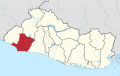
Van Province is a province in the Eastern Anatolian region of Turkey, between Lake Van and the Iranian border. It is 19,069 km2 in area and had a population of 1,035,418 at the end of 2010. Its adjacent provinces are Bitlis to the west, Siirt to the southwest, Şırnak and Hakkâri to the south, and Ağrı to the north. The capital of the province is the city of Van. The province is considered part of Western Armenia by Armenians and was part of ancient province of Vaspurakan. The region is considered to be the cradle of Armenian civilization. Before the Armenian genocide, Van Province was part of six Armenian vilayets. A majority of the province's modern day population is Kurdish.

Mount Aragats is an isolated four-peaked volcano massif in Armenia. Its northern summit, at 4,090 m (13,420 ft) above sea level, is the highest point of the Lesser Caucasus and Armenia. It is also one of the highest points in the Armenian Highlands.

San Nicolás de los Garza, sometimes known only as San Nicolás, is a city and coextensive municipality in the Mexican state of Nuevo León that is part of the Monterrey metropolitan area. It has become primarily a city for residences and family houses, although it still has several factories that tend to relocate to the periphery of the metropolitan area. It is the third-largest city in the state, behind Monterrey and Guadalupe.

Municipalities are the second-level administrative divisions of Mexico, where the first-level administrative division is the state. They should not be confused with cities or towns that may share the same name as they are distinct entities and do not share geographical boundaries. As of January 2021, there are 2,454 municipalities in Mexico, excluding the 16 boroughs of Mexico City.
Santa Rita is a town and a municipality in the Honduran department of Yoro. The Humuya River passes through it.

Salcoatitán is a municipality in the Sonsonate department of El Salvador. It is located at a kilometer to the Southwest of Juayua, at 12 Kilometers to the north of Sonsonate, and at 1045 meters over the sea level. It possesses a small and beautiful colonial church that dates back to the beginning of the 19th century, made of calicanto, tile, and roof, with heavy support of bricks and stone, built by the presbyters Santiago Quijada, Esteban España, Cosme Alonso, and Juan Hidalgo. It is dedicated San Miguel Archangel, whose festivity takes place in November.

Unciti is a town and municipality located in the province and autonomous community of Navarre, northern Spain.

Quimbaya is a town and municipality in the western part of the department of Quindío, Colombia. It is 20 km northwest of the departmental capital Armenia. The name of the city derives from the name of the Precolumbian culture that inhabited the area, the Quimbaya civilization. Located along the Colombian coffee growing axis, the municipality was made part of the "Coffee Cultural Landscape" UNESCO World Heritage Site in 2011.

Kvemo Kartli or "Lower Kartli", is a historic province and current administrative region (mkhare) in southeastern Georgia. The city of Rustavi is the regional capital.
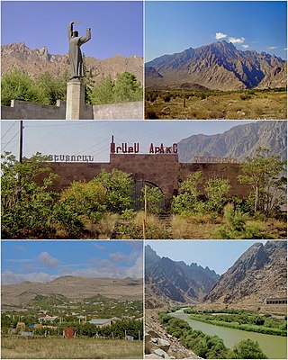
Agarak is a village in the Meghri Municipality of the Syunik Province in southern Armenia, founded in 1949. As of 2011, the population of Agarak was 4,429.

Shamlugh is a village within the Akhtala Municipality of Lori Province at the northeast of Armenia. It is situated on the left bank of Debed River, at a road distance of 196 km north of the capital Yerevan and 63 km north of the provincial centre Vanadzor. The village had a majority Greek population, however it is now predominantly populated by Armenians. According to the 2011 census, Shamlugh had 700 inhabitants, while the 2016 official estimate shows the current population is around 500.

The Armenian Genocide Martyrs Monument, better known as Montebello Genocide Memorial, is a monument in Montebello, California in the Los Angeles metropolitan area, dedicated to the victims of the Armenian genocide of 1915. The monument, opened in April 1968, is a tower of eight arches supported on 75-foot-tall (23 m) white concrete columns. The memorial was designed by Hrant Agbabian. It is the oldest and largest memorial in the United States dedicated to the Armenian Genocide victims. The inscription on the memorial plaque reads:
Armenian Martyrs Memorial Monument: This Monument erected by Americans of Armenian descent, is dedicated to the 1,500,000 Armenian victims of the Genocide perpetrated by the Turkish Government, 1915–1921, and to men of all nations who have fallen victim to crimes against humanity.
German submarine U-89 was a Type VIIC U-boat of Nazi Germany's Kriegsmarine during World War II.

Covarachía is a town and municipality in the Northern Boyacá Province, part of the Colombian Department of Boyacá. The urban centre is located at 208 kilometres (129 mi) from the department capital Tunja at an altitude of 2,320 metres (7,610 ft) in the Eastern Ranges of the Colombian Andes. The municipality borders San José de Miranda and Capitanejo in the north, Tipacoque in the south, Capitanejo in the east and in the west the municipalities Onzaga and San Joaquín (Santander).

Gachantivá is a town and municipality in the Ricaurte Province, part of the Colombian department of Boyacá. Gachantivá is located at altitudes ranging from 2,000 metres (6,600 ft) to 3,300 metres (10,800 ft) on the Altiplano Cundiboyacense and borders Villa de Leyva in the south, Santa Sofía in the west, Arcabuco in the east and Moniquirá in the north.

Teo is a municipality in the Spanish province of A Coruña in the autonomous community of Galicia in northwestern Spain. It has a population of 18,266 and an area of 79 km².
Santa Catarina Mita is a town, with a population of 14,520, and a municipality in the Jutiapa department of Guatemala. The municipality cover an area of 207 km2 and has a population of 28,983.

Chelem is a small beach in Yucatán, Mexico, in the Progreso Municipality. It is near Progreso, on the coast north of the state capital of Mérida. It is not very large, and consists mostly of small houses and restaurants.