Attapulgus, Georgia

Last updated

Attapulgus, Georgia
Decatur County Georgia Incorporated and Unincorporated areas Attapulgus Highlighted.svg
Location in Decatur County and the state of Georgia
Coordinates: 30°44′54″N84°29′2″W / 30.74833°N 84.48389°W / 30.74833; -84.48389
Country United States
State Georgia
County Decatur
Area
[1]
  Total0.80 sq mi (2.06 km2)
  Land0.80 sq mi (2.06 km2)
  Water0.00 sq mi (0.00 km2)
Elevation
318 ft (97 m)
Population
 (2020)
  Total454
  Density570.35/sq mi (220.14/km2)
Time zone UTC-5 (Eastern (EST))
  Summer (DST) UTC-4 (EDT)
ZIP codes
31715, 39815
Area code 229
FIPS code 13-04084 [2]
GNIS feature ID0354409 [3]
Website georgiainfo.galileo.usg.edu/topics/historical_markers/county/decatur/attapulgus

Attapulgus is a city in Decatur County, Georgia, United States. As of the 2020 census, the city had a population of 454, up from 449 at the 2010 census. It is part of the Bainbridge, Georgia Micropolitan Statistical Area.

Contents

The town's name is an Muscogee word meaning "Dogwood"; due to the abundance of attapulgite, which makes up the clay soil throughout much of the Southeast, the mineral was named after the town.

Attapulgus was the birthplace of civil rights leader Hosea Williams (1926-2000), who is said to have been run out of town by a lynch mob at the age of 13. He is remembered around the world for his close association with Dr. Martin Luther King Jr., and for leading, with John Lewis, the famous march across the Edmund Pettus Bridge in Selma, Alabama, in 1965 that led to the passage of the landmark Voting Rights Act of 1965. Williams served on the Atlanta City Council, the DeKalb County Commission, and in the Georgia Senate. He also started a program to feed the hungry that has continued long after his death.

Geography

Attapulgus is located at 30°44′54″N84°29′2″W / 30.74833°N 84.48389°W / 30.74833; -84.48389 (30.748243, -84.483810). [4]

The city is located near the Georgia-Florida state line. U.S. Route 27 bypasses the city to the east, leading northwest 13 mi (21 km) to Bainbridge, the Decatur County seat, and southeast 30 mi (48 km) to Tallahassee, Florida. Georgia State Route 241 connects the city with the Florida state line 6 mi (9.7 km) to the southwest.

According to the United States Census Bureau, the city has a total area of 0.8 square miles (2.1 km2), all land.

Demographics

Historical population
CensusPop.Note
1870 267
1880 255−4.5%
1930 416
1940 315−24.3%
1950 45745.1%
1960 56724.1%
1970 513−9.5%
1980 62321.4%
1990 380−39.0%
2000 49229.5%
2010 449−8.7%
2020 4541.1%
U.S. Decennial Census [5]

As of the census [2] of 2000, there were 492 people, 179 households, and 129 families residing in the city. In 2020, its population was 454.

Related Research Articles

<span class="mw-page-title-main">Seminole County, Georgia</span> County in Georgia, United States

Seminole County is a county located in the southwestern corner of U.S. state of Georgia. As of the 2020 census, the population was 9,147. The county seat is Donalsonville.

<span class="mw-page-title-main">Mitchell County, Georgia</span> County in Georgia, United States

Mitchell County is a county in the U.S. state of Georgia. As of the 2020 census, the population was 21,755. The county seat is Camilla. Mitchell County was created on December 21, 1857.

<span class="mw-page-title-main">Grady County, Georgia</span> County in Georgia, United States

Grady County is a county located in the U.S. state of Georgia. As of the 2020 census, the population was 26,236. The county seat is Cairo.

<span class="mw-page-title-main">Decatur County, Georgia</span> County in Georgia, United States

Decatur County is a county located in the U.S. state of Georgia. As of the 2020 census, the population was 29,367. The county seat is Bainbridge.

<span class="mw-page-title-main">Clinch County, Georgia</span> County in Georgia, United States

Clinch County is a county located in the southeastern part of the U.S. state of Georgia. As of the 2020 census, the population was 6,749. The county seat is Homerville. The county was created on February 14, 1850, named in honor of Duncan Lamont Clinch.

<span class="mw-page-title-main">Brooks County, Georgia</span> County in Georgia, United States

Brooks County is a county located in the U.S. state of Georgia, on its southern border with Florida. As of the 2020 census, the population was 16,301. The county seat is Quitman. The county was created in 1858 from portions of Lowndes and Thomas counties by an act of the Georgia General Assembly and was named for pro-slavery U.S. Representative Preston Brooks, after he severely beat abolitionist Senator Charles Sumner with a cane for delivering a speech attacking slavery.

<span class="mw-page-title-main">Baker County, Georgia</span> County in Georgia, United States

Baker County is a county in Georgia. As of the 2020 census, the population was 2,876. The county seat and only city is Newton. The county was created December 12, 1825, from the eastern portion of Early County by an act of the Georgia General Assembly and is named for Colonel John Baker, a hero of the American Revolutionary War.

<span class="mw-page-title-main">Gordon, Alabama</span> Town in Alabama, United States

Gordon is a town in Houston County, Alabama, United States. It was incorporated in February 1872. It is part of the Dothan, Alabama Metropolitan Statistical Area. At the 2010 census the population was 332, down from 408 in 2000.

<span class="mw-page-title-main">Fort Gaines, Georgia</span> City in Georgia, United States

Fort Gaines is a city in and the county seat of Clay County, Georgia, United States. It has a population of 1,107 as of the 2010 census.

<span class="mw-page-title-main">Bainbridge, Georgia</span> City in Georgia, United States

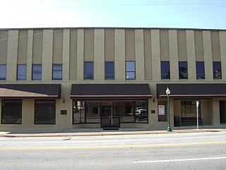
Bainbridge is a city in Decatur County, Georgia, United States. The city is the county seat of Decatur County. As of the 2020 census, the city had a population of 14,468, up from 12,697 at the 2010 census. It is the principal city of the Bainbridge, Georgia Micropolitan Statistical Area and a principal city in the Tallahassee—Bainbridge, FL-GA Combined Statistical Area.

<span class="mw-page-title-main">Brinson, Georgia</span> Town in Georgia, United States

Brinson is a town in Decatur County, Georgia, United States. As of the 2020 census, the city had a population of 217, up from 215 at the 2010 census. It is part of the Bainbridge, Georgia Micropolitan Statistical Area.

<span class="mw-page-title-main">Climax, Georgia</span> Town in Georgia, United States

Climax is a small town in Decatur County, Georgia, United States. The town was named "Climax" because it is located at the highest point of the railroad between Savannah, Georgia, and the Chattahoochee River. The population was 276 at the 2020 census, down from 280 at the 2010 census. It is part of the Bainbridge, Georgia Micropolitan Statistical Area.

<span class="mw-page-title-main">Blakely, Georgia</span> City in Georgia, United States

Blakely is a city and the county seat of Early County, Georgia, United States. As of 2020, its population was 5,371. It is located approximately halfway between Columbus and Tallahassee, Florida on U.S. Route 27.

<span class="mw-page-title-main">Cairo, Georgia</span> City in Georgia, United States

Cairo is a city in Grady County, Georgia, United States. As of the 2020 census, the city had a population of 10,179. The city is the county seat of Grady County.

<span class="mw-page-title-main">Whigham, Georgia</span> City in Georgia, United States

Whigham is a city in Grady County, Georgia, United States. The population was 428 in 2020.

<span class="mw-page-title-main">Greensboro, Georgia</span> City in Georgia, United States

Greensboro is a city in and the county seat of Greene County, Georgia, United States. Its population was 3,648 as of the 2020 census. The city is located approximately halfway between Atlanta and Augusta on Interstate 20.

<span class="mw-page-title-main">Colquitt, Georgia</span> City in Georgia, United States

Colquitt is a city and the county seat of Miller County, in the southwestern portion of the U.S. state of Georgia. The population was 2,001 at the 2020 census. Colquitt has been the county seat of Miller County since Miller County was incorporated by the Georgia Legislature in 1856. The city formally incorporated on December 19, 1860, and is Miller County's only incorporated municipality. Colquitt is named for U.S. Congressman and Senator Walter Terry Colquitt.

<span class="mw-page-title-main">Talbotton, Georgia</span> City in Georgia, United States

Talbotton is a city in Talbot County, Georgia, United States. The population was 970 at the 2010 census. The city is the county seat of Talbot County.

<span class="mw-page-title-main">Tallahassee metropolitan area</span> Metropolitan area in the United States

The Tallahassee Metropolitan Statistical area is the metropolitan area centered on Tallahassee, Florida.

The Decatur County School District is a public school district in Decatur County, Georgia, United States, based in Bainbridge. It serves the communities of Attapulgus, Bainbridge, Brinson, and Climax.

References

  1. "2020 U.S. Gazetteer Files". United States Census Bureau. Retrieved December 18, 2021.
  2. 1 2 "U.S. Census website". United States Census Bureau . Retrieved January 31, 2008.
  3. "US Board on Geographic Names". United States Geological Survey. October 25, 2007. Retrieved January 31, 2008.
  4. "US Gazetteer files: 2010, 2000, and 1990". United States Census Bureau. February 12, 2011. Retrieved April 23, 2011.
  5. "Census of Population and Housing". Census.gov. Retrieved June 4, 2015.