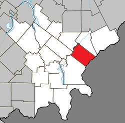
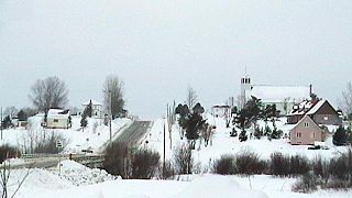
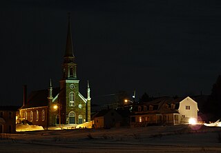
Although the post office has been known as Audet since 1894, named after Michel Audet, the first postmaster, the municipality was known as Saint-Hubert-de-Spaulding until 1959, referring to the township of Spaulding, in which it is located.
Audet sits on a plateau at 535 metres (1,755ft) in altitude in the Appalachians, making it one of the highest municipalities in Quebec.
Brome-Missisquoi is a regional county municipality in the Eastern Townships region of Quebec, Canada. Its seat is Cowansville.
Charlevoix is a regional county municipality in the Capitale-Nationale region of Quebec, Canada. The seat is Baie-Saint-Paul.
La Haute-Gaspésie is a regional county municipality in the Gaspésie–Îles-de-la-Madeleine region of eastern Quebec, Canada, on the Gaspé peninsula. The regional county municipality seat is in Sainte-Anne-des-Monts.
La Côte-de-Beaupré is a regional county municipality in the Capitale-Nationale region of Quebec, Canada. The seat is Château-Richer. Its most populous community is the municipality of Boischatel.
La Vallée-du-Richelieu(The Valley of the Richelieu) is a regional county municipality in the Montérégie region in southwestern Quebec, Canada. Its seat is McMasterville.
La Matanie is a regional county municipality, located in the Bas-Saint-Laurent region of Quebec, in Canada. From January 1, 1982 to March 9, 2013, it was known as Matane.
Minganie is a regional county municipality in the Côte-Nord region of Quebec, Canada. It includes Anticosti Island. Its seat is Havre-Saint-Pierre.
Rocher-Percé is a regional county municipality in the Gaspésie–Îles-de-la-Madeleine region of Quebec, Canada. Its seat is Chandler. Prior to July 17, 1999 it was known as Pabok Regional County Municipality.
La Vallée-de-l'Or(The Golden Valley) is a regional county municipality in the Abitibi-Témiscamingue region in Northwestern Quebec, Canada. The seat is in Val-d'Or. It is named for its gold deposits in the Harricana River and Bell River valleys.
Varennes is an off-island suburb of Montreal, in southwestern Quebec, Canada, on the Saint Lawrence River in the Marguerite-D'Youville Regional County Municipality. The city is approximately 24 kilometres (15 mi) from Downtown Montreal. The population as of the Canada 2011 Census was 20,994. In 2015, the population is listed at 24,000.
Chelsea is a municipality located immediately north of Gatineau, Quebec, Canada, and about 10 kilometres (6.2 mi) north of Ottawa. Chelsea is located within Canada's National Capital Region. It is the seat of Les Collines-de-l'Outaouais Regional County Municipality.
Saint-Augustin-de-Woburn, known locally as Woburn, is a parish municipality in Le Granit Regional County Municipality in the Estrie region of Quebec, Canada. The population is 695 as of the Canada 2011 Census. A parish municipality is the territory of a parish established as a municipality.
Frontenac is a municipality in Le Granit Regional County Municipality in Estrie, Quebec, Canada, on the Canada–United States border. Its population was 1,650 as of the Canada 2011 Census.
Sainte-Gertrude-Manneville is a municipality in the Canadian province of Quebec, located in Abitibi Regional County Municipality. It includes the population centres of Sainte-Gertrude-de-Villeneuve and Manneville.
Sainte-Germaine-Boulé is a municipality in northwestern Quebec, Canada, in the Abitibi-Ouest Regional County Municipality. It covers 108.46 square kilometres (41.88 sq mi) and had a population of 895 as of the Canada 2011 Census.
Saint-Simon-de-Rimouski is a municipality in the Les Basques Regional County Municipality in the Bas-Saint-Laurent region of Quebec, Canada. Its population in the Canada 2011 Census was 438. Before 2020 it was known as Saint-Simon.
Saint-Marcel is a municipality in Quebec located in the MRC de L'Islet in the Chaudière-Appalaches.
Kataskomiq is an Indian reserve listed by the Canadian Geographical Names Database. The reserve belongs to the Wolastoqiyik Wahsipekuk (Viger) First Nation, Maliseet people. It is not listed by Indigenous and Northern Affairs Canada or the last two Canadian census. It is located in the Bas-Saint-Laurent region of Quebec, geographically located within the territory of Rivière-du-Loup Regional County Municipality but is not legally part of it. Its population was 0 in the 2006 Canadian census and does not appear in either the 2011 or 2016 Canadian Census. Before 2021 it was known as Whitworth.
Frontenac County was a county of Quebec, Canada. It existed between 1912 and the early 1980s. The territory it covered is today divided into the regional county municipalities of Le Granit in the administrative regions of the Estrie and Beauce-Sartigan in Chaudière-Appalaches. Its capital was the municipality of Lac-Mégantic.
This page is based on this Wikipedia article Text is available under the CC BY-SA 4.0 license; additional terms may apply. Images, videos and audio are available under their respective licenses.