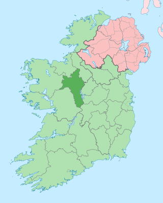
County Roscommon is a county in Ireland. It is part of the province of Connacht and the Northern and Western Region. It is the 11th largest Irish county by area and 27th most populous. Its county town and largest town is Roscommon. Roscommon County Council is the local authority for the county. The population of the county was 69,995 as of the 2022 census.
Roscommon is the county town and the largest town in County Roscommon in Ireland. It is roughly in the centre of Ireland, near the meeting of the N60, N61 and N63 roads.

Ballinasloe is a town in the easternmost part of County Galway in Connacht. Located at an ancient crossing point on the River Suck, evidence of ancient settlement in the area includes a number of Bronze Age sites. Built around a 12th-century castle, which defended the fording point, the modern town of Ballinasloe was "founded" in the early 13th century. As of the 2016 census, it was one of the largest towns in County Galway, with a population of 6,662 people.

The N6 road is a national primary road in Ireland from junction 11 on the M4 motorway at Kinnegad to Galway city. The N6 and N4 form a continuous motorway or dual carriageway from Dublin city centre to Galway City passing in an east–west direction through the midlands of Ireland. Most of the road is motorway standard with the exception of the Athlone bypass and stretches of urban road in Galway City, which are the only sections of the road that remain designated as N6 dual carriageway. There is one toll on the road outside Galway city. Major upgrades to the road were completed in December 2009 completing the first intercity motorway/dual carriageway in Ireland and the New Junctions of M6 are built and will be 164 km.
Uí Maine was the name of a kingdom situated in south Connacht, consisting of all of County Galway east of Athenry, all of southern and central County Roscommon.

March 23 - Eastern Orthodox liturgical calendar - March 25

Eyrecourt, historically known as Donanaghta, is a village in County Galway, Ireland. Eyrecourt is on the R356 regional road 12 km west of the Banagher bridge over the River Shannon.

Tulrush is a small townland on the River Suck near Ballinasloe, Ireland. It is approximately 0.84 square kilometres (0.32 sq mi) in area and located in the historical barony of Moycarn in County Roscommon. As of the 2011 census, Tulrush townland had a population of 16 people.

The United Dioceses of Dublin and Glendalough is a diocese of the Church of Ireland in the east of Ireland. It is headed by the Archbishop of Dublin, who is also styled the Primate of Ireland. The diocesan cathedral is Christ Church Cathedral, Dublin.

The R446 road is a regional road in Ireland. The road connects Kinnegad in County Westmeath to Galway City. Prior to the construction of the M6 motorway the R446 formed the main N6 road connecting Dublin and Galway. Following the opening of the M6; the old N6 road was downgraded to regional road status and was designated as the R446. The road is an alternative route between Galway and Dublin and runs in parallel to the M6.

The Diocese of Limerick and Killaloe was a former diocese of the Church of Ireland that was located in mid-western Ireland. The diocese was formed by a merger of neighbouring dioceses in 1976, before itself merging with the neighbouring Diocese of Tuam in 2022 to form the Diocese of Tuam, Limerick and Killaloe.

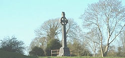
Drum is a civil parish in south County Roscommon about 5 km west of Athlone. It lies in the barony of Athlone. One of the townlands in the parish is also called Drum. Meehambee Dolmen, a portal tomb estimated to be 5,500 years old, is located in the northern part of the parish. In the village there are a number of historical and religious sites, including Drum Cemetery, St. Brigid's Church and Drum Monastic Site. Drum Parish Hall and Drum Heritage Visitor Centre are located next to the graveyard, in the townland of Belrea.
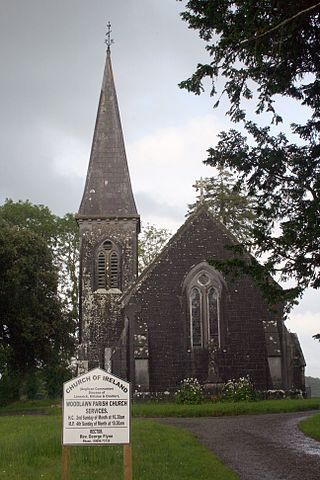
Woodlawn, historically known as Mota or Moote, is a settled area in County Galway, Ireland.

Moycashel, previously the barony of Rossaughe, and before that, Delamares country, is a barony in south County Westmeath, in Ireland. It was formed by 1542. It is bordered by three other baronies: Clonlonan to the west, Rathconrath to the north, Moyashel and Magheradernon to the north-east and Fartullagh to the west. The largest population centre is Kilbeggan.
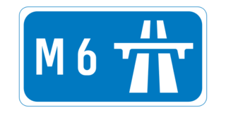
The M6 motorway is a motorway in Ireland, which runs from Dublin to Galway. The M6 extends from its junction with the M4 at Kinnegad all the way west to the outskirts of Galway City, but the Athlone bypass and the approach to Galway city - while of dual carriageway standard - have not been designated motorway and are still signed as N6. The motorway was officially completed and opened to traffic on 18 December 2009, and was the first city-to-city direct major inter-urban route to be completed in Ireland. The M6 and M4, which form the Galway-Dublin route, consist of a grade-separated 2+2 dual carriageway road with a top speed limit of 120 km/h. At approximately 144 km (90 mi), the M6 is the third longest motorway in the state and will be 159 km.
William Reeves was an Irish antiquarian and the Church of Ireland Bishop of Down, Connor and Dromore from 1886 until his death. He was the last private keeper of the Book of Armagh and at the time of his death was President of the Royal Irish Academy.
Rechtabhra mac Dubbchomar was Abbot of Aughrim, County Galway.
Cappataggle is a village located between the towns of Loughrea and Ballinasloe in east County Galway. With the areas Kilrickle and Killalaghton it forms a parish of the same name. The name Cappataggle is an anglicisation of the Irish name Ceapach an tSeagail, which translates as ‘meadow of rye’. The village is centred on many dairy, livestock and tillage farms. The new M6 Galway to Dublin motorway toll plaza is located a half km from the village.

The Diocese of Tuam, Limerick and Killaloe is a diocese of the Church of Ireland that is located in the west of Ireland. The diocese was formed by a merger of the former Diocese of Tuam, Killala and Achonry and the former Diocese of Limerick and Killaloe in 2022, after the retirement of the separate dioceses' bishops and the appointment of Michael Burrows as bishop of the united diocese. It is in the ecclesiastical province of Dublin. It is one of the eleven Church of Ireland dioceses that cover the whole of Ireland. The largest diocese by area in the Church of Ireland, it covers all of counties Clare, Galway, Kerry, Limerick and Mayo, plus parts of counties Cork, Sligo, Roscommon, Offaly, Laois and Tipperary.