Augusta, Michigan

Last updated

Augusta, Michigan
Village of Augusta
Augusta, MI location.png
Location within Kalamazoo County
USA Michigan location map.svg
Red pog.svg
Augusta
Location within the state of Michigan
Usa edcp location map.svg
Red pog.svg
Augusta
Location within the United States
Coordinates: 42°20′16″N85°21′6″W / 42.33778°N 85.35167°W / 42.33778; -85.35167
Country United States
State Michigan
County Kalamazoo
Townships Ross, Charleston
Area
[1]
  Total1.04 sq mi (2.70 km2)
  Land1.03 sq mi (2.66 km2)
  Water0.02 sq mi (0.04 km2)
Elevation
804 ft (245 m)
Population
 (2020)
  Total864
  Density841.29/sq mi (324.94/km2)
Time zone UTC-5 (Eastern (EST))
  Summer (DST) UTC-4 (EDT)
ZIP code
49012
Area code 269
FIPS code 26-04160 [2]
GNIS feature ID2398009 [3]

Augusta is a village in Kalamazoo County in the U.S. state of Michigan. The population was 885 at the 2010 census. The village is mostly within Ross Township, though a small portion extends south into Charleston Township.

Contents

Augusta is situated on the M-96 highway, about five miles (8.0 km) northeast of Galesburg, and about seven miles (11 km) west of downtown Battle Creek. Kalamazoo is an additional ten miles (16 km) west of Galesburg. Fort Custer Recreation Area is immediately south of the village on the east side of the Kalamazoo River.

Augusta was established in 1832. [4]

Geography

According to the United States Census Bureau, the village has a total area of 1.02 square miles (2.64 km2), of which 1.01 square miles (2.62 km2) is land and 0.01 square miles (0.03 km2) is water. [5]

Demographics

Historical population
CensusPop.Note
1890 498
1900 5418.6%
1910 494−8.7%
1920 65131.8%
1930 7119.2%
1940 78510.4%
1950 89814.4%
1960 9728.2%
1970 1,0255.5%
1980 913−10.9%
1990 9271.5%
2000 899−3.0%
2010 885−1.6%
2020 864−2.4%
U.S. Decennial Census [6]

2010 census

As of the 2010 census, [7] there were 885 people, 362 households, and 223 families living in the village. The population density was 876.2 inhabitants per square mile (338.3/km2). There were 394 housing units at an average density of 390.1 per square mile (150.6/km2). The racial makeup of the village was 94.0% White, 1.5% African American, 1.4% Native American, 0.1% Asian, 1.0% from other races, and 2.0% from two or more races. Hispanic or Latino of any race were 2.4% of the population.

There were 362 households, of which 31.8% had children under the age of 18 living with them, 41.2% were married couples living together, 13.8% had a female householder with no husband present, 6.6% had a male householder with no wife present, and 38.4% were non-families. 29.8% of all households were made up of individuals, and 8% had someone living alone who was 65 years of age or older. The average household size was 2.44 and the average family size was 3.02.

The median age in the village was 39.2 years. 24.2% of residents were under the age of 18; 9.9% were between the ages of 18 and 24; 24.4% were from 25 to 44; 30.6% were from 45 to 64; and 11% were 65 years of age or older. The gender makeup of the village was 49.8% male and 50.2% female.

2000 census

As of the 2000 census, [2] there were 899 people, 368 households, and 238 families living in the village. The population density was 962.7 inhabitants per square mile (371.7/km2). There were 392 housing units at an average density of 419.8 per square mile (162.1/km2). The racial makeup of the village was 95.77% White, 0.67% African American, 1.11% Native American, 0.22% Asian, 0.33% from other races, and 1.89% from two or more races. Hispanic or Latino of any race were 1.33% of the population.

There were 368 households, out of which 34.8% had children under the age of 18 living with them, 50.5% were married couples living together, 11.4% had a female householder with no husband present, and 35.3% were non-families. 28.5% of all households were made up of individuals, and 8.4% had someone living alone who was 65 years of age or older. The average household size was 2.44 and the average family size was 3.03.

In the village, the population was spread out, with 27.0% under the age of 18, 6.5% from 18 to 24, 36.8% from 25 to 44, 19.0% from 45 to 64, and 10.7% who were 65 years of age or older. The median age was 36 years. For every 100 females, there were 99.3 males. For every 100 females age 18 and over, there were 89.6 males.

The median income for a household in the village was $44,375, and the median income for a family was $52,250. Males had a median income of $36,087 versus $30,625 for females. The per capita income for the village was $19,207. About 6.0% of families and 4.8% of the population were below the poverty line, including 4.2% of those under age 18 and 6.5% of those age 65 or over.

Schools

In 1951, members of the community, along with those from neighboring Galesburg, formed a joint public school district. Today, Galesburg-Augusta Community Schools consists of a primary school and a high school in Galesburg and a middle school in Augusta. [8]

Points of interest

Notable people

Related Research Articles

<span class="mw-page-title-main">Kalamazoo County, Michigan</span> County in Michigan, United States

Kalamazoo County is a county located in the U.S. state of Michigan. As of 2020, the population was 261,670. The county seat is Kalamazoo.

<span class="mw-page-title-main">East Galesburg, Illinois</span> Village in Illinois, United States

East Galesburg is a village in Knox County, Illinois, United States. The population was 812 as of the 2010 census, down from 839 in 2000. It is part of the Galesburg Micropolitan Statistical Area.

<span class="mw-page-title-main">Allegan, Michigan</span> City in Michigan, United States

Allegan is a city and the county seat of Allegan County, Michigan Its population was 5,222 at the 2020 census. It’s located 40 miles (64 km) southwest of Grand Rapids and 30 miles (48 km) northwest of Kalamazoo, both via US 131. It lies within Allegan Township but is administratively autonomous.

<span class="mw-page-title-main">Douglas, Michigan</span> City in Michigan, United States

Douglas is a city in Allegan County in the U.S. state of Michigan. The population was 1,378 at the 2020 census. The city is surrounded by Saugatuck Township and the city of Saugatuck is adjacent on the north.

<span class="mw-page-title-main">Custer Township, Antrim County, Michigan</span> Civil township in Michigan, United States

Custer Township is a civil township of Antrim County in the U.S. state of Michigan. The population was 1,150 at the 2020 census.

<span class="mw-page-title-main">Charleston Township, Kalamazoo County, Michigan</span> Civil township in Michigan, United States

Charleston Township is a civil township of Kalamazoo County in the U.S. state of Michigan. The 2020 census recorded a population of 1,904, slightly down from 1,975 at the 2010 census.

<span class="mw-page-title-main">Climax, Michigan</span> Village in Michigan, United States

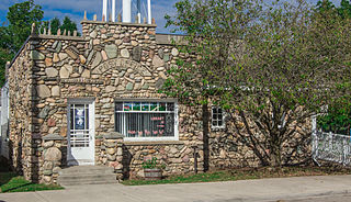
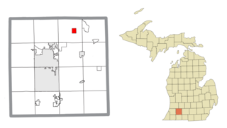
Climax is a village in Kalamazoo County in the U.S. state of Michigan. The population was 767 at the 2010 census. The village is located within Climax Township on the northern boundary with Charleston Township, and is roughly 12 miles (19 km) west of Battle Creek and 16 miles (26 km) east of Kalamazoo. Climax shares a school district with the neighboring town of Scotts.

<span class="mw-page-title-main">Comstock Township, Michigan</span> Charter township in Michigan, United States

Comstock Charter Township is a charter township of Kalamazoo County in the U.S. state of Michigan, located east of the city of Kalamazoo and is part of the Kalamazoo–Portage Metropolitan Area. The 2020 census recorded the population within the township at 15,231.

<span class="mw-page-title-main">Galesburg, Michigan</span> City in Michigan, United States

Galesburg is a city in Kalamazoo County in the U.S. state of Michigan. The population was 2,049 at the 2020 census.

<span class="mw-page-title-main">Greater Galesburg, Michigan</span> Unincorporated community & former census-designated place in Michigan, United States

Greater Galesburg was a census-designated place (CDP) in Kalamazoo County in the U.S. state of Michigan, surrounding the city of Galesburg. As a CDP, it used for statistical purposes and does not have any legal status as a municipality. The population was 1,631 at the 2000 census. The CDP was deleted and not reported in the 2010 census

<span class="mw-page-title-main">Portage, Michigan</span> City in Michigan, United States

Portage is a city in Kalamazoo County, Michigan, United States. The population was 48,891 at the 2020 census. It is the smaller of the two main cities included in the Kalamazoo-Portage Metropolitan Statistical Area, which had a population of 261,670 in 2020.

<span class="mw-page-title-main">Richland, Michigan</span> Village in Michigan, United States

Richland is a village in Kalamazoo County in the U.S. state of Michigan. The population was 751 at the 2010 census, up from 593 at the 2000 census.

<span class="mw-page-title-main">Ross Township, Michigan</span> Civil township in Michigan, United States

Ross Township is a township in Kalamazoo County in the U.S. state of Michigan. The population was 4,851 at the 2020 census, up from 4,664 at the 2010 census.

<span class="mw-page-title-main">Texas Charter Township, Michigan</span> Charter township in Michigan, United States

Texas Charter Township, officially named the Charter Township of Texas, is a charter township of Kalamazoo County, in the U.S. state of Michigan. As of the 2020 census, the township population was 17,691, up from 14,697 at the 2010 census. It encompasses the entire portion of the survey township T3S R12W.

<span class="mw-page-title-main">Blissfield, Michigan</span> Village in Michigan, United States

Blissfield is a village in Lenawee County in the U.S. state of Michigan. The population was 3,340 at the 2010 census. The village is mostly located within Blissfield Township with only very small portions extending west into Palmyra Township and south into Riga Township. The Blissfield post office first opened March 28, 1828. Hervey Bliss, who was the first white settler in 1824 and for whom the town is named, was the first postmaster.

<span class="mw-page-title-main">Custer, Michigan</span> Village in Michigan, United States

Custer is a village in Mason County in the U.S. state of Michigan. The population was 272 at the 2020 census. The village is located within Custer Township.

<span class="mw-page-title-main">Custer Township, Mason County, Michigan</span> Civil township in Michigan, United States

Custer Township is a civil township of Mason County in the U.S. state of Michigan. The population was 1,321 at the 2020 census. The village of Custer is located within the township.

<span class="mw-page-title-main">Brady Township, Kalamazoo County, Michigan</span> Civil township in Michigan, United States

Brady Township is a civil township of Kalamazoo County in the U.S. state of Michigan. As of the 2020 census, the township population was 4,445.

<span class="mw-page-title-main">Richland Township, Kalamazoo County, Michigan</span> Civil township in Michigan, United States

Richland Township is a civil township of Kalamazoo County in the U.S. state of Michigan. The population was 8,693 at the 2020 census, up from 7,580 at the 2010 census.

<span class="mw-page-title-main">Schoolcraft Township, Kalamazoo County, Michigan</span> Civil township in Michigan, United States

Schoolcraft Township is a civil township of Kalamazoo County in the U.S. state of Michigan. The population was 9,183 at the 2020 census, up from 8,214 at the 2010 census. The township is named for Henry Schoolcraft, noted for conducting many early land surveys throughout Michigan.

References

Notes

  1. "2020 U.S. Gazetteer Files". United States Census Bureau. Retrieved May 21, 2022.
  2. 1 2 "U.S. Census website". United States Census Bureau . Retrieved January 31, 2008.
  3. U.S. Geological Survey Geographic Names Information System: Augusta, Michigan
  4. Romig 1986, p. 35.
  5. "US Gazetteer files 2010". United States Census Bureau. Archived from the original on January 12, 2012. Retrieved November 25, 2012.
  6. "Census of Population and Housing". Census.gov. Retrieved June 4, 2015.
  7. "U.S. Census website". United States Census Bureau . Retrieved November 25, 2012.
  8. "G-A Community Schools' Official Website". Archived from the original on December 10, 2011. Retrieved October 6, 2019.
  9. "Wayne Lamb - College of Liberal Arts". The Legacy Project. Purdue University.

Sources

  1. "The Olde World Village". www.oldeworldvillage.com. Retrieved October 10, 2018.