Bagong Silang

Last updated

Bagong Silang
Barangay 176
Bagong Silang arch (Zabarte Road, Caloocan; 05-29-2022).jpg
Bagong Silang Welcome Arch
Bagong Silang
Metro Manila location map.svg
Red pog.svg
Bagong Silang
Coordinates: 14°46′37.71″N121°2′35″E / 14.7771417°N 121.04306°E / 14.7771417; 121.04306
Country Philippines
Region National Capital Region
City Caloocan
District 1st District of Caloocan
EstablishedMay 20, 1971
Government
  Type Barangay
  Barangay CaptainJoel Bacolod
Area
  Total5.24 km2 (2.02 sq mi)
Population
 (2020) [1]
  Total261,729
  Density50,000/km2 (130,000/sq mi)
Time zone UTC+8 (PST)
Postal Code
1428
Area code 02

Bagong Silang or Barangay 176 is a barangay of Caloocan, Metro Manila, Philippines. It is known for being the most populous barangay in the Philippines, with a population of 261,729 according to the 2020 census. It is also the northernmost barangay of Metro Manila located in the northern section of the city bordering the province of Bulacan.

Contents

History

The barangay occupies parts of land originally of Tala Estate, which is historically under the jurisdiction of the town of Novaliches before it was absorbed by Caloocan in 1903. [2] [3] [4] The 808-hectare (2,000-acre) estate was reserved and acquired by the government in 1938 primarily for a leprosarium, which turned out to be the Central Luzon Sanitarium (present-day Dr. Jose N. Rodriguez Memorial Hospital); however, only one-third of the land was used for such purpose. [5] Due to advancements in medical science that no longer requires the segregation of hansenites, the leprosarium needed lesser land area, paving the way for housing and urban development in the area. [6] The barangay was established during the term of President Ferdinand Marcos in 1971. [7] The name of the barangay corresponds to the English word newborn, meant to signify renewed hope for its residents who were resettled from their original slum areas in Tondo, Manila, Commonwealth in Quezon City, and San Juan. [8] [9]

Proposed partitions

In February 1989, President Corazon Aquino approved Republic Act (RA) No. 6714, reducing the number of barangays in Caloocan from 188 to 60. As part of this plan, Barangay 176 (Bagong Silang) was slated to be divided into five smaller barangays. [10] A plebiscite was held on March 10; [11] [12] with only 10% of the city's voters participating. [13] [11] Majority of the participated voters reportedly opposed the proposal, thus the existing barangays continued as independent entities. [13]

In September 2013, the barangay was proposed to be divided into seven smaller barangays to alleviate perceived issues in its administration. It was reported that residents complained that due to the barangay's size, both in terms of land area and population, government services were spread thin. [8] [9]

In November 2022, Caloocan 1st district representative Oscar Malapitan introduced a bill for the partition. [14] On April 3, 2024, President Bongbong Marcos signed Republic Act No. 11993, which divides the barangay into six smaller barangays designated with letters from A (176-A) to F (176-F). The proposal is subject to a plebiscite to be held 90 days from the effectivity of the law. [15] [16]

Geography

The barangay is located in North Caloocan. The Marilao River flows along the northern and western borders of the barangay, separating it from Bulacan. Barangays 174, 175 and 178 lie south of Bagong Silang, while Barangays 187 and 188 lie on the east.

Bagong Silang is the largest barangay in the country in terms of population, being more populous than about two-thirds of the cities in the country. Due to the large population, addresses in the barangay are formatted as Phase, Package, Block and Lot. [8]

Demographics

Barangay hall (Barangay 176) 03077jfChurches Roads Camarin North Bagong Silang Caloocan Cityfvf 11.JPG
Barangay hall (Barangay 176)

Bagong Silang is also the largest barangay in terms of population with over 261,000 residents which accounts for about 16 percent of Caloocan's total population. Bagong Silang became the relocation site of people living in slum areas across Metro Manila since the 1970s greatly contributing to Bagong Silang's population. [8] [9]

Schools

There are seven public elementary schools and three public high schools in Bagong Silang.

Elementary:

  1. Bagong Silang Elementary School – Phase 1, Bagong Silang, Caloocan
  2. Sto. Niño Elementary School – Phase 1, Bagong Silang, Caloocan
  3. Gabriela Silang Elementary School (former Bagong Silang Elementary School – Annex) – Phase 1, Bagong Silang, Caloocan
  4. Rene Cayetano Elementary School – Phase 8B, Bagong Silang, Caloocan
  5. Pag-asa Elementary School – Phase 7B Bagong Silang, Caloocan
  6. Silanganan Elementary School – Phase 3, Bagong Silang, Caloocan
  7. Star Elementary School – Phase 1, Bagong Silang, Caloocan
  8. Kalayaan Elementary School – Phase 10B, Bagong Silang, Caloocan

High School:

  1. Bagong Silang High School – Phase 3, Bagong Silang, Caloocan
  2. Benigno Aquino Jr. High School – Phase 2, Bagong Silang, Caloocan
  3. Kalayaan National High School – Phase 10B, Bagong Silang, High School [8] [9]
  4. Tala High School – Phase 5, Bagong Silang, Caloocan


Related Research Articles

<span class="mw-page-title-main">Quezon City</span> Highly urbanized city in Metro Manila, Philippines

Quezon City, also known as the City of Quezon and Q.C., is the most populous city in the Philippines. According to the 2020 census, it has a population of 2,960,048 people. It was founded on October 12, 1939, and was named after Manuel L. Quezon, the second president of the Philippines.

<span class="mw-page-title-main">San Jose del Monte</span> Component city in Bulacan, Philippines

San Jose del Monte, officially the City of San Jose del Monte, is a 1st class component city in the province of Bulacan, Philippines. According to the 2020 census, it has a population of 651,813 people, making it the largest local government unit within the province of Bulacan and Central Luzon, and the 18th most populated city in the Philippines.

<span class="mw-page-title-main">Taguig</span> Highly urbanized city in Metro Manila, Philippines

Taguig, officially the City of Taguig, is the fifth-most populous city in the Philippines with a population of 1.2 million people. The city is one of the Philippines' cultural, financial, high-tech, entertainment and media centers with significant influence on commerce, health care, research, technology, education, politics, tourism, dining, art, fashion, and sports. Taguig is also an important center for the country's international diplomacy, hosting several embassies. It is also home to the headquarters of several major multinational corporations.

<span class="mw-page-title-main">Antipolo</span> Capital of Rizal, Philippines

Antipolo, officially the City of Antipolo, is a 1st class component city and capital of the province of Rizal, Philippines. According to the 2020 census, it has a population of 887,399 people. It is the most populous city in the Calabarzon region, and the seventh most-populous city in the Philippines. It is also the most populated city under the component city status.

<span class="mw-page-title-main">Caloocan</span> Highly urbanized city in Metro Manila, Philippines

Caloocan, officially the City of Caloocan, is a 1st class highly urbanized city in Metro Manila, Philippines. According to the 2020 census, it has a population of 1,661,584 people making it the fourth-most populous city in the Philippines.

<span class="mw-page-title-main">Malabon</span> Highly urbanized city in Metro Manila, Philippines

Malabon, officially the City of Malabon, is a 1st class highly urbanized city in the National Capital Region of the Philippines. According to the 2020 census, it has a population of 380,522 people.

<span class="mw-page-title-main">Navotas</span> Highly urbanized city in Metro Manila, Philippines

Navotas, officially the City of Navotas, is a 1st class highly urbanized city in the National Capital Region of the Philippines. According to the 2020 census, it has a population of 247,543 people.

<span class="mw-page-title-main">Carmona, Cavite</span> Component city in Cavite, Philippines

Carmona, officially the City of Carmona, is a component city in the province of Cavite, Philippines. According to the 2020 census, it has a population of 106,256 people.

<span class="mw-page-title-main">Novaliches</span> Place in National Capital Region, Philippines

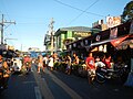
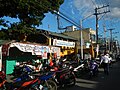
Novaliches is a place that forms the northern areas of Quezon City, and encompasses the whole area of North Caloocan.

<span class="mw-page-title-main">Roman Catholic Diocese of Novaliches</span> Roman Catholic diocese in the Philippines

The Diocese of Novaliches is a diocese of the Latin Church of the Catholic Church in the Philippines. The diocese was created by Pope John Paul II on December 7, 2002, by virtue of his Apostolic Constitution Animarum Utilitati, and was canonically erected on January 16, 2003, from the Archdiocese of Manila. The diocese previously existed as the Ecclesiastical District of Quezon City-North, which was renamed the District of Novaliches in 2002.

<span class="mw-page-title-main">Quirino Highway</span> Road in the Philippines

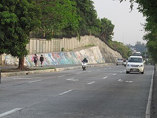
The Quirino Highway, formerly called the El Quirino Express Road or Ipo Road, is a four-to-eight lane, secondary highway that connects Quezon City to the municipality of Norzagaray in Bulacan, Philippines. The road is designated as National Route 127 (N127) of the Philippine highway network within the city bounds of Quezon City, Radial Road 7 (R-7), and a spur of Radial Road 8 (R-8) of Metro Manila's arterial road network.

<span class="mw-page-title-main">Novaliches Cathedral</span> Roman Catholic cathedral in Quezon City, Philippines

Novaliches Cathedral, canonically recognized as the Cathedral-Shrine and Parish of the Good Shepherd, is a Roman Catholic church located along Regalado Avenue in Barangay Fairview, Quezon City in the Philippines. It is the seat of the Diocese of Novaliches. It was established on August 5, 1975 by Manila Archbishop, Jaime Lachica Sin, who designated Fidelis Ruben Limcaco as the church's first parish priest.

<span class="mw-page-title-main">Bagong Silang High School</span> Public high school in Caloocan

Bagong Silang High School is the second largest public secondary school in Caloocan in Metro Manila and it was established on August 3, 1983.

Metro Manila, the capital region of the Philippines, is a large metropolitan area that has several levels of subdivisions. Administratively, the region is divided into seventeen primary local government units with their own separate elected mayors and councils who are coordinated by the Metropolitan Manila Development Authority, a national government agency headed by a chairperson directly appointed by the Philippine president. The cities and municipality that form the region's local government units are further divided into several barangays or villages which are headed by an elected barangay captain and barangay council.

<span class="mw-page-title-main">Glorieta Park</span>

Glorieta Park, sometimes spelled Glorietta Park, is an urban park in Caloocan, northern Metro Manila, the Philippines. It is situated near the border of barangays 187 and 188 in the former Tala Estate in North Caloocan. The park is one of three city-owned parks in Caloocan under the management of the Caloocan Parks Administration Services, the others being the Buena Park and Sports Complex in South Caloocan and the Caloocan Amparo Nature Park in eastern Tala, North Caloocan.

Barangay BF Homes Caloocan or Barangay 169 is a barangay of Caloocan, Metro Manila, Philippines. The barangay is known for having jurisdiction of the larger portions of the Banco Filipino-developed real estate projects in Northern Manila, and is considered the most affluent barangay in Caloocan.

<span class="mw-page-title-main">Sucat, Muntinlupa</span> Barangay in Muntinlupa City, Metro Manila, Philippines

Sucat is an administrative division in southern Metro Manila, the Philippines. It is an urban barangay in Muntinlupa City with many high-rise condominiums and commercial establishments in the area. The area is also well known for the Sucat exit of the South Luzon Expressway and Metro Manila Skyway.

<span class="mw-page-title-main">Barangay 76, Caloocan</span> Barangay in Caloocan City, Metro Manila, Philippines

Barangay 76 is a barangay of Caloocan, Metro Manila, Philippines. It is known for being the least populous barangay in Metro Manila, with a population of 2 according to the 2020 census. Formerly an agricultural land and later an informal settlement, it is currently predominated by commercial establishments.

References

  1. Census of Population (2020). "National Capital Region (NCR)". Total Population by Province, City, Municipality and Barangay. Philippine Statistics Authority . Retrieved July 8, 2021.
  2. "Spanish Era". Roman Catholic Diocese of Novaliches. August 2016. Retrieved August 2, 2022.
  3. PHIMCOS (August 2020). "Occupation and Victory The Philippines in World War II". The Murillo Bulletin Special World War II Issue. Retrieved August 2, 2022.
  4. Act No. 942 (October 12, 1903), An Act Reducing the Thirty-Two Municipalities of the Province of Rizal to Fifteen , retrieved May 12, 2022
  5. G.R. No. 148606 (June 30, 2008), CHARLES LIMBAUAN, petitioner, vs. FAUSTINO ACOSTA, respondent. , retrieved August 2, 2022
  6. G.R. No. 106593 (November 16, 1999), NATIONAL HOUSING AUTHORITY, petitioners, vs. HONORABLE MAURO T. ALLARDE, Presiding Judge of the Regional Trial Court, Branch 123, Kalookan City and SPOUSES RUFINO AND JUANITA MATEO, respondents. , retrieved August 2, 2022
  7. Presidential Proclamation No. 843, s. 1971 (April 26, 1971), Reserving the Tala Estate for various government uses as well as for housing and urban development. , retrieved August 2, 2022
  8. 1 2 3 4 5 "Caloocan councilor pushes for the division of Barangay Bagong Silang". Philippine Information Agency. September 19, 2013. Archived from the original on February 8, 2015. Retrieved September 16, 2014.
  9. 1 2 3 4 Melican, Nathaniel (September 16, 2014). "Largest barangay in PH can't live up to 'new hope' image; split pushed". Philippine Daily Inquirer. Retrieved September 16, 2014.
  10. Republic Act No. 6714 (February 28, 1989), An Act Merging, Dividing, and/or Reviving the Different Barangays in Caloocan City and for Other Purposes, Official Gazette of the Republic of the Philippines , retrieved November 27, 2023
  11. 1 2 "Kalookan plebiscite today". Manila Standard . March 10, 1989. p. 9. Retrieved April 6, 2024 via Google Books.
  12. Presidential Proclamation No. 384 (March 9, 1989), Declaring March 10, 1989 as a special day in Caloocan City , retrieved April 6, 2024
  13. 1 2 Mahilum, E. (March 11, 2023). "Voter turnout low for KC plebiscite". Manila Standard . p. 9. Retrieved April 6, 2024 via Google Books.
  14. Dioquino, Aaron Homer (June 20, 2023). "Caloocan gov't plans to split Brgy. Bagong Silang into six separate villages". Manila Bulletin . Retrieved April 6, 2024.
  15. Mangaluz, Jean (April 5, 2024). "Marcos signs law dividing Caloocan barangay into six". Inquirer.net . Retrieved April 5, 2024.
  16. "Batas na maghahati sa anim na barangay sa Bagong Silang, Caloocan, nilagdaan na ni PBBM". RMN News (in Tagalog). April 5, 2024. Retrieved April 5, 2024.