
Sherburne County is a county in Central Minnesota. At the 2020 census, the population was 97,183. The county seat is Elk River.

Becker is a city in Sherburne County, Minnesota, between the Mississippi and Elk Rivers. The population was 4,877 at the 2020 census.
Rollins is an unincorporated community in Ault Township, Saint Louis County, Minnesota, United States.
The Elk River is an 84.0-mile-long (135.2 km) river in east-central Minnesota in the United States. It is a tributary of the Mississippi River, draining a watershed of 630 square miles (1,600 km2).

The Saint Francis River is a 79.0-mile-long (127.1 km) tributary of the Elk River in east-central Minnesota in the United States. Via the Elk River, it is part of the watershed of the Mississippi River, draining an area historically characterized by mixed hardwood and coniferous forests on flat to rolling till plains.
Inger is an unincorporated community and census-designated place (CDP) in Itasca County, Minnesota, United States, along the Bowstring River of the Leech Lake Indian Reservation. As of the 2010 census, its population was 212.
Markham is an unincorporated community in Colvin Township, Saint Louis County, Minnesota, United States.
Fairbanks is an unincorporated community in Fairbanks Township, Saint Louis County, Minnesota, United States; located within the Superior National Forest.
Skibo is an unincorporated community in Bassett Township, Saint Louis County, Minnesota, United States.
Robinson is an unincorporated community in Morse Township, Saint Louis County, Minnesota, United States.
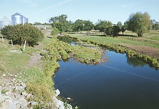
Santiago is an unincorporated community in Santiago Township, Sherburne County, Minnesota, United States, near the junction of Sherburne County Roads 3 and 11. The St. Francis River flows through the community.

Reads Landing is an unincorporated community in Pepin Township, Wabasha County, Minnesota, United States, along the Mississippi River. The community is located between Lake City and Wabasha along U.S. Highway 61 at the junction with Wabasha County Road 77 and near Wabasha, Lake City, Camp Lacupolis, and Maple Springs. Reads Landing is located within section 24 of Pepin Township.
Giese is an unincorporated community in Wagner Township, Aitkin County, Minnesota, United States, located near Finlayson.
Lindford is an unincorporated community in Koochiching County, Minnesota, United States.
Gemmell is an unincorporated community in Koochiching County, Minnesota, United States; located near Mizpah and Northome.
Libby is an unincorporated community in Libby Township, Aitkin County, Minnesota, United States. The community is located between McGregor and Jacobson along State Highway 65. The Mississippi River flows nearby. Libby is located immediately northwest of Big Sandy Lake.
East Lake is an unincorporated community in Spalding Township, Aitkin County, Minnesota, United States.
Salida is an unincorporated community in Becker Township, Sherburne County, Minnesota, United States. The community is near the junction of U.S. Highway 10 and Sherburne County Road 11. Nearby towns include Becker and Big Lake.

Orrock is an unincorporated community in Orrock Township, Sherburne County, Minnesota, United States.
Cable is an unincorporated community in Haven Township, Sherburne County, Minnesota, United States. The community is between Clear Lake and St. Cloud along U.S. Highway 10 near Sherburne County Road 65, 42nd Street SE.


