
Dudley is an unincorporated community and census-designated place (CDP) in Wayne County, North Carolina, United States, about 9 miles south of Goldsboro. It was first listed as a CDP in the 2020 census with a population of 826. Dudley is included in the Goldsboro, North Carolina Metropolitan Statistical Area.
Lisbon is a census-designated place located in western Howard County in the state of Maryland, United States, located roughly between Baltimore and Frederick and north of Washington, D.C. It is contained in an area of roughly one square mile. Lisbon is located along Interstate 70 and Maryland Route 144 and is home to the first roundabout in Maryland. It first appeared as a CDP in the 2020 Census with a population of 282.
Pauline is an unincorporated community and census-designated place (CDP) in Spartanburg County, South Carolina, United States. It was first listed as a CDP in the 2020 census with a population of 209.
Grandy is an unincorporated community and census-designated place (CDP) in Currituck County, North Carolina, USA. It was first listed as a CDP in the 2020 census with a population of 2,776. It is located along US 158 between the Currituck Sound and the North River.
Smithtown is an unincorporated community and census-designated place (CDP) in northern Yadkin County, North Carolina, United States. It was first listed as a CDP in the 2020 census with a population of 224.
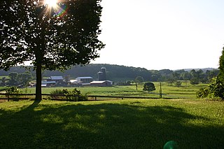
Nebo is an unincorporated community and census-designated place (CDP) in the Nebo Township of eastern McDowell County, North Carolina, United States. It was first listed as a CDP in the 2020 census with a population of 1,790.
Smarr is an unincorporated community and census-designated place (CDP) in Monroe County, in the U.S. state of Georgia. It was first listed as a CDP in the 2020 census with a population of 218.

The Asheville metropolitan area is a metropolitan area centered on the principal city of Asheville, North Carolina. The U.S. Office of Management and Budget defines the Asheville, NC Metropolitan Statistical Area, a metropolitan statistical area used by the United States Census Bureau and other entities, as comprising the four counties of Buncombe, Haywood, Henderson, and Madison. The area's population was 424,858 according to the 2010 United States Census, and 469,454 according to the 2020 United States Census.

Green Sea is an unincorporated community and census-designated place (CDP) in Horry County, South Carolina, United States, near the city of Loris. It was first listed as a CDP in the 2020 census with a population of 105.
Dacusville is a small unincorporated community and census-designated place (CDP) in Pickens County, South Carolina, United States. It is best known for its tractor show once a year in the month of September. The community also has an elementary school and a middle school. It was first listed as a CDP in the 2020 census with a population of 399.
The Governors Village is a 450+ acre New Urbanism neighborhood and census-designated place (CDP) in Chatham County, North Carolina, United States, with an address of Chapel Hill. It was first listed as a CDP in the 2020 census with a population of 1,512.

Seabrook is an unincorporated community and census-designated place (CDP) located in Beaufort County, South Carolina, United States. It was first listed as a CDP in the 2020 census with a population of 1,255.
Lobeco is an unincorporated community and census-designated place (CDP) located in Beaufort County, South Carolina, United States. Per the 2020 census, the population was 292.
Kirkville is a census-designated place and unincorporated community in Itawamba County, Mississippi, United States.
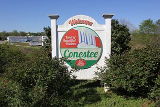
Conestee is an unincorporated community and census-designated place (CDP) in Greenville County, South Carolina, United States. It was first listed as a CDP in the 2020 census with a population of 904.

Jackson Springs is an unincorporated community and census-designated place (CDP) in Moore County, North Carolina, United States. It was first listed as a CDP in the 2020 census with a population of 154.
Crouse is an unincorporated community and census-designated place (CDP) in Lincoln County, North Carolina, United States. It was first listed as a CDP in the 2020 census with a population of 322. Crouse has a post office with ZIP code 28033.
Drayton is an unincorporated community and census-designated place (CDP) in Spartanburg County, in the U.S. state of South Carolina. It was first listed as a CDP in the 2020 census with a population of 1,115.
Emma is an unincorporated community and census-designated place (CDP) in Buncombe County, North Carolina, United States. It was first listed as a CDP in the 2020 census with a population of 2,174.
Carolina Meadows is a planned community and census-designated place (CDP) in Chatham County, North Carolina, United States. It was first listed as a CDP in the 2020 census with a population of 727.


