
Wake County is located in the U.S. state of North Carolina. As of the 2020 census, its population was 1,129,410, making it North Carolina's most populous county. From July 2005 to July 2006, Wake County was the 9th-fastest growing county in the United States, with Cary and Raleigh being the 8th- and 15th-fastest growing communities, respectively.

Holly Springs is a town in Wake County, North Carolina, United States. As of the 2020 census, the town population was 41,239, a 67% increase from 2010.

Knightdale is a town in Wake County, North Carolina, United States. As of the 2020 census, Knightdale has a population of 19,435, up from 11,401 in 2010. The U.S. Census Bureau estimates the town's population to be 17,843, as of July 1, 2019. Knightdale's population grew 10.4% from 2010 to 2013, making it the second fastest-growing community in the Research Triangle region for that time period.

Mount Vernon is a town and the county seat of Franklin County, Texas, United States. The population was 2,491 at the 2020 United States census.

Cary is a town in Wake, Chatham, and Durham counties in the U.S. state of North Carolina and is part of the Raleigh-Cary, NC Metropolitan Statistical Area. According to the 2020 census, its population was 174,721, making it the seventh-most populous municipality in North Carolina, and the 148th-most populous in the United States. In 2022, the town's population had increased to 180,388.

Lady Bird Lake is a river-like reservoir on the Colorado River in Austin, Texas, United States. The City of Austin created the reservoir in 1960 as a cooling pond for a new city power plant. The lake, which has a surface area of 416 acres (168 ha), is now used primarily for recreation and flood control. The reservoir is named in honor of former First Lady of the United States Lady Bird Johnson.

The Yadkin River is one of the longest rivers in the US state of North Carolina, flowing 215 miles (346 km). It rises in the northwestern portion of the state near the Blue Ridge Parkway's Thunder Hill Overlook. Several parts of the river are impounded by dams for water, power, and flood control. The river becomes the Pee Dee River at the confluence of the Uwharrie River south of the community of Badin and east of the town of Albemarle. The river then flows into South Carolina near Cheraw, which is at the Fall Line. The entirety of the Yadkin River and the Great Pee Dee River is part of the Yadkin-Pee Dee River Basin.

B. Everett Jordan Lake is a reservoir in New Hope Valley, west of Cary and south of Durham in Chatham County, North Carolina, in the United States; the northernmost end of the lake extends into southwestern Durham County.

Pettigrew State Park is a North Carolina State Park in Tyrrell and Washington Counties, North Carolina in the United States. It covers 5,951 acres (24.08 km2) around the shore lines of Lake Phelps and the Scuppernong River. The park's developed facilities are south of U.S. Route 64 near Roper and Creswell, North Carolina. Pettigrew State Park is open for year-round recreation, including hiking, camping, fishing, boating and picnicking.

The Watauga River is a large stream of western North Carolina and East Tennessee. It is 78.5 miles (126.3 km) long with its headwaters in Linville Gap to the South Fork Holston River at Boone Lake.

Lake Norman is the largest man-made body of fresh water in North Carolina. It was created between 1959 and 1964 as part of the construction of the Cowans Ford Dam by Duke Energy. Located in Iredell County, 40 miles north of Charlotte, Lake Norman State Park boasts the region's popular mountain biking trail system.

Lake Greeson is a reservoir on the Little Missouri River, about 6 miles (10 km) north of Murfreesboro, Arkansas, United States. Famous for its scenery and recreation, it is surrounded by 15 parks that offer opportunities for camping, fishing, boating, biking, and swimming.
The Minnesota Valley National Wildlife Refuge is a 14,000-acre (5,666 ha) National Wildlife Refuge in eastern and central Minnesota. Located just south of the city of Minneapolis, it is one of fourteen Regional Priority Urban Wildlife Refuges in the nation. Many parts of the Refuge are near large establishments of the Twin Cities; the Bloomington Education and Visitor Center and two trailheads are located just blocks from the Mall of America, the Wilkie Unit is just east of Valleyfair and the Louisville Swamp Unit is just south of Minnesota Renaissance Festival.

Mill Creek Park is a metropolitan park located in Youngstown, Ohio. It stretches from the near west side of Youngstown to the southern borders of the city and neighboring Boardman, Ohio. The park "encompasses approximately 4400 acres (10.5 km2), 20 mi (32 km) of drives, and 15 mi (24 km) of foot trails" as well as a variety of bridges, ponds, streams, well-tended gardens, and waterfalls. The Trust for Public Land ranks one part of Mill Creek as the 142nd largest park located within the limits of a U.S. city.

Chadwick Lake is a reservoir supplying water to the Town of Newburgh, in Orange County, New York, United States, in which it is located. It is a manmade lake created in 1926 on private property owned by the Chadwick family by damming Quassaick Creek. It was maintained for recreational purposes for 36 years. In 1962, it was purchased by the Town of Newburgh as a reservoir to supply the Town with water. In more recent years, its use as a water supply has been supplanted by the Delaware Aqueduct and so Chadwick Lake has reverted to its original function of a recreational facility. It is located immediately to the northwest of the junction of NY 32 and 300 in the Cronomer Valley section of the town. It is open to the public, and there are recreational facilities near the southern end.

Fred G. Bond Metro Park is the largest municipal park in Cary, North Carolina. It is also one of the largest municipal parks in Wake County. It is located at 801 High House Road, physically the geographic center of the town. The park has been described as "an oasis in the middle of Cary".
Sunset Lake is a lake in Holly Springs, North Carolina, part of the central North Carolina near Cary, NC and Apex, NC. Covering 125 acres in southwestern Wake County. The lake is owned by the Sunset Lake Homeowners Association.
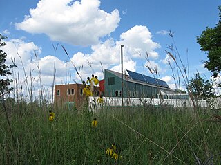
Base Lake Dam is an embankment dam in Holly Springs, North Carolina which creates Bass Lake.
The Fonta Flora State Trail is a unit of the North Carolina state park system in Buncombe, McDowell, and Burke Counties, North Carolina, in the United States, and it consists of 90 acres (36 ha) of conservation land and 19 miles (31 km) designated multi-use trail. The State Trail is planned as a continuous route for hikers and cyclists from Asheville to Morganton, with a loop around Lake James. The trail is a collaboration between local governments, local land conservancies the US Forest Service, and the state, with development coordinated by the North Carolina Division of Parks and Recreation (NCDPR).

Bass Lake, also known as Cone Lake, is a 22-acre (8.9 ha) man-made lake or reservoir located in Blowing Rock, Watauga County, North Carolina, United States. The Moses H. Cone estate, also called Flat Top Manor, is on a hillside overlooking the lake, whose elevation is 3,563 feet (1,086 m). Cone constructed two lakes on the property: Trout Lake and Cone Lake. The lakes are within Moses H. Cone Memorial Park which is listed in the National Register of Historic Places.


 The Bass Lake deck at sunset
 Southernmost walking trail
 Picnic shelter

