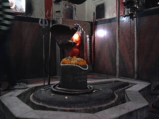
Khandwa is a city and a nagar nigam in the Nimar region of Madhya Pradesh, India. It is the administrative headquarters of the Khandwa district, formerly known as East Nimar District.

Datia is the district headquarter of the Datia District in north central Madhya Pradesh,a state of Central India. It is an ancient town, mentioned in the Mahabharata ruled by King Dantavakra. The city is 78 km from Gwalior, 325 km south of New Delhi and 344 km north of Bhopal. About 18 km from Datia is Sonagiri, a sacred Jain hill. Datia is also about 31 km from Jhansi and 52 km from Orchha. The nearest airport is at Gwalior. It was formerly the seat of the eponymous princely state in the British Raj. Datia is situated near Gwalior and on the border with Uttar Pradesh.

Ratlam is a city in the northwestern part of the Malwa region in Madhya Pradesh state of India. The city of Ratlam lies 480 metres (1,570 ft)above sea level. It is the administrative headquarters of Ratlam district, which was created in 1947 after the independence of India. It is located 294 kilometres west of the state capital Bhopal.
Gohad is a city and a municipality in Bhind district in the Indian state of Madhya Pradesh. A town of historical importance it is situated close to the city of Gwalior. The Gohad Fort is located here.

Guna is a city and a municipality in Guna district in the Indian state of Madhya Pradesh. It is the administrative headquarters of Guna District and is located on the banks of Parbati river.

Siwan is a city and nagar parishad in the Indian state of Bihar. It is the administrative headquarters of Siwan district and one of the urban settlements out of three in the district. It is located close to Uttar Pradesh.

Bhind district is a district in the Chambal division of the Indian state of Madhya Pradesh. The town of Bhind is the district headquarters.Bhind District is situated in Chambal region in the northwest of the state. It is surrounded by Agra, Etawah, Jalaun and Jhansi districts of Uttar Pradesh state to the north and the east, and the Madhya Pradesh districts of Datia to the south, Gwalior to the southwest, and Morena to the west. The geography of the district is characterised by uneven ravines, plain fertile fields and scanty forests. The total area of the district is 4,459 km2 (1,722 sq mi).
Satna is a city in the Indian state of Madhya Pradesh. It serves as the headquarters of Satna district. It is 7th largest city and 8th most populous city of the state. The city is 500 km east of the state capital Bhopal. The city is distributed over a land area of 111.9 square kilometres.

Sagar district is a district of Madhya Pradesh state in central India. The town of Sagar serves as its administrative center.

Gyanpur is a town and a nagar panchayat in Bhadohi district in the Indian state of Uttar Pradesh.

Deoria is a city in the state of Uttar Pradesh, India. It is one of five tehsils of the Deoria district. Deoria is located 45 km east of Gorakhpur and about 317 km from the state capital Lucknow. It shares its eastern border with the Indian state of Bihar.
Gormi is a block and a nagar panchayat in Bhind district in the Indian state of Madhya Pradesh. Gormi is located at 26.6°N 78.52°E..
Gulaothi is a town, near Bulandshahr city in the Bulandshahr district that falls under the Meerut division of the Indian state of Uttar Pradesh.
Kairana is a city and a municipal board in Shamli district of the Indian state of Uttar Pradesh. It is approximately 14 km (8.7 mi) from Shamli city.
Karera is a municipality or Nagar Parishad in the Shivpuri district of the Indian state of Madhya Pradesh.
Lahar is a city and a Nagar Palika in Bhind district in the Indian state of Madhya Pradesh.
Naraini is a town and Nagar panchayat in Banda district in the Indian state of Uttar Pradesh. It is one of the four tehsils of Banda District.
Nasrullaganj, also known as Bherunda or Bhairunda, is a nagar panchayat in Sehore district in the Indian state of Madhya Pradesh. The nearest airport is in Bhopal.

Kunda is a town and a Tehsil in Pratapgarh district in the Indian state of Uttar Pradesh.
Alampur is a town and a nagar panchayat in Bhind district in the Indian state of Madhya Pradesh. Alampur is known for its history, for the chhatri of Malhar Rao Holkar which is in Alampur.


