Central Railway is one of the 19 zones of Indian Railways. Its headquarters is in Mumbai at Chhatrapati Shivaji Maharaj Terminus. It has the distinction of operating the first passenger railway line in India, which opened from Mumbai to Thane on 16 April 1853.

Lonavala-Khandala is a hill station and a Municipal Council in the Pune district, Maharashtra, India. It is about 64 km west of Pune and 96 km to the east of Mumbai. It is known for its production of the hard candy chikki and is also a major stop on the railway line connecting Mumbai and Pune. From the Pune suburbs, local trains are available from Pune Junction. Both the Mumbai-Pune Expressway as well as the Mumbai-Bengaluru highway pass through Lonavala.
Matheran is an automobile-free hill station and a municipal council in the Karjat taluka of the Raigad district located in the Indian state of Maharashtra. Matheran is part of the Mumbai Metropolitan Region, and one of the smallest hill stations in India. It is located in the Western Ghats, at an elevation of around 800 m above sea level. It is about 90 km from Mumbai, and 120 km from Pune. This proximity to these urban areas makes it a weekend getaway for many. Matheran, which means "forest on the forehead" in Marathi, is an eco-sensitive region, declared by the Ministry of Environment, Forest and Climate Change, Government of India. It is Asia's only automobile-free hill station.
Badlapur is a city in Thane district, Maharashtra state, India. Badlapur is a city on the banks of Ulhas River in Thane district of Maharashtra state in Konkan division. It is governed by Kulgaon-Badlapur Municipal Council.Badlapur is a city located just 40 km from Thane City in Thane district, Maharashtra, India. This city is a part of Mumbai Metropolitan Region managed by Municipal Council. The current estimated population of Badlapur city in 2023 is 238,000. It has a Badlapur railway station on the Central line of the Mumbai Suburban Railway
Panvel is a city and taluka in Raigad district of Maharashtra, India. It is highly populated due to its closeness to Mumbai. Panvel is also governed for development purpose by the body of Mumbai Metropolitan Region. Panvel Municipal Corporation is the first Municipal Corporation in Raigad and the 27th Municipal corporation of Maharashtra State.

Neral is a town in Raigad district in the Indian state of Maharashtra. It is 83 km+ developing city of Raigad district which is well connected to Panvel, Mumbai, Thane and Pune. Local people from communities like Agri, Kumbhar, Brhamin, Muslim, etc settled here because this place was key route to Matheran and vikatgad which were politically important for maratha empire, Mughal empire and East India Company. Neral to Matheran Train Route was devoloped by East India Company For traiding and colonial pourposes. hutatma vir bhai kotwal was a great hero who rebel against British Police in Neral - Matheran. The village was founded around in 12th century by Chanche family, due to heavy floods wiped out their most of the cultivating land. The place where Chanche family shifted NeralPada Many other families from surrounding villages followed the same in following years to safeguard themselves from regular floods affecting their homes, farms and animals.

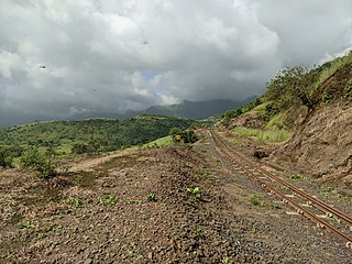
The Matheran Hill Railway (MHR) is a 2 ft narrow-gauge heritage railway in Maharashtra, India, which is administered by the Central Railway. It covers a distance of 21 km (13 mi), cutting a swathe through forest and connecting Neral to Matheran in the Western Ghats. The MHR is on the tentative list of UNESCO World Heritage Sites.

Dudhsagar Falls is a four-tiered waterfall located on the Mandovi River in the Indian state of Goa. It is 60 km from Panaji by road and is located on the Belgaum–Vasco Da Gama rail route about 46 km east of Madgaon and 80 km south of Belgaum. Dudhsagar Falls is amongst India's tallest waterfalls with a height of 310 m (1017 feet) and an average width of 30 metres (100 feet).
Raigad district, previously Colaba district, is a district in the Konkan division of Maharashtra, India. The headquarters of the district is Alibag. Other major cities in the district are Panvel, Karjat, Navi Mumbai, Khopoli, Shrivardhan and Mahad.
Shelu is a town in Karjat Tehsil, Maharashtra, India. It also has a station on the Mumbai Suburban Railway in Raigad district. The station is on the Mumbai - Karjat route after Vangani. Shelu Local Language is Marathi. Shelu Village Total population is 1374 and number of houses are 286. Female Population is 48.7%. Village literacy rate is 71.4% and the Female Literacy rate is 31.7%. The famous Ulhas River passed through this town and it is a source of fresh water for this area. In the western side of the shelu town Matheran Mountains are there and on the easter side of the Shelu town Ulhas River passes through. The Shelu town has India Post's Branch Post office its PIN Code is 410101.

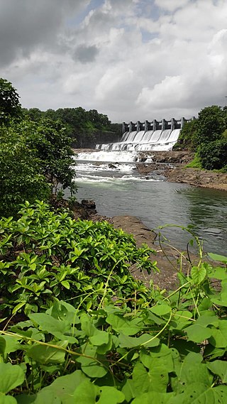
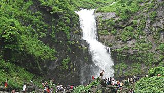
Palasdari, also known as Padusdhurree during the British Raj is a tourist destination and a railway junction on Karjat-Khopoli route of Mumbai Suburban Railway. The name Palasdari is derived from Palas, meaning “tree” and Dari means "Valley" in the Marathi language. It is situated on Karjat-Khopoli State Highway No. 35. Palasdari has a well known Palasdari dam. It is frequented by people from Mumbai, Panvel and Navi Mumbai particularly during rainy season. The whole area is surrounded by waterfalls and greenery during monsoon.
Bhivpuri is a town in Karjat Taluka near Mumbai. It is the location of Bhivpuri Road railway station of the Mumbai Suburban Railway. A temple of Sai Baba of Shirdi is located here. Numerous nearby waterfalls attract visitors on weekends. Bhivpuri Dam and a hydro-electricity generation plant of Tata Power is located nearby. Neral is the previous stop and Karjat is the next stop. Bhivpuri has state highway which is connecting to NH4, Panvel & Navi Mumbai and the other side connects to Badlapur & Thane District. In Bhivpuri there is one new multi facilities hospital located which covers the area from Shelu, Neral to Karjat.
Vithalwadi is a railway station on the Central line of the Mumbai Suburban Railway network. It is on the Karjat route. Kalyan is the previous stop and Ulhasnagar is the next stop.
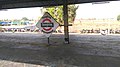
Neral Junction is a railway station on the Central line of the Mumbai Suburban Railway network located in the town of Neral. It is a junction railway station between Kalyan - Karjat section of Central railway connecting Mumbai and Pune. It is the starting point of the narrow gauge Matheran Hill Railway connecting the hill station of Matheran.

Karjat is a railway station on the Central line of the Mumbai Suburban Railway network. Karjat is a major rail terminus, connected via local trains to Chhatrapati Shivaji Maharaj Terminus Mumbai, Khopoli and Panvel

Panvel railway station is a railway station on the Harbour Line and Central line of the Mumbai Suburban Railway network.
Kashele is a village near the city of Karjat, in the state of Maharashtra, India. The village is located 82 km from Mumbai, and its official language is Marathi. As of the 2011 census, Kashele had a population of 2875, in 576 households.

Siddhagad literally 'Valour Fort' is a small fort located in Thane District, in the Western Indian state of Maharashtra.(Google)
Poshir is a village near the city of Neral, in the state of Maharashtra, India.

Vikatgad / Peb Fort is a fort located 19 km (12 mi) from Karjat, in Raigad district, of Maharashtra. This fort is in continuation with the Malang gad, Tauli Hill and Chanderi fort of the Matheran Hill Range. Vikatgad is a favourite destination for one-day trekkers. The trek path to Vikatgad is along deep ravines and cliffs. Its closeness to Matheran and Neral attracts many trekkers on weekends. The forest department and local villagers are doing plantation and some restoration works on the fort. The altitude of Vikatgad, also known as Peb fort is 640 meters above sea level.